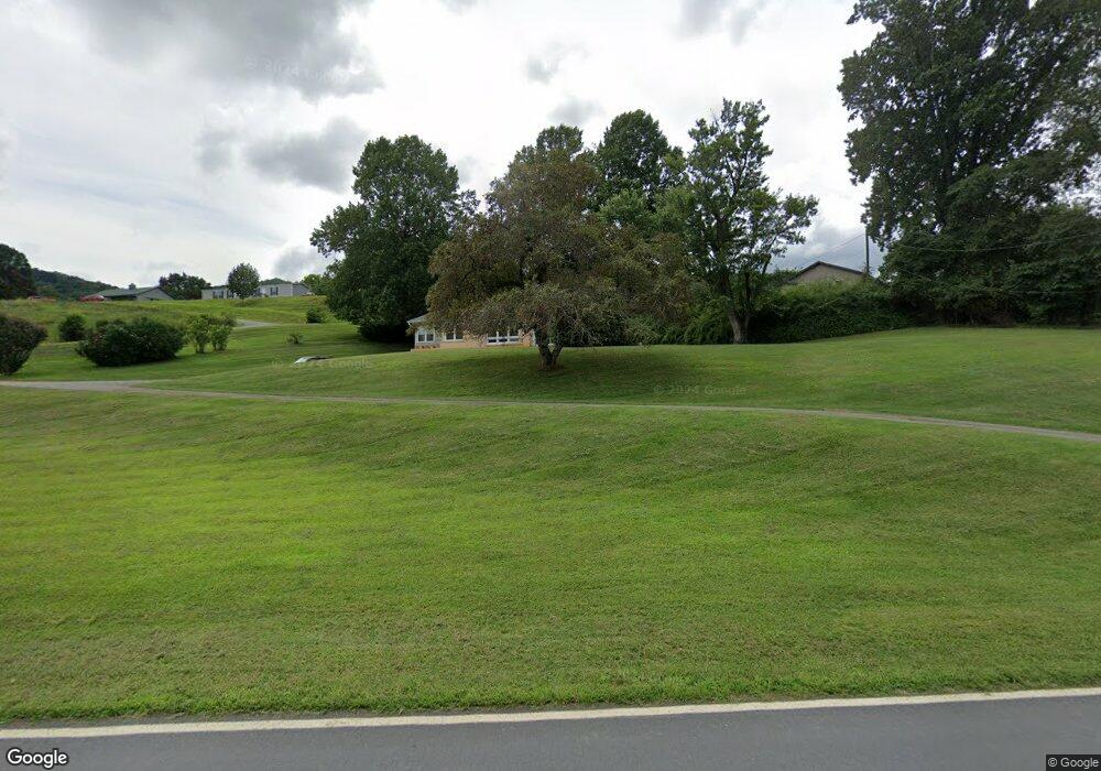
1782 Queentown Rd Canton, NC 28716
Estimated Value: $274,000 - $410,000
3
Beds
2
Baths
1,604
Sq Ft
$212/Sq Ft
Est. Value
About This Home
This home is located at 1782 Queentown Rd, Canton, NC 28716 and is currently estimated at $339,653, approximately $211 per square foot. 1782 Queentown Rd is a home located in Haywood County with nearby schools including Meadowbrook Elementary School, Canton Middle, and Pisgah High School.
Ownership History
Date
Name
Owned For
Owner Type
Purchase Details
Closed on
Nov 7, 2022
Sold by
Pearson Crisp Scott and Bowers Darlene
Bought by
Crisp Isaac Scott and Crisp Brittany Dailey
Current Estimated Value
Home Financials for this Owner
Home Financials are based on the most recent Mortgage that was taken out on this home.
Original Mortgage
$140,000
Outstanding Balance
$133,869
Interest Rate
5%
Mortgage Type
New Conventional
Estimated Equity
$205,784
Purchase Details
Closed on
Jul 12, 2001
Bought by
Crisp Scott Pearson and Crisp Darlene Bowers
Create a Home Valuation Report for This Property
The Home Valuation Report is an in-depth analysis detailing your home's value as well as a comparison with similar homes in the area
Home Values in the Area
Average Home Value in this Area
Purchase History
| Date | Buyer | Sale Price | Title Company |
|---|---|---|---|
| Crisp Isaac Scott | $159,000 | -- | |
| Crisp Isaac Scott | $159,000 | None Listed On Document | |
| Crisp Scott Pearson | $127,500 | -- |
Source: Public Records
Mortgage History
| Date | Status | Borrower | Loan Amount |
|---|---|---|---|
| Open | Crisp Isaac Scott | $140,000 | |
| Closed | Crisp Isaac Scott | $140,000 |
Source: Public Records
Tax History Compared to Growth
Tax History
| Year | Tax Paid | Tax Assessment Tax Assessment Total Assessment is a certain percentage of the fair market value that is determined by local assessors to be the total taxable value of land and additions on the property. | Land | Improvement |
|---|---|---|---|---|
| 2025 | -- | $176,500 | $32,800 | $143,700 |
| 2024 | $1,297 | $176,500 | $32,800 | $143,700 |
| 2023 | $1,280 | $176,500 | $32,800 | $143,700 |
| 2022 | $1,253 | $176,500 | $32,800 | $143,700 |
| 2021 | $1,253 | $176,500 | $32,800 | $143,700 |
| 2020 | $1,016 | $127,900 | $21,900 | $106,000 |
| 2019 | $1,021 | $127,900 | $21,900 | $106,000 |
| 2018 | $1,021 | $127,900 | $21,900 | $106,000 |
| 2017 | $1,008 | $127,900 | $0 | $0 |
| 2016 | $1,038 | $136,400 | $0 | $0 |
| 2015 | $1,038 | $136,400 | $0 | $0 |
| 2014 | $933 | $136,400 | $0 | $0 |
Source: Public Records
Map
Nearby Homes
- 1685 Queentown Rd
- 50 Morning Star Rd
- 32 Perseverance Dr
- 27 Barkn Cove
- 292 Skyline Dr
- 28 Back Stage Pass
- 178 Keith Dr
- 286 Keith Dr
- 18 Skyline Dr
- 236 Haywood Dr
- 8 W Haywood Dr
- 29 Belmont St
- 177 Rhoda St
- 54 Bittersweet Trail
- 109 Rhoda St
- 57 Eden Brook Dr
- 188 Longue Vue Ln
- 355 Johnson Dr
- 4 Mayapple Ln
- 589 Pisgah Dr
- 1762 Queentown Rd
- 1850 Queentown Rd
- 1700 Queentown Rd
- 1826 Queentown Rd
- 1830 Queentown Rd
- 111 Moore Rd
- 1670 Queentown Rd
- 135 Moore Rd
- 134 Moore Rd
- 66 Moore Rd
- 17 Moore Rd
- 1050 Kims Cove Rd
- 190 Moore Rd
- 81 Sterling Dr
- 0 Moore Rd
- 00 Moore Rd
- 988 Kims Cove Rd
- 934 Kims Cove Rd
- 938 Kims Cove Rd
- 1726 Queentown Rd