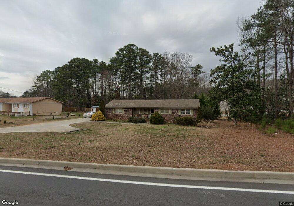
1782 S Gordon Rd Austell, GA 30168
Estimated Value: $239,997 - $297,000
3
Beds
2
Baths
1,269
Sq Ft
$201/Sq Ft
Est. Value
About This Home
This home is located at 1782 S Gordon Rd, Austell, GA 30168 and is currently estimated at $255,249, approximately $201 per square foot. 1782 S Gordon Rd is a home located in Cobb County with nearby schools including Bryant Elementary School, Lindley Middle School, and Pebblebrook High School.
Ownership History
Date
Name
Owned For
Owner Type
Purchase Details
Closed on
Jun 1, 2012
Sold by
Thomas Julian
Bought by
Select Property Grp Llc
Current Estimated Value
Purchase Details
Closed on
May 27, 2011
Sold by
Hud & Housing Of Urban Dev
Bought by
Julian Thomas
Purchase Details
Closed on
Dec 7, 2010
Sold by
Chase Hm Fin Llc
Bought by
Hud & Housing Of Urban Dev
Purchase Details
Closed on
May 1, 1998
Sold by
Collard Patricia
Bought by
Dulaney Garland C
Home Financials for this Owner
Home Financials are based on the most recent Mortgage that was taken out on this home.
Original Mortgage
$97,032
Interest Rate
7.1%
Mortgage Type
FHA
Create a Home Valuation Report for This Property
The Home Valuation Report is an in-depth analysis detailing your home's value as well as a comparison with similar homes in the area
Home Values in the Area
Average Home Value in this Area
Purchase History
| Date | Buyer | Sale Price | Title Company |
|---|---|---|---|
| Select Property Grp Llc | $35,001 | -- | |
| Julian Thomas | -- | -- | |
| Hud & Housing Of Urban Dev | -- | -- | |
| Chase Hm Fin Llc | $105,710 | -- | |
| Dulaney Garland C | $96,900 | -- |
Source: Public Records
Mortgage History
| Date | Status | Borrower | Loan Amount |
|---|---|---|---|
| Previous Owner | Dulaney Garland C | $97,032 |
Source: Public Records
Tax History Compared to Growth
Tax History
| Year | Tax Paid | Tax Assessment Tax Assessment Total Assessment is a certain percentage of the fair market value that is determined by local assessors to be the total taxable value of land and additions on the property. | Land | Improvement |
|---|---|---|---|---|
| 2025 | $2,804 | $93,064 | $28,000 | $65,064 |
| 2024 | $2,806 | $93,064 | $28,000 | $65,064 |
| 2023 | $2,314 | $76,752 | $16,000 | $60,752 |
| 2022 | $2,329 | $76,752 | $16,000 | $60,752 |
| 2021 | $1,834 | $60,444 | $16,000 | $44,444 |
| 2020 | $1,834 | $60,444 | $16,000 | $44,444 |
| 2019 | $1,449 | $47,732 | $11,200 | $36,532 |
| 2018 | $1,035 | $34,096 | $11,400 | $22,696 |
| 2017 | $980 | $34,096 | $11,400 | $22,696 |
| 2016 | $980 | $34,096 | $11,400 | $22,696 |
| 2015 | $1,004 | $34,096 | $11,400 | $22,696 |
| 2014 | $416 | $14,000 | $0 | $0 |
Source: Public Records
Map
Nearby Homes
- 1784 Brandemere Dr Unit 3
- 1151 S Gordon Rd
- 6445 Sherwood Trail
- 1576 S Gordon Rd
- 6651 Malvin Dr
- 6675 S Dillon Rd
- 1972 Cox Dr Unit 5
- 6718 Roscommon Dr
- 6581 Coventry Point Unit 1
- 6627 Coventry Point
- 6992 Ivy Pointe Row
- 2072 Woodbine Cir
- 6736 Ivy Log Dr
- 1507 Locust Log Way
- 6854 Panda Ct Unit A
- 6811 Panda Dr Unit A
- 1550 Greenbrook Dr
- 1310 Dillon Rd
- 1792 S Gordon Rd
- 6342 Milo Dr
- 6346 Milo Dr
- 6338 Milo Dr
- 1622 Brandemere Ln
- 1802 S Gordon Rd
- 1626 Brandemere Ln
- 1630 Brandemere Ln
- 1614 Brandemere Ln
- 1618 Brandemere Ln
- 6350 Milo Dr
- 1634 Brandemere Ln Unit 1634
- 1634 Brandemere Ln
- 1634 Brandemere Ln Unit X
- 0 Brandemere Ln Unit 8727265
- 1652 Brandemere Ln
- 1610 Brandemere Ln
- 1812 S Gordon Rd Unit 1
- 6347 Milo Dr
- 6330 Milo Dr