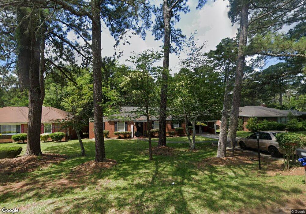
1782 Upper River Rd Macon, GA 31211
Estimated Value: $113,000 - $141,299
3
Beds
1
Bath
1,416
Sq Ft
$88/Sq Ft
Est. Value
About This Home
This home is located at 1782 Upper River Rd, Macon, GA 31211 and is currently estimated at $124,325, approximately $87 per square foot. 1782 Upper River Rd is a home located in Bibb County with nearby schools including Martin Luther King Jr. Elementary School, Appling Middle School, and Northeast High School.
Ownership History
Date
Name
Owned For
Owner Type
Purchase Details
Closed on
Aug 15, 2006
Sold by
R & B Properties Ventures Llc
Bought by
Brannen Helen Dianne
Current Estimated Value
Purchase Details
Closed on
Jan 9, 2005
Sold by
Stanley Edmund Pratt and Stanley Harry Lamar
Bought by
Stanley Reese P
Home Financials for this Owner
Home Financials are based on the most recent Mortgage that was taken out on this home.
Original Mortgage
$41,535
Interest Rate
6.22%
Mortgage Type
Unknown
Purchase Details
Closed on
Jan 4, 2005
Sold by
Stanley Reese P
Bought by
R & B Properties Ventures Llc
Home Financials for this Owner
Home Financials are based on the most recent Mortgage that was taken out on this home.
Original Mortgage
$41,535
Interest Rate
6.22%
Mortgage Type
Unknown
Create a Home Valuation Report for This Property
The Home Valuation Report is an in-depth analysis detailing your home's value as well as a comparison with similar homes in the area
Home Values in the Area
Average Home Value in this Area
Purchase History
| Date | Buyer | Sale Price | Title Company |
|---|---|---|---|
| Brannen Helen Dianne | $57,000 | None Available | |
| Stanley Reese P | -- | None Available | |
| R & B Properties Ventures Llc | -- | None Avilebel |
Source: Public Records
Mortgage History
| Date | Status | Borrower | Loan Amount |
|---|---|---|---|
| Previous Owner | R & B Properties Ventures Llc | $41,535 |
Source: Public Records
Tax History Compared to Growth
Tax History
| Year | Tax Paid | Tax Assessment Tax Assessment Total Assessment is a certain percentage of the fair market value that is determined by local assessors to be the total taxable value of land and additions on the property. | Land | Improvement |
|---|---|---|---|---|
| 2025 | $1,004 | $40,864 | $3,770 | $37,094 |
| 2024 | $1,038 | $40,864 | $3,770 | $37,094 |
| 2023 | $1,067 | $36,026 | $3,770 | $32,256 |
| 2022 | $1,128 | $32,577 | $3,521 | $29,056 |
| 2021 | $820 | $21,575 | $3,144 | $18,431 |
| 2020 | $838 | $21,575 | $3,144 | $18,431 |
| 2019 | $845 | $21,575 | $3,144 | $18,431 |
| 2018 | $1,473 | $21,575 | $3,144 | $18,431 |
| 2017 | $808 | $21,575 | $3,144 | $18,431 |
| 2016 | $746 | $21,575 | $3,144 | $18,431 |
| 2015 | $1,057 | $21,575 | $3,144 | $18,431 |
| 2014 | $1,215 | $21,575 | $3,144 | $18,431 |
Source: Public Records
Map
Nearby Homes
- 1770 Upper River Rd
- 1794 Upper River Rd
- 1764 Upper River Rd
- 1755 Foster Place
- 1745 Foster Place
- 1758 Upper River Rd
- 1808 Upper River Rd
- 1803 Kirkwood Dr
- 1776 Foster Place
- 1725 Foster Place
- 1752 Upper River Rd
- 1772 Foster Place
- 1770 Foster Place
- 0 Foster Place
- 1758 Foster Place
- 1746 Upper River Rd Unit 100
- 1746 Hamilton Dr
- 1816 Upper River Rd
- 1705 Foster Place
- 1705 Foster Pl (Multiple Parcels)