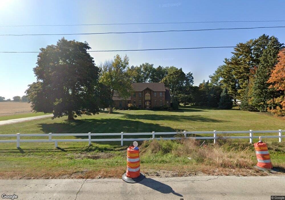
17821 Il Route 23 Dekalb, IL 60115
Estimated Value: $421,000 - $562,000
--
Bed
--
Bath
--
Sq Ft
2.09
Acres
About This Home
This home is located at 17821 Il Route 23, Dekalb, IL 60115 and is currently estimated at $504,780. 17821 Il Route 23 is a home located in DeKalb County with nearby schools including Lincoln Elementary School, Huntley Middle School, and De Kalb High School.
Ownership History
Date
Name
Owned For
Owner Type
Purchase Details
Closed on
Aug 9, 2017
Sold by
Zimmerman Richard
Bought by
17821 Route 23 Land Trust
Current Estimated Value
Purchase Details
Closed on
Dec 27, 2016
Sold by
Crum Trust and Crum Charles William
Bought by
Zimmerman Richard
Home Financials for this Owner
Home Financials are based on the most recent Mortgage that was taken out on this home.
Original Mortgage
$236,250
Interest Rate
3.63%
Mortgage Type
Stand Alone First
Purchase Details
Closed on
Apr 16, 2014
Sold by
Crum Trust
Bought by
Johnson Trust
Create a Home Valuation Report for This Property
The Home Valuation Report is an in-depth analysis detailing your home's value as well as a comparison with similar homes in the area
Home Values in the Area
Average Home Value in this Area
Purchase History
| Date | Buyer | Sale Price | Title Company |
|---|---|---|---|
| 17821 Route 23 Land Trust | -- | None Available | |
| Zimmerman Richard | $271,500 | -- | |
| Johnson Trust | -- | -- |
Source: Public Records
Mortgage History
| Date | Status | Borrower | Loan Amount |
|---|---|---|---|
| Previous Owner | Zimmerman Richard | $236,250 |
Source: Public Records
Tax History Compared to Growth
Tax History
| Year | Tax Paid | Tax Assessment Tax Assessment Total Assessment is a certain percentage of the fair market value that is determined by local assessors to be the total taxable value of land and additions on the property. | Land | Improvement |
|---|---|---|---|---|
| 2024 | $10,436 | $145,025 | $27,851 | $117,174 |
| 2023 | $10,436 | $132,625 | $25,470 | $107,155 |
| 2022 | $11,348 | $130,755 | $25,111 | $105,644 |
| 2021 | $11,826 | $122,476 | $23,521 | $98,955 |
| 2020 | $11,569 | $116,047 | $22,286 | $93,761 |
| 2019 | $11,409 | $111,691 | $21,449 | $90,242 |
| 2018 | $11,217 | $107,025 | $20,553 | $86,472 |
| 2017 | $10,957 | $100,588 | $19,317 | $81,271 |
| 2016 | $10,656 | $96,608 | $18,553 | $78,055 |
| 2015 | -- | $91,140 | $17,503 | $73,637 |
| 2014 | -- | $90,345 | $17,350 | $72,995 |
Source: Public Records
Map
Nearby Homes
- Lot 66 Pebble Beach Ct
- 283 Par Five Dr Unit D
- Lot 78 Pebble Beach Ct
- Lot 77 Pebble Beach Ct
- 3011 S 4th St
- 253 Bent Grass Cir
- 255 Bent Grass Cir
- 235 Saint Andrews Dr
- 18.6 Acre Lot Fairview Dr
- TBD Peace Rd
- TBD Fairview Dr
- 212 Saint Andrews Dr
- 8750 Gurler Rd
- TBD 8.67 Acres Fairview Dr
- 617 E Fairview Dr
- 129 Devonshire Dr
- 427 & 427.5 6th St
- 532 - 534 College Ave
- 216 Pardridge Place
- 1208 Stafford St
- 17855 Il Route 23
- 17889 Il Route 23
- 360 Gurler Rd
- 350 Gurler Rd
- 395 Gurler Rd
- 365 Gurler Rd
- 355 Gurler Rd
- 335 Gurler Rd
- 3275 S 4th St
- 329 Gurler Rd
- 3255 S 4th St
- 345 Gurler Rd
- 3205 S 4th St
- 295 Parfive Dr
- 295 Par Five Dr
- 301 Par Five Dr Unit C
- 301 Par Five Dr Unit D
- 301 Par Five Dr
- 301 Par Five Dr Unit A