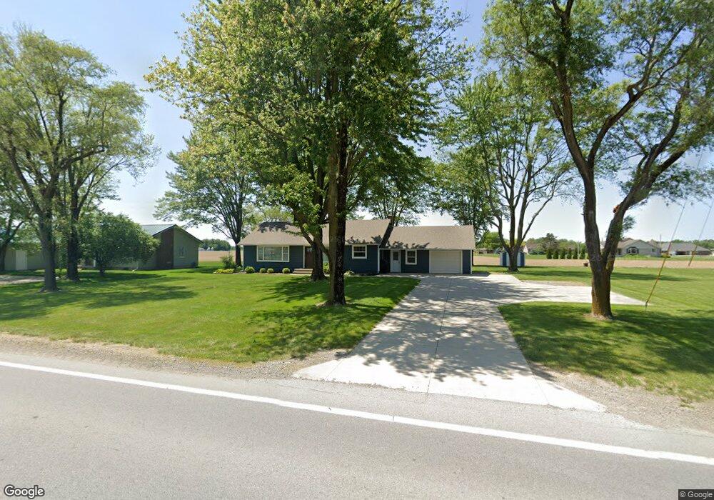
17826 Us Route 224 Fort Jennings, OH 45844
Estimated Value: $206,000 - $240,000
--
Bed
--
Bath
1,440
Sq Ft
$157/Sq Ft
Est. Value
About This Home
This home is located at 17826 Us Route 224, Fort Jennings, OH 45844 and is currently estimated at $226,005, approximately $156 per square foot. 17826 Us Route 224 is a home with nearby schools including Kalida Elementary School and Kalida High School.
Ownership History
Date
Name
Owned For
Owner Type
Purchase Details
Closed on
Sep 22, 2023
Sold by
Unverferth Ryan L and Unverferth Jill M
Bought by
Unverferth Grant R
Current Estimated Value
Home Financials for this Owner
Home Financials are based on the most recent Mortgage that was taken out on this home.
Original Mortgage
$140,000
Outstanding Balance
$136,898
Interest Rate
6.96%
Mortgage Type
New Conventional
Estimated Equity
$89,107
Purchase Details
Closed on
May 25, 2016
Sold by
Martz Susan and Conrad Barbara
Bought by
Unverferth Ryan L and Rieman Jill M
Purchase Details
Closed on
Jul 2, 2002
Bought by
Martz Susan Etal 4
Create a Home Valuation Report for This Property
The Home Valuation Report is an in-depth analysis detailing your home's value as well as a comparison with similar homes in the area
Home Values in the Area
Average Home Value in this Area
Purchase History
| Date | Buyer | Sale Price | Title Company |
|---|---|---|---|
| Unverferth Grant R | -- | None Listed On Document | |
| Unverferth Ryan L | $115,000 | Attorney | |
| Martz Susan Etal 4 | -- | -- |
Source: Public Records
Mortgage History
| Date | Status | Borrower | Loan Amount |
|---|---|---|---|
| Open | Unverferth Grant R | $140,000 |
Source: Public Records
Tax History Compared to Growth
Tax History
| Year | Tax Paid | Tax Assessment Tax Assessment Total Assessment is a certain percentage of the fair market value that is determined by local assessors to be the total taxable value of land and additions on the property. | Land | Improvement |
|---|---|---|---|---|
| 2024 | $1,308 | $47,160 | $4,720 | $42,440 |
| 2023 | $1,485 | $35,790 | $3,730 | $32,060 |
| 2022 | $1,248 | $35,791 | $3,731 | $32,060 |
| 2021 | $1,252 | $35,790 | $3,730 | $32,060 |
| 2020 | $1,250 | $23,670 | $3,110 | $20,560 |
| 2019 | $1,092 | $31,290 | $3,730 | $27,560 |
| 2018 | $1,067 | $31,290 | $3,730 | $27,560 |
| 2017 | $849 | $31,290 | $3,730 | $27,560 |
| 2016 | $828 | $23,670 | $3,110 | $20,560 |
| 2015 | $832 | $23,670 | $3,110 | $20,560 |
| 2014 | $822 | $23,670 | $3,110 | $20,560 |
| 2013 | $852 | $23,670 | $3,110 | $20,560 |
Source: Public Records
Map
Nearby Homes
- 106 Carnation St
- 15105 Road 15m
- 20501 U S 224
- 0 Sr 115 & Rd J Unit 6128830
- 0 Sr 115 & Rd J
- 17736 Road 20p
- 12806 Road K
- 147 Elm St
- 148 S Water St
- 0 Heritage Cir Unit 6112034
- 0 Heritage Cir Unit 303239
- 202 S Main St
- 320 Auglaize St
- 0 Road 24-Q
- 209 Willow Bend Dr
- 717 & 717 1/2 & 721 E Third St
- 304 Oakview (Unit E) Dr
- 308 Delphos Rd
- 204 E Sugar St
- 402 S 5th St
- 17850 Us Route 224
- 501 S Broad St
- 17783 U S 224
- 18022 Road M17
- 18075 Road M17
- 0 Road 17n
- 18115 Road M17
- 18074 Road M17
- 18121 Road M17
- 18155 Road M17
- 18116 Road M17
- 18185 Road M17
- 400 S Broad St
- 202 E Western Ave
- 115 W Water St
- 105 Water St
- 109 W Water St
- 203 W Western Ave
- 114 E Water St
- 207 W Western Ave