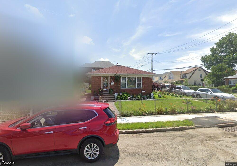
17828 119th Rd Jamaica, NY 11434
Saint Albans NeighborhoodEstimated Value: $627,527 - $707,000
--
Bed
--
Bath
1,050
Sq Ft
$622/Sq Ft
Est. Value
About This Home
This home is located at 17828 119th Rd, Jamaica, NY 11434 and is currently estimated at $653,132, approximately $622 per square foot. 17828 119th Rd is a home located in Queens County with nearby schools including Ps 36 St Albans School, Is 59 Springfield Gardens, and Rochdale Early Advantage Charter School.
Ownership History
Date
Name
Owned For
Owner Type
Purchase Details
Closed on
Oct 27, 2009
Sold by
Hendrickson Elizabeth M
Bought by
Edwards Reuben
Current Estimated Value
Home Financials for this Owner
Home Financials are based on the most recent Mortgage that was taken out on this home.
Original Mortgage
$240,000
Outstanding Balance
$157,191
Interest Rate
5.06%
Mortgage Type
Purchase Money Mortgage
Estimated Equity
$495,941
Purchase Details
Closed on
Jan 21, 2002
Sold by
Jones Earl W
Bought by
Jones Earl W and Brown-Jones Dorothy
Create a Home Valuation Report for This Property
The Home Valuation Report is an in-depth analysis detailing your home's value as well as a comparison with similar homes in the area
Home Values in the Area
Average Home Value in this Area
Purchase History
| Date | Buyer | Sale Price | Title Company |
|---|---|---|---|
| Edwards Reuben | $300,000 | -- | |
| Jones Earl W | -- | -- |
Source: Public Records
Mortgage History
| Date | Status | Borrower | Loan Amount |
|---|---|---|---|
| Open | Edwards Reuben | $240,000 |
Source: Public Records
Tax History Compared to Growth
Tax History
| Year | Tax Paid | Tax Assessment Tax Assessment Total Assessment is a certain percentage of the fair market value that is determined by local assessors to be the total taxable value of land and additions on the property. | Land | Improvement |
|---|---|---|---|---|
| 2025 | $5,420 | $27,994 | $11,006 | $16,988 |
| 2024 | $5,420 | $26,986 | $10,930 | $16,056 |
| 2023 | $5,113 | $25,459 | $9,325 | $16,134 |
| 2022 | $4,795 | $32,880 | $14,460 | $18,420 |
| 2021 | $5,055 | $32,880 | $14,460 | $18,420 |
| 2020 | $4,938 | $28,260 | $14,460 | $13,800 |
| 2019 | $4,704 | $26,760 | $14,460 | $12,300 |
| 2018 | $4,325 | $21,216 | $11,647 | $9,569 |
| 2017 | $4,080 | $20,016 | $10,914 | $9,102 |
| 2016 | $4,001 | $20,016 | $10,914 | $9,102 |
| 2015 | $2,277 | $19,440 | $12,060 | $7,380 |
| 2014 | $2,277 | $18,740 | $11,882 | $6,858 |
Source: Public Records
Map
Nearby Homes
- 119-48 178th St
- 119-72 178th St
- 11984 178th Place
- 11819 179th St
- 179-01 120th Ave
- 119-60 177th St
- 176-43 120th Ave
- 176-27 Sunbury Rd
- 17715 Troutville Rd
- 186-02 Foch Blvd
- 17710 Troutville Rd
- 12126 Irwin Place
- 17955 Anderson Rd
- 18822 119th Ave
- 17918 Selover Rd
- 17720 Leslie Rd
- 11942 189th St
- 174-41 125th Ave
- 119-73 Merrill St
- 179-47 Zoller Rd
- 17832 119th Rd
- 11951 178th Place
- 17836 119th Rd
- 11955 178th Place
- 11944 178th Place
- 17838 119th Rd
- 119-59 178th Place
- 11959 178th Place
- 178-27 119th Rd
- 11952 178th Place
- 11912 179th St
- 17840 119th Rd
- 11961 178th Place
- 17827 119th Rd
- 178-19 119th Rd
- 17829 119th Rd
- 17812 119th Rd
- 11908 179th St
- 17840 119th Rd