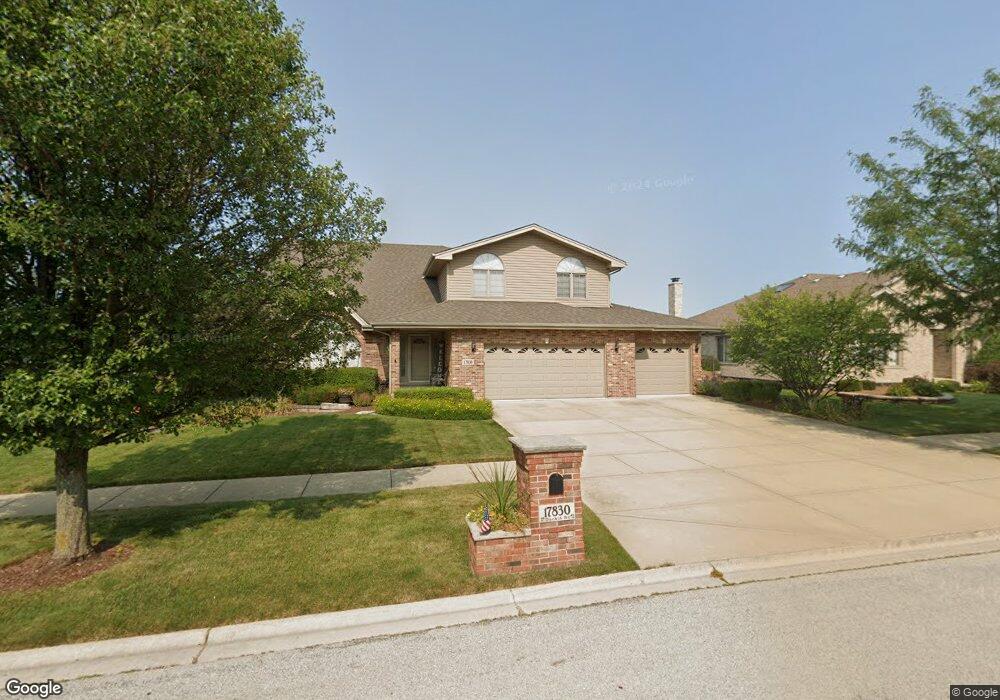
17830 Durkin Rd Tinley Park, IL 60487
Central Tinley Park NeighborhoodEstimated Value: $570,884 - $658,000
4
Beds
3
Baths
3,417
Sq Ft
$176/Sq Ft
Est. Value
About This Home
This home is located at 17830 Durkin Rd, Tinley Park, IL 60487 and is currently estimated at $600,971, approximately $175 per square foot. 17830 Durkin Rd is a home located in Cook County with nearby schools including Millennium Elementary School, Prairie View Middle School, and Victor J Andrew High School.
Ownership History
Date
Name
Owned For
Owner Type
Purchase Details
Closed on
Apr 11, 2005
Sold by
Standard Bank & Trust Co
Bought by
Wall Thomas J and Wall Laurie A
Current Estimated Value
Home Financials for this Owner
Home Financials are based on the most recent Mortgage that was taken out on this home.
Original Mortgage
$324,730
Outstanding Balance
$167,946
Interest Rate
6.12%
Mortgage Type
Fannie Mae Freddie Mac
Estimated Equity
$433,025
Create a Home Valuation Report for This Property
The Home Valuation Report is an in-depth analysis detailing your home's value as well as a comparison with similar homes in the area
Home Values in the Area
Average Home Value in this Area
Purchase History
| Date | Buyer | Sale Price | Title Company |
|---|---|---|---|
| Wall Thomas J | $387,000 | Cti |
Source: Public Records
Mortgage History
| Date | Status | Borrower | Loan Amount |
|---|---|---|---|
| Open | Wall Thomas J | $324,730 |
Source: Public Records
Tax History
| Year | Tax Paid | Tax Assessment Tax Assessment Total Assessment is a certain percentage of the fair market value that is determined by local assessors to be the total taxable value of land and additions on the property. | Land | Improvement |
|---|---|---|---|---|
| 2025 | $12,962 | $50,000 | $6,109 | $43,891 |
| 2024 | $12,962 | $50,000 | $6,109 | $43,891 |
| 2023 | $11,750 | $50,000 | $6,109 | $43,891 |
| 2022 | $11,750 | $36,380 | $5,313 | $31,067 |
| 2021 | $11,403 | $36,378 | $5,312 | $31,066 |
| 2020 | $11,183 | $36,378 | $5,312 | $31,066 |
| 2019 | $10,855 | $36,901 | $4,781 | $32,120 |
| 2018 | $12,131 | $41,658 | $4,781 | $36,877 |
| 2017 | $11,826 | $41,658 | $4,781 | $36,877 |
| 2016 | $11,422 | $36,889 | $4,250 | $32,639 |
| 2015 | $11,259 | $36,889 | $4,250 | $32,639 |
| 2014 | $11,180 | $36,889 | $4,250 | $32,639 |
| 2013 | $12,391 | $43,657 | $4,250 | $39,407 |
Source: Public Records
Map
Nearby Homes
- 19209 Buncrana Cir
- 18037 Sippel Dr
- 18113 Mager Dr Unit 18113
- 18154 Bettenhausen Dr
- 17807 Linden Dr
- 18161 Mager Dr Unit 18161
- 8320 Heather Ln
- 8314 Heather Ln
- 18295 Kirby Dr Unit 2718295
- 8835 174th St
- 8990 175th St
- 8718 Black Oak Ave
- 9038 Mansfield Dr Unit 8
- 9213 Kylemore Ct
- 17565 Windsor Pkwy Unit 37
- 7832 Joliet Dr S
- 7816 Marquette Dr S
- 9201 175th St
- 7799 Bristol Park Dr Unit 1SE
- 8444 W 171st St
- 17824 Durkin Rd
- 17836 Durkin Rd
- 17829 Harper Rd
- 17823 Harper Rd
- 17835 Harper Rd
- 17818 Durkin Rd
- 17842 Durkin Rd
- 17831 Durkin Rd
- 17825 Durkin Rd
- 17817 Harper Rd
- 17841 Harper Rd
- 17837 Durkin Rd
- 17812 Durkin Rd
- 17819 Durkin Rd
- 17843 Durkin Rd
- 17811 Harper Rd
- 17832 Harper Rd
- 17838 Harper Rd
- 17813 Durkin Rd
- 17826 Harper Rd
Your Personal Tour Guide
Ask me questions while you tour the home.