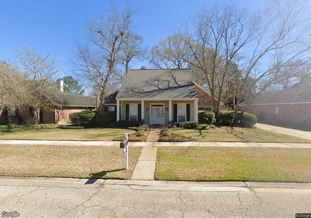
17832 General Forrest Ave Baton Rouge, LA 70817
Shenandoah NeighborhoodEstimated Value: $267,043 - $327,000
--
Bed
--
Bath
2,005
Sq Ft
$148/Sq Ft
Est. Value
About This Home
This home is located at 17832 General Forrest Ave, Baton Rouge, LA 70817 and is currently estimated at $297,511, approximately $148 per square foot. 17832 General Forrest Ave is a home located in East Baton Rouge Parish with nearby schools including Shenandoah Elementary School, Woodlawn Middle School, and Woodlawn High School.
Ownership History
Date
Name
Owned For
Owner Type
Purchase Details
Closed on
Jun 4, 2019
Sold by
Devaux John M and Devaux Joyce B
Bought by
Devaux John M and Devaux Joyce B
Current Estimated Value
Purchase Details
Closed on
Apr 9, 1999
Sold by
Geter Geter Clifton D
Bought by
Devaux John Martin and Devaux Joyce Babin
Home Financials for this Owner
Home Financials are based on the most recent Mortgage that was taken out on this home.
Original Mortgage
$130,900
Outstanding Balance
$32,733
Interest Rate
6.89%
Mortgage Type
Purchase Money Mortgage
Estimated Equity
$264,778
Create a Home Valuation Report for This Property
The Home Valuation Report is an in-depth analysis detailing your home's value as well as a comparison with similar homes in the area
Home Values in the Area
Average Home Value in this Area
Purchase History
| Date | Buyer | Sale Price | Title Company |
|---|---|---|---|
| Devaux John M | -- | None Available | |
| Devaux John Martin | $154,000 | -- |
Source: Public Records
Mortgage History
| Date | Status | Borrower | Loan Amount |
|---|---|---|---|
| Open | Devaux John Martin | $130,900 |
Source: Public Records
Tax History Compared to Growth
Tax History
| Year | Tax Paid | Tax Assessment Tax Assessment Total Assessment is a certain percentage of the fair market value that is determined by local assessors to be the total taxable value of land and additions on the property. | Land | Improvement |
|---|---|---|---|---|
| 2024 | $1,545 | $20,050 | $2,400 | $17,650 |
| 2023 | $1,545 | $20,050 | $2,400 | $17,650 |
| 2022 | $2,356 | $20,050 | $2,400 | $17,650 |
| 2021 | $2,312 | $20,050 | $2,400 | $17,650 |
| 2020 | $2,341 | $20,050 | $2,400 | $17,650 |
| 2019 | $2,288 | $18,800 | $2,400 | $16,400 |
| 2018 | $2,260 | $18,800 | $2,400 | $16,400 |
| 2017 | $2,260 | $18,800 | $2,400 | $16,400 |
| 2016 | $1,343 | $18,800 | $2,400 | $16,400 |
| 2015 | $1,342 | $18,800 | $2,400 | $16,400 |
| 2014 | $1,315 | $18,800 | $2,400 | $16,400 |
| 2013 | -- | $18,800 | $2,400 | $16,400 |
Source: Public Records
Map
Nearby Homes
- 5487 Hagerstown Dr
- 5246 Stones River Ave
- 5730 N Shore Dr
- 17845 Coffee Rd
- 17633 E Fort Pickens Ave
- 5534 Round Forrest Dr
- 5211 Fort Gregg Dr
- 6046 Hagerstown Dr
- 18343 Wildlife Way Dr
- 17630 Creek Hollow Rd
- 6130 Wildlife Way Ct
- 6134 Hagerstown Dr
- 4633 Elm Shadow Dr
- 19222 Indian Ridge Ave
- 5845 S Shore Dr
- 5821 Fort Sumpter Dr
- 5532 Summer Lake Dr
- 5927 S Shore Dr
- 6041 Cottage Row Dr
- 6226 Double Tree Dr
- 17726 General Forrest Ave
- 17836 General Forrest Ave
- 17842 General Forrest Ave
- 17822 General Forrest Ave
- 18237 Creek Hollow Rd
- 18227 Creek Hollow Rd
- 18247 Creek Hollow Rd
- 17831 General Forrest Ave
- 17825 General Forrest Ave
- 17835 General Forrest Ave
- 17846 General Forrest Ave
- 17841 E General Forest
- 18217 Creek Hollow Rd
- 17821 General Forrest Ave
- 17841 General Forrest Ave
- 17768 General Forrest Ave
- 17845 General Forrest Ave
- 17852 General Forrest Ave
- 17856 E General Forest
- 17856 General Forrest Ave