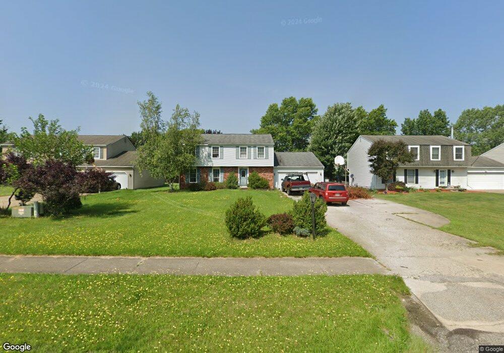
17838 Howe Rd Strongsville, OH 44136
Estimated Value: $362,384 - $422,000
4
Beds
4
Baths
2,470
Sq Ft
$158/Sq Ft
Est. Value
About This Home
This home is located at 17838 Howe Rd, Strongsville, OH 44136 and is currently estimated at $390,596, approximately $158 per square foot. 17838 Howe Rd is a home located in Cuyahoga County with nearby schools including Strongsville High School.
Ownership History
Date
Name
Owned For
Owner Type
Purchase Details
Closed on
Nov 15, 2014
Sold by
Guminey Linda
Bought by
Lechler Albert F
Current Estimated Value
Home Financials for this Owner
Home Financials are based on the most recent Mortgage that was taken out on this home.
Original Mortgage
$127,500
Outstanding Balance
$98,028
Interest Rate
4.1%
Mortgage Type
New Conventional
Estimated Equity
$292,568
Purchase Details
Closed on
Jul 21, 1999
Sold by
Guminey Linda
Bought by
Guminey Linda
Purchase Details
Closed on
Jun 22, 1978
Bought by
Guminey Lawrence J
Purchase Details
Closed on
Apr 19, 1977
Bought by
Baycrest Homes Inc
Purchase Details
Closed on
Jan 1, 1977
Bought by
North East Land Co
Create a Home Valuation Report for This Property
The Home Valuation Report is an in-depth analysis detailing your home's value as well as a comparison with similar homes in the area
Home Values in the Area
Average Home Value in this Area
Purchase History
| Date | Buyer | Sale Price | Title Company |
|---|---|---|---|
| Lechler Albert F | $150,000 | Maximum Title | |
| Guminey Linda | -- | -- | |
| Guminey Lawrence J | $67,800 | -- | |
| Baycrest Homes Inc | $43,500 | -- | |
| North East Land Co | -- | -- |
Source: Public Records
Mortgage History
| Date | Status | Borrower | Loan Amount |
|---|---|---|---|
| Open | Lechler Albert F | $127,500 |
Source: Public Records
Tax History Compared to Growth
Tax History
| Year | Tax Paid | Tax Assessment Tax Assessment Total Assessment is a certain percentage of the fair market value that is determined by local assessors to be the total taxable value of land and additions on the property. | Land | Improvement |
|---|---|---|---|---|
| 2024 | $4,756 | $101,290 | $17,605 | $83,685 |
| 2023 | $4,631 | $73,960 | $21,180 | $52,780 |
| 2022 | $4,597 | $73,960 | $21,180 | $52,780 |
| 2021 | $4,561 | $73,960 | $21,180 | $52,780 |
| 2020 | $4,226 | $60,620 | $17,360 | $43,260 |
| 2019 | $4,102 | $173,200 | $49,600 | $123,600 |
| 2018 | $3,571 | $60,620 | $17,360 | $43,260 |
| 2017 | $3,483 | $52,510 | $13,760 | $38,750 |
| 2016 | $3,455 | $52,510 | $13,760 | $38,750 |
| 2015 | $3,884 | $52,510 | $13,760 | $38,750 |
| 2014 | $3,884 | $58,210 | $13,760 | $44,450 |
Source: Public Records
Map
Nearby Homes
- 17130 Golden Star Dr
- 18229 Howe Rd
- 17159 Turkey Meadow Ln
- 16650 Lanier Ave
- 14558 Drake Rd
- 16711 Beech Cir
- 18987 Laurell Cir
- 14985 Camden Cir
- 16969 Antler Ln
- 17682 Drake Rd
- 14132 Walking Stick Way
- 19694 Benbow Rd
- 15772 Boston Rd
- 19740 Benbow Rd
- 15604-REAR Boston Rd
- 15188 Trails Landing
- 14292 Trenton Ave
- 17745 Brick Mill Run
- 17029 Eagles Nest Cir
- 18294 Drake Rd
- 17804 Howe Rd
- 17872 Howe Rd
- 17780 Howe Rd
- 17906 Howe Rd
- 17857 Blazing Star Dr
- 17831 Blazing Star Dr
- 17805 Blazing Star Dr
- 17736 Howe Rd
- 17831 Howe Rd
- 17138 Golden Star Dr
- 17823 Howe Rd
- 17773 Blazing Star Dr
- 17702 Howe Rd
- 17785 Howe Rd
- 17974 Howe Rd
- 17959 Howe Rd
- 17741 Howe Rd
- 17759 Blazing Star Dr
- 17668 Howe Rd
- 17129 Golden Star Dr