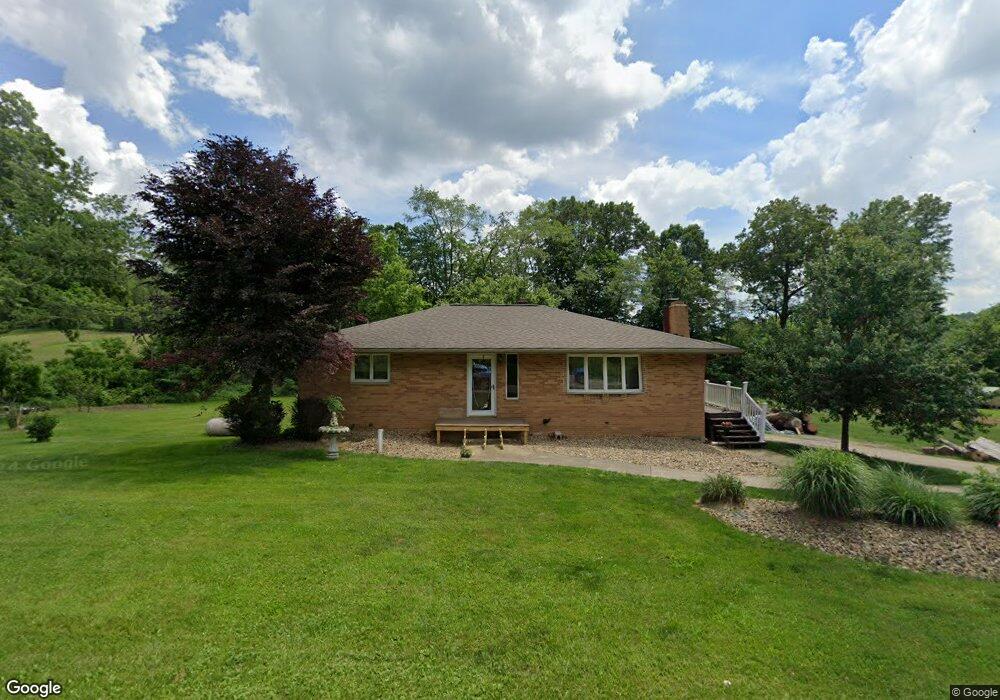
1784 Center Rd Clinton, OH 44216
Estimated Value: $289,150 - $343,000
3
Beds
3
Baths
1,835
Sq Ft
$171/Sq Ft
Est. Value
About This Home
This home is located at 1784 Center Rd, Clinton, OH 44216 and is currently estimated at $314,288, approximately $171 per square foot. 1784 Center Rd is a home located in Summit County with nearby schools including Northwest Primary School, W.S. Stinson Elementary School, and Northwest Middle School.
Ownership History
Date
Name
Owned For
Owner Type
Purchase Details
Closed on
Jan 29, 2010
Sold by
Harper Robert T
Bought by
Shaffer Walter S
Current Estimated Value
Home Financials for this Owner
Home Financials are based on the most recent Mortgage that was taken out on this home.
Original Mortgage
$147,283
Outstanding Balance
$98,543
Interest Rate
5.25%
Mortgage Type
FHA
Estimated Equity
$215,745
Purchase Details
Closed on
Oct 1, 2004
Sold by
Harper Lori M
Bought by
Harper Robert T
Create a Home Valuation Report for This Property
The Home Valuation Report is an in-depth analysis detailing your home's value as well as a comparison with similar homes in the area
Home Values in the Area
Average Home Value in this Area
Purchase History
| Date | Buyer | Sale Price | Title Company |
|---|---|---|---|
| Shaffer Walter S | $150,000 | Bond & Associates Title Agen | |
| Harper Robert T | -- | -- |
Source: Public Records
Mortgage History
| Date | Status | Borrower | Loan Amount |
|---|---|---|---|
| Open | Shaffer Walter S | $147,283 |
Source: Public Records
Tax History
| Year | Tax Paid | Tax Assessment Tax Assessment Total Assessment is a certain percentage of the fair market value that is determined by local assessors to be the total taxable value of land and additions on the property. | Land | Improvement |
|---|---|---|---|---|
| 2024 | $3,826 | $85,992 | $14,599 | $71,393 |
| 2023 | $3,826 | $85,992 | $14,599 | $71,393 |
| 2022 | $3,102 | $63,851 | $10,812 | $53,039 |
| 2021 | $3,110 | $63,851 | $10,812 | $53,039 |
| 2020 | $3,119 | $63,850 | $10,810 | $53,040 |
| 2019 | $2,942 | $58,070 | $12,590 | $45,480 |
| 2018 | $2,940 | $58,070 | $12,590 | $45,480 |
| 2017 | $2,702 | $58,070 | $12,590 | $45,480 |
| 2016 | $2,659 | $49,480 | $12,590 | $36,890 |
| 2015 | $2,702 | $49,480 | $12,590 | $36,890 |
| 2014 | $2,821 | $49,480 | $12,590 | $36,890 |
| 2013 | $2,821 | $49,490 | $12,590 | $36,900 |
Source: Public Records
Map
Nearby Homes
- 5429 Grove Rd
- 6090 Manchester Rd Unit 6096
- 6235 Manchester Rd
- 771 Leeman Dr
- 1365 Vanderhoof Rd
- 715 Highland Park Dr
- 2672 Lyman Dr
- V/L 1 Grill Rd
- 2761 North St
- 6300 S Cleveland Massillon Rd
- 2543 Shadow Ln
- 8177 S Cleveland Massillon Rd Unit 16
- 4698 Manchester Rd
- 2457 Bishop Oval
- 2688 Himelrigh Blvd
- 5766 Weaver Rd
- 6151 Taylor Rd
- V/L Monroe Square
- 5813 S Cleveland Massillon Rd
- 3179 Vanderhoof Rd
Your Personal Tour Guide
Ask me questions while you tour the home.