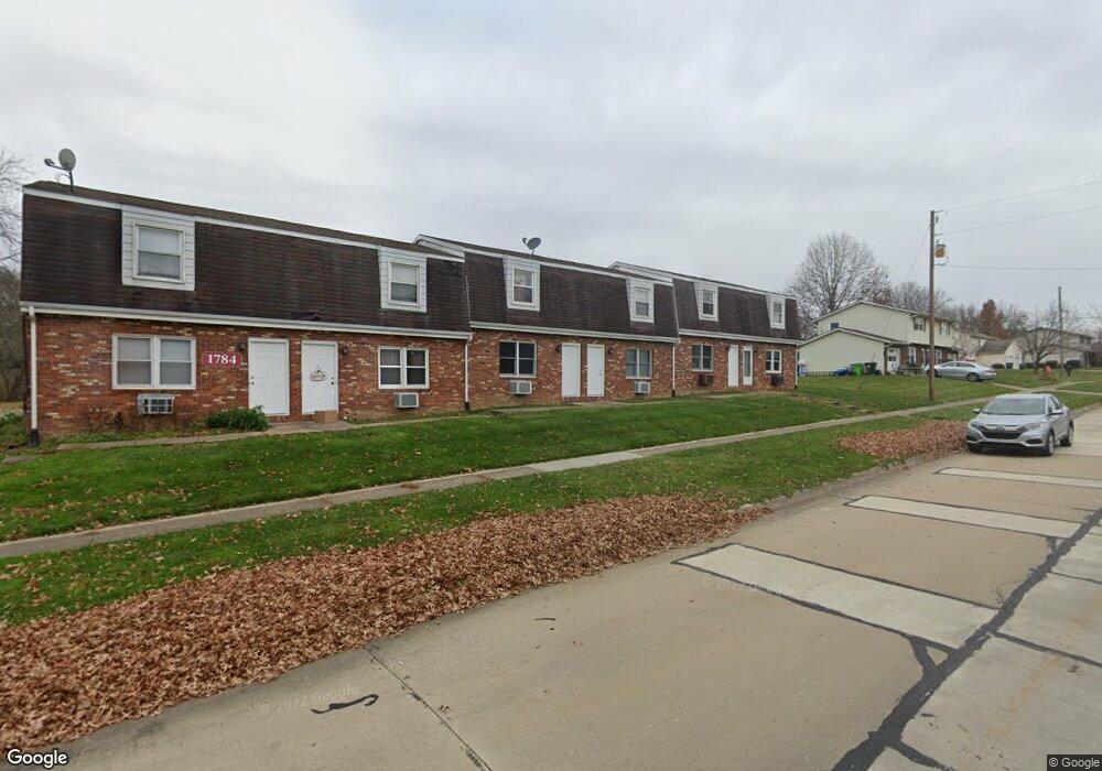
1784 Normandy Dr Wooster, OH 44691
Estimated Value: $96,000 - $121,000
2
Beds
2
Baths
864
Sq Ft
$129/Sq Ft
Est. Value
About This Home
This home is located at 1784 Normandy Dr, Wooster, OH 44691 and is currently estimated at $111,799, approximately $129 per square foot. 1784 Normandy Dr is a home located in Wayne County with nearby schools including Parkview Elementary School, Edgewood Middle School, and Wooster High School.
Ownership History
Date
Name
Owned For
Owner Type
Purchase Details
Closed on
Jun 9, 2025
Sold by
Schaad Michael
Bought by
Lyons Run Properties Llc
Current Estimated Value
Purchase Details
Closed on
Jun 29, 2020
Sold by
Steiner Ronald Gene and Steiner Ruth Irma
Bought by
Schaad Michael
Purchase Details
Closed on
Jun 25, 2019
Sold by
Steiner Ronald G and Steiner Ruth I
Bought by
Schaad Michael
Home Financials for this Owner
Home Financials are based on the most recent Mortgage that was taken out on this home.
Original Mortgage
$35,000
Interest Rate
0.35%
Mortgage Type
Land Contract Argmt. Of Sale
Purchase Details
Closed on
Jan 10, 2012
Sold by
Steiner Ruth I and Steiner Ronald G
Bought by
Steiner Ronald Gene and Steiner Ruth Irma
Purchase Details
Closed on
Jun 14, 1994
Sold by
Slabaugh Marvin C
Bought by
Steiner Ruth I
Create a Home Valuation Report for This Property
The Home Valuation Report is an in-depth analysis detailing your home's value as well as a comparison with similar homes in the area
Home Values in the Area
Average Home Value in this Area
Purchase History
| Date | Buyer | Sale Price | Title Company |
|---|---|---|---|
| Lyons Run Properties Llc | $118,000 | Wayne County Title | |
| Lyons Run Properties Llc | $118,000 | Wayne County Title | |
| Schaad Michael | $42,000 | None Available | |
| Schaad Michael | $42,000 | None Available | |
| Steiner Ronald Gene | -- | Attorney | |
| Steiner Ruth I | $37,500 | -- |
Source: Public Records
Mortgage History
| Date | Status | Borrower | Loan Amount |
|---|---|---|---|
| Previous Owner | Schaad Michael | $35,000 |
Source: Public Records
Tax History
| Year | Tax Paid | Tax Assessment Tax Assessment Total Assessment is a certain percentage of the fair market value that is determined by local assessors to be the total taxable value of land and additions on the property. | Land | Improvement |
|---|---|---|---|---|
| 2024 | $819 | $19,800 | $2,400 | $17,400 |
| 2023 | $822 | $19,800 | $2,400 | $17,400 |
| 2022 | $757 | $14,450 | $1,750 | $12,700 |
| 2021 | $781 | $14,450 | $1,750 | $12,700 |
| 2020 | $759 | $14,450 | $1,750 | $12,700 |
| 2019 | $812 | $14,840 | $1,750 | $13,090 |
| 2018 | $814 | $14,840 | $1,750 | $13,090 |
| 2017 | $810 | $14,840 | $1,750 | $13,090 |
| 2016 | $741 | $12,470 | $1,750 | $10,720 |
| 2015 | $728 | $12,470 | $1,750 | $10,720 |
| 2014 | $728 | $12,470 | $1,750 | $10,720 |
| 2013 | $738 | $12,430 | $1,390 | $11,040 |
Source: Public Records
Map
Nearby Homes
- 972 Carriage Ln
- 862 Marilyn Dr
- 835 Marilyn Dr
- 869 Meadow Ln
- 1960 Autumn Run
- 2185 Ryan Ct
- 1717 Carlin Trail
- 1627 Carlin Trail
- 1624 Carlin Trail
- 1643 Carlin Trail
- Birch Plan at Clear Creek Run - Single Family Homes
- Aspen Plan at Clear Creek Run - Single Family Homes
- Tupelo Plan at Clear Creek Run - Single Family Homes
- Spruce Plan at Clear Creek Run - Single Family Homes
- Hazel Plan at Clear Creek Run - Single Family Homes
- 1587 Saunders Dr
- 2360 Star Dr
- 1540 W Highland Ave
- 2447 Wetherington Ln Unit 131
- 2447 Wetherington Ln Unit 130
- 1784 Normandy Dr
- 1784 Normandy Dr
- 1784 Normandy Dr
- 1784 Normandy Dr
- 1784 Normandy Dr
- 1784 Normandy Dr
- 1784 Normandy Dr
- 1784 Normandy Dr
- 1784 Normandy Dr
- 1784 Normandy Dr Unit 101-02-03-04-05-06-0
- 1796 Normandy Dr
- 1772 Normandy Dr
- 1772 Normandy Dr
- 1772 Normandy Dr
- 1772 Normandy Dr
- 1772 Normandy Dr Unit 204
- 1772 Normandy Dr
- 1772 Normandy Dr
- 1772 Normandy Dr Unit 201-202-203-206-207
- 1785 Normandy Dr
Your Personal Tour Guide
Ask me questions while you tour the home.