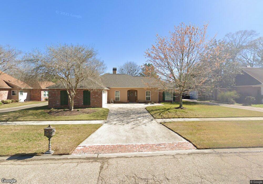
17842 General Forrest Ave Baton Rouge, LA 70817
Shenandoah NeighborhoodEstimated Value: $322,445 - $359,000
--
Bed
--
Bath
2,318
Sq Ft
$146/Sq Ft
Est. Value
About This Home
This home is located at 17842 General Forrest Ave, Baton Rouge, LA 70817 and is currently estimated at $338,111, approximately $145 per square foot. 17842 General Forrest Ave is a home located in East Baton Rouge Parish with nearby schools including Shenandoah Elementary School, Woodlawn Middle School, and Woodlawn High School.
Ownership History
Date
Name
Owned For
Owner Type
Purchase Details
Closed on
May 13, 1998
Sold by
Andrus Berendson Berendson Gustavo Antionio
Bought by
Powell Lloyd P and Powell Connie S
Current Estimated Value
Home Financials for this Owner
Home Financials are based on the most recent Mortgage that was taken out on this home.
Original Mortgage
$150,858
Outstanding Balance
$29,682
Interest Rate
7.18%
Mortgage Type
VA
Estimated Equity
$308,429
Create a Home Valuation Report for This Property
The Home Valuation Report is an in-depth analysis detailing your home's value as well as a comparison with similar homes in the area
Home Values in the Area
Average Home Value in this Area
Purchase History
| Date | Buyer | Sale Price | Title Company |
|---|---|---|---|
| Powell Lloyd P | $147,900 | -- |
Source: Public Records
Mortgage History
| Date | Status | Borrower | Loan Amount |
|---|---|---|---|
| Open | Powell Lloyd P | $150,858 |
Source: Public Records
Tax History Compared to Growth
Tax History
| Year | Tax Paid | Tax Assessment Tax Assessment Total Assessment is a certain percentage of the fair market value that is determined by local assessors to be the total taxable value of land and additions on the property. | Land | Improvement |
|---|---|---|---|---|
| 2024 | $2,477 | $28,180 | $2,500 | $25,680 |
| 2023 | $2,477 | $23,180 | $2,500 | $20,680 |
| 2022 | $2,707 | $23,180 | $2,500 | $20,680 |
| 2021 | $2,656 | $23,180 | $2,500 | $20,680 |
| 2020 | $2,690 | $23,180 | $2,500 | $20,680 |
| 2019 | $2,526 | $20,850 | $2,500 | $18,350 |
| 2018 | $2,495 | $20,850 | $2,500 | $18,350 |
| 2017 | $2,495 | $20,850 | $2,500 | $18,350 |
| 2016 | $1,571 | $20,850 | $2,500 | $18,350 |
| 2015 | $1,571 | $20,850 | $2,500 | $18,350 |
| 2014 | $1,538 | $20,850 | $2,500 | $18,350 |
| 2013 | -- | $20,850 | $2,500 | $18,350 |
Source: Public Records
Map
Nearby Homes
- 5487 Hagerstown Dr
- 5246 Stones River Ave
- 5730 N Shore Dr
- 17633 E Fort Pickens Ave
- 5211 Fort Gregg Dr
- 17845 Coffee Rd
- 6046 Hagerstown Dr
- 5534 Round Forrest Dr
- 18343 Wildlife Way Dr
- 4633 Elm Shadow Dr
- 17630 Creek Hollow Rd
- 6130 Wildlife Way Ct
- 6134 Hagerstown Dr
- 19222 Indian Ridge Ave
- 5845 S Shore Dr
- 5927 S Shore Dr
- 17237 Monitor Ave
- 6226 Double Tree Dr
- 5821 Fort Sumpter Dr
- 5532 Summer Lake Dr
- 17846 General Forrest Ave
- 17836 General Forrest Ave
- 17832 General Forrest Ave
- 17856 E General Forest
- 17856 General Forrest Ave
- 17852 General Forrest Ave
- 18247 Creek Hollow Rd
- 17726 General Forrest Ave
- 17841 E General Forest
- 17841 General Forrest Ave
- 18319 Creek Hollow Rd
- 17835 General Forrest Ave
- 17845 General Forrest Ave
- 18237 Creek Hollow Rd
- 17831 General Forrest Ave
- 17851 General Forrest Ave
- 18329 Creek Hollow Rd
- 18227 Creek Hollow Rd
- 17825 General Forrest Ave
- 17855 General Forrest Ave