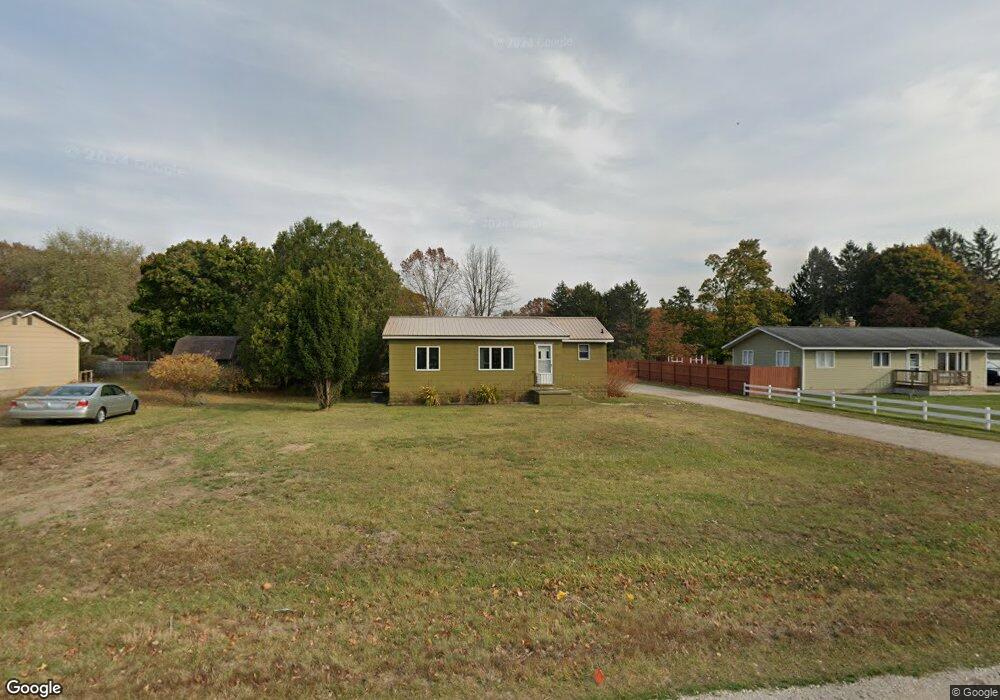
1785 Maple Rd Manistee, MI 49660
Estimated Value: $205,793 - $300,000
2
Beds
1
Bath
1,200
Sq Ft
$203/Sq Ft
Est. Value
About This Home
This home is located at 1785 Maple Rd, Manistee, MI 49660 and is currently estimated at $243,698, approximately $203 per square foot. 1785 Maple Rd is a home located in Manistee County with nearby schools including John F. Kennedy Elementary School, Thomas Jefferson Elementary School, and Manistee Middle / High School.
Create a Home Valuation Report for This Property
The Home Valuation Report is an in-depth analysis detailing your home's value as well as a comparison with similar homes in the area
Home Values in the Area
Average Home Value in this Area
Tax History
| Year | Tax Paid | Tax Assessment Tax Assessment Total Assessment is a certain percentage of the fair market value that is determined by local assessors to be the total taxable value of land and additions on the property. | Land | Improvement |
|---|---|---|---|---|
| 2025 | $596 | $69,300 | $0 | $0 |
| 2024 | $6 | $65,600 | $0 | $0 |
| 2023 | $552 | $52,400 | $0 | $0 |
| 2022 | $2,080 | $45,300 | $45,300 | $0 |
| 2021 | $2,526 | $63,200 | $63,200 | $0 |
| 2020 | $2,344 | $53,700 | $53,700 | $0 |
| 2019 | $1,196 | $44,300 | $44,300 | $0 |
| 2018 | $1,174 | $42,600 | $42,600 | $0 |
| 2017 | $1,150 | $41,400 | $41,400 | $0 |
| 2016 | $299 | $47,300 | $47,300 | $0 |
| 2015 | -- | $25,700 | $25,700 | $0 |
| 2014 | -- | $33,200 | $0 | $0 |
Source: Public Records
Map
Nearby Homes
Your Personal Tour Guide
Ask me questions while you tour the home.