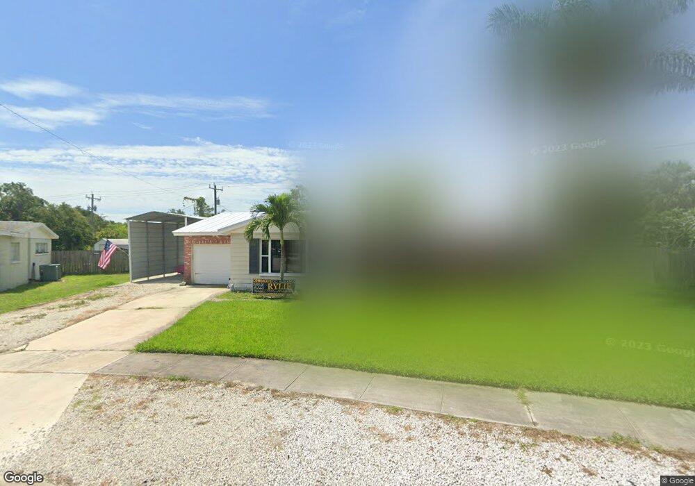
1785 S Merrimac Dr Merritt Island, FL 32952
Estimated Value: $318,695 - $356,000
3
Beds
2
Baths
1,397
Sq Ft
$238/Sq Ft
Est. Value
About This Home
This home is located at 1785 S Merrimac Dr, Merritt Island, FL 32952 and is currently estimated at $332,674, approximately $238 per square foot. 1785 S Merrimac Dr is a home located in Brevard County with nearby schools including Tropical Elementary School, Thomas Jefferson Middle School, and Merritt Island High School.
Ownership History
Date
Name
Owned For
Owner Type
Purchase Details
Closed on
Aug 12, 2008
Sold by
Us Bank Na
Bought by
Villarreal Matthew A
Current Estimated Value
Home Financials for this Owner
Home Financials are based on the most recent Mortgage that was taken out on this home.
Original Mortgage
$123,120
Outstanding Balance
$81,400
Interest Rate
6.48%
Estimated Equity
$251,274
Purchase Details
Closed on
Feb 27, 2008
Sold by
Mcclure Ralph E and Mcclure Christine L
Bought by
Us Bank Na
Purchase Details
Closed on
Mar 31, 2006
Sold by
Smith Walter D and Smith Vickie L
Bought by
Mcclure Ralph E and Mcclure Christine L
Home Financials for this Owner
Home Financials are based on the most recent Mortgage that was taken out on this home.
Original Mortgage
$190,000
Interest Rate
7.9%
Create a Home Valuation Report for This Property
The Home Valuation Report is an in-depth analysis detailing your home's value as well as a comparison with similar homes in the area
Home Values in the Area
Average Home Value in this Area
Purchase History
| Date | Buyer | Sale Price | Title Company |
|---|---|---|---|
| Villarreal Matthew A | $130,000 | Watson Title Insurance Inc | |
| Us Bank Na | -- | Attorney | |
| Mcclure Ralph E | $237,500 | Island Title & Escrow Corp |
Source: Public Records
Mortgage History
| Date | Status | Borrower | Loan Amount |
|---|---|---|---|
| Open | Villarreal Matthew A | $123,120 | |
| Previous Owner | Mcclure Ralph E | $190,000 |
Source: Public Records
Tax History Compared to Growth
Tax History
| Year | Tax Paid | Tax Assessment Tax Assessment Total Assessment is a certain percentage of the fair market value that is determined by local assessors to be the total taxable value of land and additions on the property. | Land | Improvement |
|---|---|---|---|---|
| 2025 | $1,018 | $76,410 | -- | -- |
| 2024 | $999 | $74,260 | -- | -- |
| 2023 | $999 | $72,100 | $0 | $0 |
| 2022 | $941 | $70,000 | $0 | $0 |
| 2021 | $949 | $67,970 | $0 | $0 |
| 2020 | $904 | $67,040 | $0 | $0 |
| 2019 | $851 | $65,540 | $0 | $0 |
| 2018 | $851 | $64,320 | $0 | $0 |
| 2017 | $851 | $63,000 | $0 | $0 |
| 2016 | $858 | $61,710 | $25,000 | $36,710 |
| 2015 | $865 | $61,290 | $20,000 | $41,290 |
| 2014 | $870 | $60,810 | $20,000 | $40,810 |
Source: Public Records
Map
Nearby Homes
- 550 S Banana River Dr Unit 101
- 550 S Banana River Dr Unit 203
- 1740 Angel Ave
- 1784 N Merrimac Dr
- 474 Newfound Harbor Dr
- 472 Newfound Harbor Dr
- 513 Summers Creek Dr
- 790 Raven St
- 200 S Banana River Dr Unit B-3
- 200 S Banana River Dr Unit C-18
- 200 S Banana River Dr Unit D-17
- 200 S Banana River Dr Unit H-12
- 200 S Banana River Dr Unit E1
- 200 S Banana River Dr Unit D-18
- 200 S Banana River Dr Unit F12
- 200 S Banana River Dr Unit A12
- 200 S Banana River Dr
- 200 S Banana River Dr Unit A18
- 830 S Banana River Dr
- 860 S Banana River Dr
- 1775 S Merrimac Dr
- 570 E Merrimac Dr
- 1780 S Merrimac Dr
- 560 E Merrimac Dr
- 1765 S Merrimac Dr
- 1770 S Merrimac Dr
- 1825 Worley Ave
- 1760 S Merrimac Dr
- 1755 S Merrimac Dr
- 1775 Monitor St
- 540 E Merrimac Dr
- 1765 Monitor St
- 1835 Worley Ave
- 575 S Banana River Dr
- 1755 Monitor St
- 1735 S Merrimac Dr
- 1775 Worley Ave
- 1765 Worley Ave
- 530 E Merrimac Dr
- 545 S Banana River Dr