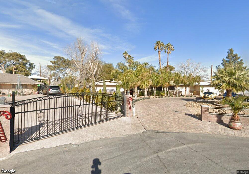
1786 Colt Place Las Vegas, NV 89119
University District NeighborhoodEstimated Value: $637,026 - $868,000
4
Beds
3
Baths
2,980
Sq Ft
$243/Sq Ft
Est. Value
About This Home
This home is located at 1786 Colt Place, Las Vegas, NV 89119 and is currently estimated at $725,007, approximately $243 per square foot. 1786 Colt Place is a home located in Clark County with nearby schools including Lewis E Rowe Elementary School, William E. Orr Middle School, and Del Sol Academy of the Performing Arts.
Ownership History
Date
Name
Owned For
Owner Type
Purchase Details
Closed on
Oct 30, 2018
Sold by
Cole Larry A
Bought by
The Cole Family Trust
Current Estimated Value
Purchase Details
Closed on
Aug 28, 2015
Sold by
Cole Larrry A and Laak Lara H
Bought by
Cole Larry A
Home Financials for this Owner
Home Financials are based on the most recent Mortgage that was taken out on this home.
Original Mortgage
$379,500
Interest Rate
3.97%
Mortgage Type
VA
Purchase Details
Closed on
Jul 22, 2008
Sold by
Wohletz Richard F and Wohletz Lynda J
Bought by
Cole Larry A and Laak Lara H
Home Financials for this Owner
Home Financials are based on the most recent Mortgage that was taken out on this home.
Original Mortgage
$417,000
Interest Rate
6.31%
Mortgage Type
VA
Purchase Details
Closed on
Aug 16, 1995
Sold by
Wohletz Richard F and Wohletz Lynda J
Bought by
Wohletz Richard F and Wohletz Lynda J
Create a Home Valuation Report for This Property
The Home Valuation Report is an in-depth analysis detailing your home's value as well as a comparison with similar homes in the area
Home Values in the Area
Average Home Value in this Area
Purchase History
| Date | Buyer | Sale Price | Title Company |
|---|---|---|---|
| The Cole Family Trust | -- | None Available | |
| Cole Larry A | -- | Fidelity National Agency So | |
| Cole Larry A | $417,000 | First American Title Howard | |
| Wohletz Richard F | -- | -- |
Source: Public Records
Mortgage History
| Date | Status | Borrower | Loan Amount |
|---|---|---|---|
| Previous Owner | Cole Larry A | $379,500 | |
| Previous Owner | Cole Larry A | $417,000 |
Source: Public Records
Tax History Compared to Growth
Tax History
| Year | Tax Paid | Tax Assessment Tax Assessment Total Assessment is a certain percentage of the fair market value that is determined by local assessors to be the total taxable value of land and additions on the property. | Land | Improvement |
|---|---|---|---|---|
| 2025 | $1,853 | $105,209 | $48,300 | $56,909 |
| 2024 | $1,717 | $105,209 | $48,300 | $56,909 |
| 2023 | $1,717 | $108,586 | $57,400 | $51,186 |
| 2022 | $1,590 | $94,678 | $48,650 | $46,028 |
| 2021 | $1,472 | $85,050 | $42,350 | $42,700 |
| 2020 | $1,364 | $80,048 | $38,500 | $41,548 |
| 2019 | $1,324 | $78,509 | $38,500 | $40,009 |
| 2018 | $1,286 | $74,100 | $36,400 | $37,700 |
| 2017 | $2,169 | $73,956 | $34,300 | $39,656 |
| 2016 | $1,204 | $68,977 | $26,950 | $42,027 |
| 2015 | $1,292 | $60,455 | $17,850 | $42,605 |
| 2014 | $1,255 | $61,629 | $19,075 | $42,554 |
Source: Public Records
Map
Nearby Homes
- 1729 Jupiter Ct Unit B
- 4453 Alto Verde Dr
- 1675 Jupiter Ct Unit C
- 4568 Carriage Ln
- 1569 Hialeah Dr
- 1857 Arbol Verde Way
- 1511 Living Desert Dr Unit C
- 1500 Hialeah Dr Unit A
- 1500 Hialeah Dr Unit C
- 1509 Lorilyn Ave Unit 2
- 2004 Canterbury Dr
- 1467 Hialeah Dr Unit D
- 1481 Lorilyn Ave Unit 1
- 1450 Hialeah Dr Unit D
- 1424 Santa Anita Dr Unit D
- 4363 Spencer St Unit 8
- 4560 Rancho Hills Dr
- 1722 E University Ave Unit 5
- 1375 Hialeah Dr Unit C
- 1370 Hialeah Dr Unit B
- 4575 Spencer St
- 4603 Spencer St
- 1762 Colt Place
- 1765 Santa Anita Dr
- 1737 Santa Anita Dr
- 1793 Santa Anita Dr
- 1782 Colt Place
- 1709 Santa Anita Dr
- 1759 Colt Place
- 4578 Spencer St
- 1770 Gabriel Dr
- 4634 Spencer St
- 1681 Santa Anita Dr
- 4566 Spencer St
- 1768 Santa Anita Dr
- 4599 Carriage Ln
- 1736 Santa Anita Dr
- 1736 Gabriel Dr
- 4538 Spencer St
- 1830 Gabriel Dr