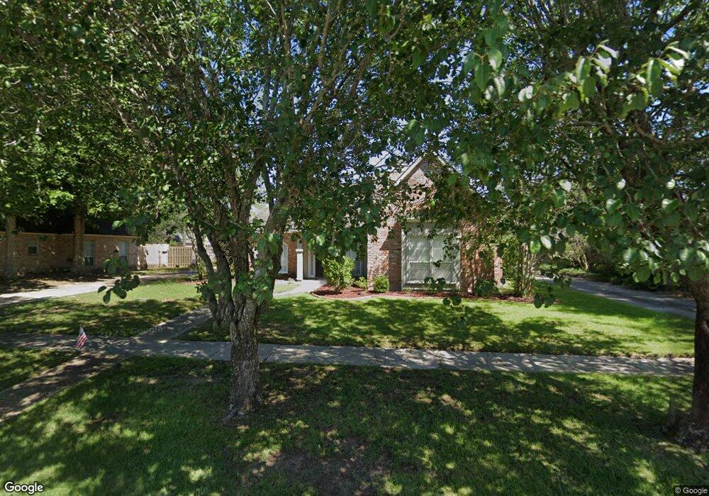
17861 General Forrest Ave Baton Rouge, LA 70817
Shenandoah NeighborhoodEstimated Value: $329,717 - $379,000
--
Bed
--
Bath
2,385
Sq Ft
$150/Sq Ft
Est. Value
About This Home
This home is located at 17861 General Forrest Ave, Baton Rouge, LA 70817 and is currently estimated at $358,179, approximately $150 per square foot. 17861 General Forrest Ave is a home located in East Baton Rouge Parish with nearby schools including Shenandoah Elementary School, Woodlawn Middle School, and Woodlawn High School.
Ownership History
Date
Name
Owned For
Owner Type
Purchase Details
Closed on
Jun 28, 2017
Sold by
Modica Baron Michael Christopher and Modica Baron Christina
Bought by
Chapman King Jeffrey Allen and Chapman King Lorri Lynn
Current Estimated Value
Home Financials for this Owner
Home Financials are based on the most recent Mortgage that was taken out on this home.
Original Mortgage
$255,920
Outstanding Balance
$213,382
Interest Rate
4.02%
Mortgage Type
New Conventional
Estimated Equity
$144,797
Create a Home Valuation Report for This Property
The Home Valuation Report is an in-depth analysis detailing your home's value as well as a comparison with similar homes in the area
Home Values in the Area
Average Home Value in this Area
Purchase History
| Date | Buyer | Sale Price | Title Company |
|---|---|---|---|
| Chapman King Jeffrey Allen | $319,900 | Champlin Title Inc |
Source: Public Records
Mortgage History
| Date | Status | Borrower | Loan Amount |
|---|---|---|---|
| Open | Chapman King Jeffrey Allen | $255,920 |
Source: Public Records
Tax History Compared to Growth
Tax History
| Year | Tax Paid | Tax Assessment Tax Assessment Total Assessment is a certain percentage of the fair market value that is determined by local assessors to be the total taxable value of land and additions on the property. | Land | Improvement |
|---|---|---|---|---|
| 2024 | $2,913 | $31,990 | $2,400 | $29,590 |
| 2023 | $2,913 | $31,990 | $2,400 | $29,590 |
| 2022 | $3,696 | $31,990 | $2,400 | $29,590 |
| 2021 | $3,625 | $31,990 | $2,400 | $29,590 |
| 2020 | $3,672 | $31,990 | $2,400 | $29,590 |
| 2019 | $3,819 | $31,990 | $2,400 | $29,590 |
| 2018 | $3,771 | $31,990 | $2,400 | $29,590 |
| 2017 | $2,661 | $22,300 | $2,400 | $19,900 |
| 2016 | $1,733 | $22,300 | $2,400 | $19,900 |
| 2015 | $1,733 | $22,300 | $2,400 | $19,900 |
| 2014 | $1,697 | $22,300 | $2,400 | $19,900 |
| 2013 | -- | $22,300 | $2,400 | $19,900 |
Source: Public Records
Map
Nearby Homes
- 5487 Hagerstown Dr
- 5246 Stones River Ave
- 5730 N Shore Dr
- 17633 E Fort Pickens Ave
- 5211 Fort Gregg Dr
- 4633 Elm Shadow Dr
- 17845 Coffee Rd
- 6046 Hagerstown Dr
- 5534 Round Forrest Dr
- 18343 Wildlife Way Dr
- 19222 Indian Ridge Ave
- 6134 Hagerstown Dr
- 6130 Wildlife Way Ct
- 5845 S Shore Dr
- 17237 Monitor Ave
- 5927 S Shore Dr
- 6226 Double Tree Dr
- 16825 Chadsford Ave
- 5821 Fort Sumpter Dr
- 16756 Merrimac Ave
- 17855 General Forrest Ave
- 17830 Chancellorsville Ave
- 17851 General Forrest Ave
- 17840 Chancellorsville Ave
- 17820 Chancellorsville Ave
- 17871 General Forrest Ave
- 17866 General Forrest Ave
- 17862 General Forrest Ave
- 17810 Chancellorsville Ave
- 17860 Chancellorsville Ave
- 17852 General Forrest Ave
- 17870 General Forrest Ave
- 17845 General Forrest Ave
- 17881 General Forrest Ave
- 17856 E General Forest
- 17856 General Forrest Ave
- 17764 Chancellorsville Ave
- 17880 Chancellorsville Ave
- 17846 General Forrest Ave
- 17841 E General Forest