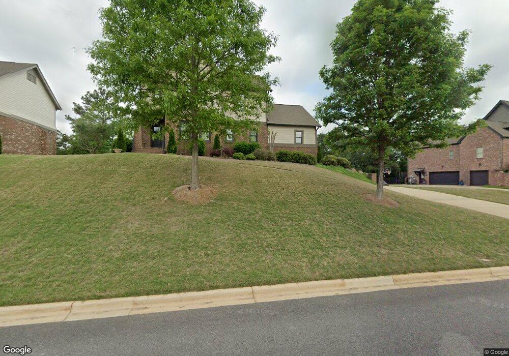
1787 Southpointe Dr Unit 14 Hoover, AL 35244
Estimated Value: $660,000 - $732,870
4
Beds
4
Baths
3,694
Sq Ft
$189/Sq Ft
Est. Value
About This Home
This home is located at 1787 Southpointe Dr Unit 14, Hoover, AL 35244 and is currently estimated at $697,468, approximately $188 per square foot. 1787 Southpointe Dr Unit 14 is a home located in Shelby County with nearby schools including South Shades Crest Elementary School, Brock's Gap Intermediate School, and Robert F. Bumpus Middle School.
Ownership History
Date
Name
Owned For
Owner Type
Purchase Details
Closed on
Dec 14, 2015
Sold by
Quinn Sean M and Quinn Dawn R
Bought by
Cromes Jason Michael and Cromes Ashley Powell
Current Estimated Value
Home Financials for this Owner
Home Financials are based on the most recent Mortgage that was taken out on this home.
Original Mortgage
$330,000
Outstanding Balance
$261,841
Interest Rate
3.97%
Mortgage Type
Purchase Money Mortgage
Estimated Equity
$435,627
Purchase Details
Closed on
May 21, 2012
Sold by
Nsh Corp
Bought by
Quinn Sean M and Doubrava Dawn R
Home Financials for this Owner
Home Financials are based on the most recent Mortgage that was taken out on this home.
Original Mortgage
$324,505
Interest Rate
3.91%
Mortgage Type
New Conventional
Create a Home Valuation Report for This Property
The Home Valuation Report is an in-depth analysis detailing your home's value as well as a comparison with similar homes in the area
Home Values in the Area
Average Home Value in this Area
Purchase History
| Date | Buyer | Sale Price | Title Company |
|---|---|---|---|
| Cromes Jason Michael | $412,500 | None Available | |
| Quinn Sean M | $353,505 | None Available |
Source: Public Records
Mortgage History
| Date | Status | Borrower | Loan Amount |
|---|---|---|---|
| Open | Cromes Jason Michael | $330,000 | |
| Previous Owner | Quinn Sean M | $324,505 |
Source: Public Records
Tax History Compared to Growth
Tax History
| Year | Tax Paid | Tax Assessment Tax Assessment Total Assessment is a certain percentage of the fair market value that is determined by local assessors to be the total taxable value of land and additions on the property. | Land | Improvement |
|---|---|---|---|---|
| 2024 | $3,957 | $59,500 | $0 | $0 |
| 2023 | $3,564 | $54,060 | $0 | $0 |
| 2022 | $3,187 | $48,540 | $0 | $0 |
| 2021 | $2,990 | $45,580 | $0 | $0 |
| 2020 | $2,902 | $44,260 | $0 | $0 |
| 2019 | $2,813 | $42,920 | $0 | $0 |
| 2017 | $2,591 | $39,580 | $0 | $0 |
| 2015 | $2,382 | $36,440 | $0 | $0 |
| 2014 | $2,325 | $35,580 | $0 | $0 |
Source: Public Records
Map
Nearby Homes
- 1776 Southpointe Dr Unit 35
- 1800 Southpointe Dr
- 4100 S Shades Crest Rd
- 4019 Adrian St
- 3600 Burnham Place
- 3608 Burnham Place
- 3505 Blackridge Cir
- 3495 Blackridge Cir
- 3501 Blackridge Cir
- 3456 Blackridge Cir
- 3441 Blackridge Cir
- 1234 Blackridge Cir
- 0222 Blackridge Cir
- 0004 Blackridge Cir
- 0006 Blackridge Cir
- 0001 Blackridge Cir
- 0002 Blackridge Cir
- 0005 Blackridge Cir
- 003 Blackridge Cir
- 3446 Blackridge Cir
- 1787 Southpointe Dr
- 1791 Southpointe Dr
- 1783 Southpointe Dr
- 1795 Southpointe Dr
- 1784 Southpointe Dr Unit 33
- 1784 Southpointe Dr
- 1788 Southpointe Dr
- 1792 Southpointe Dr Unit 31
- 1792 Southpointe Dr
- 1775 Southpointe Dr
- 1780 Southpointe Dr
- 1799 Southpointe Dr Unit 17
- 1799 Southpointe Dr
- 1796 Southpointe Dr Unit 30
- 1796 Southpointe Dr
- 1803 Southpointe Dr
- 1771 Southpointe Dr
- 1800 Southpointe Dr Unit 29
- 1772 Southpointe Dr
- 1804 Southpointe Dr Unit 28