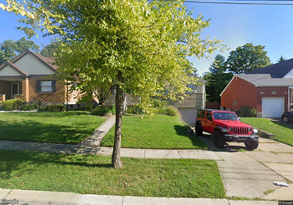
1787 Tuxworth Ave Cincinnati, OH 45238
West Price Hill NeighborhoodEstimated Value: $164,000 - $223,000
3
Beds
2
Baths
1,654
Sq Ft
$120/Sq Ft
Est. Value
About This Home
This home is located at 1787 Tuxworth Ave, Cincinnati, OH 45238 and is currently estimated at $198,914, approximately $120 per square foot. 1787 Tuxworth Ave is a home located in Hamilton County with nearby schools including Carson School, Gilbert A. Dater High School, and Western Hills High School.
Ownership History
Date
Name
Owned For
Owner Type
Purchase Details
Closed on
May 23, 2016
Sold by
U S Bank National Association
Bought by
Stallo Rew Kyle
Current Estimated Value
Home Financials for this Owner
Home Financials are based on the most recent Mortgage that was taken out on this home.
Interest Rate
3.58%
Purchase Details
Closed on
Feb 22, 2016
Sold by
Casey Amy M
Bought by
U S Bank National Association
Home Financials for this Owner
Home Financials are based on the most recent Mortgage that was taken out on this home.
Interest Rate
3.65%
Purchase Details
Closed on
Nov 28, 2008
Sold by
Bloemker Steven
Bought by
Casey Amy M and Casey William H
Home Financials for this Owner
Home Financials are based on the most recent Mortgage that was taken out on this home.
Original Mortgage
$95,060
Interest Rate
5.96%
Mortgage Type
FHA
Create a Home Valuation Report for This Property
The Home Valuation Report is an in-depth analysis detailing your home's value as well as a comparison with similar homes in the area
Home Values in the Area
Average Home Value in this Area
Purchase History
| Date | Buyer | Sale Price | Title Company |
|---|---|---|---|
| Stallo Rew Kyle | $42,500 | -- | |
| U S Bank National Association | $46,000 | -- | |
| Casey Amy M | $98,000 | Attorney |
Source: Public Records
Mortgage History
| Date | Status | Borrower | Loan Amount |
|---|---|---|---|
| Closed | U S Bank National Association | -- | |
| Previous Owner | U S Bank National Association | -- | |
| Previous Owner | Casey Amy M | $95,060 |
Source: Public Records
Tax History Compared to Growth
Tax History
| Year | Tax Paid | Tax Assessment Tax Assessment Total Assessment is a certain percentage of the fair market value that is determined by local assessors to be the total taxable value of land and additions on the property. | Land | Improvement |
|---|---|---|---|---|
| 2024 | $2,889 | $45,466 | $5,590 | $39,876 |
| 2023 | $2,894 | $45,466 | $5,590 | $39,876 |
| 2022 | $1,167 | $16,363 | $5,551 | $10,812 |
| 2021 | $1,143 | $16,363 | $5,551 | $10,812 |
| 2020 | $1,146 | $16,363 | $5,551 | $10,812 |
| 2019 | $1,145 | $14,875 | $5,047 | $9,828 |
| 2018 | $1,146 | $14,875 | $5,047 | $9,828 |
| 2017 | $1,103 | $14,875 | $5,047 | $9,828 |
| 2016 | $2,283 | $30,185 | $5,394 | $24,791 |
| 2015 | $1,942 | $30,185 | $5,394 | $24,791 |
| 2014 | $1,956 | $30,185 | $5,394 | $24,791 |
| 2013 | $2,260 | $34,301 | $6,129 | $28,172 |
Source: Public Records
Map
Nearby Homes
- 1803 Ashbrook Dr
- 1774 Ashbrook Dr
- 1861 Ashbrook Dr
- 1869 Ashbrook Dr
- 4764 Clevesdale Dr
- 4798 Prosperity Place
- 4826 Prosperity Place
- 4885 N Overlook Ave
- 4965 Glenway Ave
- 4934 Relleum Ave
- 4638 Glenway Ave
- 4910 Ferguson Place
- 1131 Olivia Ln
- 4925 Shirley Place
- 1225 Amanda Place
- 5020 Sidney Rd
- 1205 Amanda Place
- 5027 Sidney Rd
- 1226 Rutledge Ave
- 1227 Texas Ave
- 1783 Tuxworth Ave
- 1791 Tuxworth Ave
- 1779 Tuxworth Ave
- 1795 Tuxworth Ave
- 1775 Tuxworth Ave
- 1799 Tuxworth Ave
- 1784 Tuxworth Ave
- 1790 Tuxworth Ave
- 1780 Tuxworth Ave
- 1771 Tuxworth Ave
- 1803 Tuxworth Ave
- 1776 Tuxworth Ave
- 1746 Hillfred Ln
- 1772 Tuxworth Ave
- 1767 Tuxworth Ave
- 1768 Tuxworth Ave
- 1740 Hillfred Ln
- 1805 Tuxworth Ave
- 1805 Tuxworth Ave
- 1805 Tuxworth Ave Unit 1