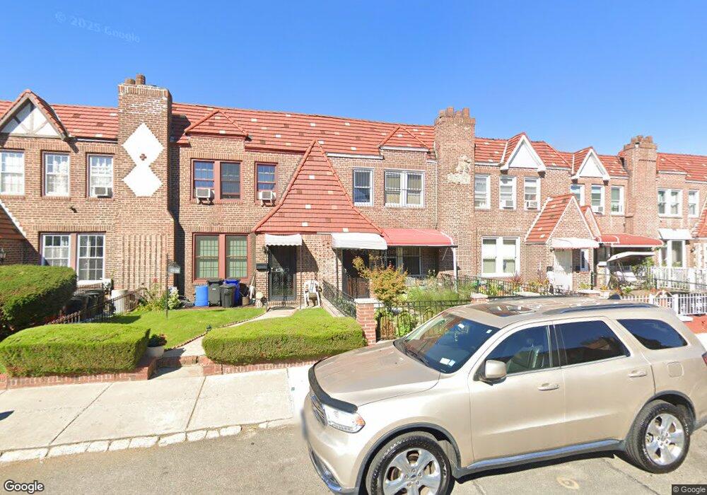
179-61 Anderson Rd Jamaica, NY 11434
Saint Albans NeighborhoodEstimated Value: $651,000 - $756,000
3
Beds
3
Baths
1,600
Sq Ft
$449/Sq Ft
Est. Value
About This Home
This home is located at 179-61 Anderson Rd, Jamaica, NY 11434 and is currently estimated at $717,735, approximately $448 per square foot. 179-61 Anderson Rd is a home located in Queens County with nearby schools including The Jermaine L. Green STEM Institute of Queens, Catherine & Count Basie Middle School 72, and Riverton Street Charter School.
Ownership History
Date
Name
Owned For
Owner Type
Purchase Details
Closed on
Jan 24, 2020
Sold by
Chang Claudene R
Bought by
Cabrera Estela
Current Estimated Value
Purchase Details
Closed on
Jul 19, 2003
Sold by
Dolly Frances
Bought by
Chang Claudene R
Purchase Details
Closed on
Jun 17, 2002
Sold by
Galit Network Llc
Bought by
Dolly Frances
Home Financials for this Owner
Home Financials are based on the most recent Mortgage that was taken out on this home.
Original Mortgage
$27,600
Interest Rate
6.2%
Purchase Details
Closed on
May 8, 2002
Sold by
Smith Flora
Bought by
Galit Network
Home Financials for this Owner
Home Financials are based on the most recent Mortgage that was taken out on this home.
Original Mortgage
$27,600
Interest Rate
6.2%
Create a Home Valuation Report for This Property
The Home Valuation Report is an in-depth analysis detailing your home's value as well as a comparison with similar homes in the area
Home Values in the Area
Average Home Value in this Area
Purchase History
| Date | Buyer | Sale Price | Title Company |
|---|---|---|---|
| Cabrera Estela | $515,000 | -- | |
| Cabrera Estela | $515,000 | -- | |
| Chang Claudene R | -- | -- | |
| Chang Claudene R | -- | -- | |
| Dolly Frances | -- | -- | |
| Dolly Frances | -- | -- | |
| Galit Network | -- | -- | |
| Galit Network | -- | -- |
Source: Public Records
Mortgage History
| Date | Status | Borrower | Loan Amount |
|---|---|---|---|
| Previous Owner | Dolly Frances | $27,600 | |
| Previous Owner | Galit Network | $211,600 |
Source: Public Records
Tax History Compared to Growth
Tax History
| Year | Tax Paid | Tax Assessment Tax Assessment Total Assessment is a certain percentage of the fair market value that is determined by local assessors to be the total taxable value of land and additions on the property. | Land | Improvement |
|---|---|---|---|---|
| 2025 | $5,721 | $28,927 | $8,126 | $20,801 |
| 2024 | $5,721 | $28,483 | $8,793 | $19,690 |
| 2023 | $5,458 | $26,873 | $8,338 | $18,535 |
| 2022 | $5,101 | $33,060 | $11,040 | $22,020 |
| 2021 | $5,073 | $32,040 | $11,040 | $21,000 |
| 2020 | $5,103 | $29,400 | $11,040 | $18,360 |
| 2019 | $4,672 | $25,200 | $11,040 | $14,160 |
| 2018 | $4,267 | $22,394 | $10,843 | $11,551 |
| 2017 | $4,041 | $21,292 | $10,617 | $10,675 |
| 2016 | $3,706 | $21,292 | $10,617 | $10,675 |
| 2015 | $2,203 | $20,088 | $10,986 | $9,102 |
| 2014 | $2,203 | $19,780 | $10,481 | $9,299 |
Source: Public Records
Map
Nearby Homes
- 17955 Anderson Rd
- 179-50 Anderson Rd
- 179-47 Zoller Rd
- 17918 Selover Rd
- 178-10 Leslie Rd
- 17915 Eveleth Rd
- 17911 Eveleth Rd
- 12811 Harry Douglass Way
- 179-01 120th Ave
- 178-20 Selover Rd
- 17720 Leslie Rd
- 178-26 Zoller Rd
- 17836 Eveleth Rd
- 11984 178th Place
- 122-22 Nellis St
- 17710 Troutville Rd
- 17715 Troutville Rd
- 119-72 178th St
- 12244 Nellis St
- 176-27 Sunbury Rd
- 17961 Anderson Rd
- 17961 Anderson Rd
- 179-63 Anderson Rd
- 17963 Anderson Rd
- 17959 Anderson Rd
- 17965 Anderson Rd
- 17965 Anderson Rd
- 179-65 Anderson Rd
- 17957 Anderson Rd
- 17967 Anderson Rd
- 17967 Anderson Rd
- 179-55 Anderson Rd
- 17955 Anderson Rd
- 17969 Anderson Rd
- 17953 Anderson Rd
- 17971 Anderson Rd
- 17971 Anderson Rd
- 179-71 Anderson Rd
- 17951 Anderson Rd
- 179-51 Anderson Rd