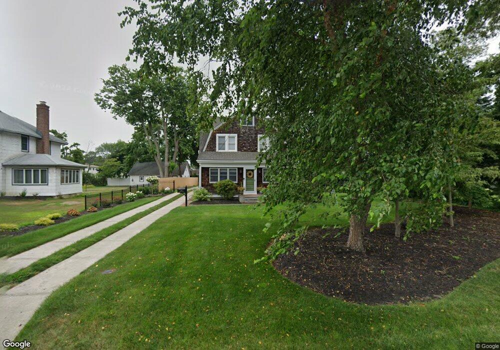
179 Atlantic Ave Blue Point, NY 11715
Estimated Value: $686,000 - $848,000
4
Beds
2
Baths
1,690
Sq Ft
$448/Sq Ft
Est. Value
About This Home
This home is located at 179 Atlantic Ave, Blue Point, NY 11715 and is currently estimated at $757,675, approximately $448 per square foot. 179 Atlantic Ave is a home located in Suffolk County with nearby schools including James Wilson Young Middle School, Bayport Blue Point High School, and Holy Angels Regional School.
Ownership History
Date
Name
Owned For
Owner Type
Purchase Details
Closed on
Aug 2, 2021
Sold by
Atkinson Donna
Bought by
Devery Deanna and Turner James
Current Estimated Value
Purchase Details
Closed on
Dec 30, 2011
Sold by
Hock Jonathan and Hock Donna
Bought by
Hock Donna
Home Financials for this Owner
Home Financials are based on the most recent Mortgage that was taken out on this home.
Original Mortgage
$175,000
Interest Rate
3%
Mortgage Type
Purchase Money Mortgage
Create a Home Valuation Report for This Property
The Home Valuation Report is an in-depth analysis detailing your home's value as well as a comparison with similar homes in the area
Home Values in the Area
Average Home Value in this Area
Purchase History
| Date | Buyer | Sale Price | Title Company |
|---|---|---|---|
| Devery Deanna | $599,500 | None Available | |
| Hock Donna | -- | -- |
Source: Public Records
Mortgage History
| Date | Status | Borrower | Loan Amount |
|---|---|---|---|
| Previous Owner | Hock Donna | $175,000 |
Source: Public Records
Tax History
| Year | Tax Paid | Tax Assessment Tax Assessment Total Assessment is a certain percentage of the fair market value that is determined by local assessors to be the total taxable value of land and additions on the property. | Land | Improvement |
|---|---|---|---|---|
| 2024 | $14,136 | $2,925 | $400 | $2,525 |
| 2023 | $14,136 | $2,925 | $400 | $2,525 |
| 2022 | $10,899 | $2,925 | $400 | $2,525 |
| 2021 | $10,899 | $2,925 | $400 | $2,525 |
| 2020 | $11,384 | $2,925 | $400 | $2,525 |
| 2019 | $11,384 | $0 | $0 | $0 |
| 2018 | $10,743 | $2,925 | $400 | $2,525 |
| 2017 | $10,743 | $2,925 | $400 | $2,525 |
| 2016 | $10,866 | $2,925 | $400 | $2,525 |
| 2015 | -- | $2,925 | $400 | $2,525 |
| 2014 | -- | $2,925 | $400 | $2,525 |
Source: Public Records
Map
Nearby Homes
- 92 Park St
- 45 S Prospect Ave
- 21 S Summit Ave
- 26 Lakeland Ave
- 55 Oyster Cove Ln
- 151 Fairharbor Dr Unit 151
- 64 Highland Ave
- 142 Fairharbor Dr Unit 142
- 6 Oyster Cove Ln
- 210 Fairharbor Dr Unit 210
- 16 Bransford St
- 135 Fair Harbor Dr Unit 135
- 150 Fair Harbor Dr Unit 150
- 101 Fair Harbor Dr Unit 101
- 58 Fairharbor Dr Unit 58
- 63 Fair Harbor Dr Unit 63
- 16 Fair Harbor Dr Unit 16
- 50 W Lake Dr
- 132 Rosebud Ct
- 8 Atlantic Ave