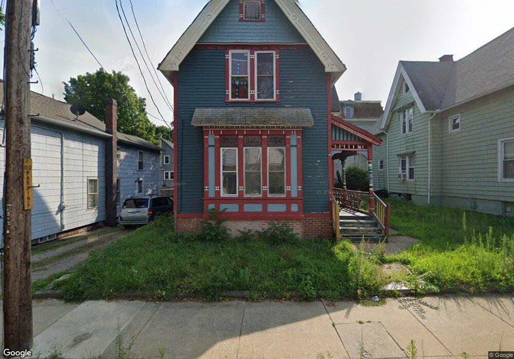
179 Broad St Norwich, CT 06360
Central Norwich NeighborhoodEstimated Value: $222,858 - $272,000
4
Beds
2
Baths
1,635
Sq Ft
$154/Sq Ft
Est. Value
About This Home
This home is located at 179 Broad St, Norwich, CT 06360 and is currently estimated at $252,215, approximately $154 per square foot. 179 Broad St is a home located in New London County with nearby schools including Moriarty Magnet Elementary School, Kelly STEAM Magnet Middle School, and Integrated Day Charter School.
Ownership History
Date
Name
Owned For
Owner Type
Purchase Details
Closed on
Jul 14, 2006
Sold by
Gomes Steven
Bought by
Evvard Beverly
Current Estimated Value
Home Financials for this Owner
Home Financials are based on the most recent Mortgage that was taken out on this home.
Original Mortgage
$124,100
Outstanding Balance
$73,919
Interest Rate
6.71%
Estimated Equity
$178,296
Purchase Details
Closed on
Jan 24, 2003
Sold by
Gwer Alton and Gwer Karen
Bought by
Villacorta Patricia
Home Financials for this Owner
Home Financials are based on the most recent Mortgage that was taken out on this home.
Original Mortgage
$107,350
Interest Rate
6.11%
Create a Home Valuation Report for This Property
The Home Valuation Report is an in-depth analysis detailing your home's value as well as a comparison with similar homes in the area
Home Values in the Area
Average Home Value in this Area
Purchase History
| Date | Buyer | Sale Price | Title Company |
|---|---|---|---|
| Evvard Beverly | $146,000 | -- | |
| Evvard Beverly | $146,000 | -- | |
| Villacorta Patricia | $113,000 | -- | |
| Villacorta Patricia | $113,000 | -- |
Source: Public Records
Mortgage History
| Date | Status | Borrower | Loan Amount |
|---|---|---|---|
| Open | Villacorta Patricia | $124,100 | |
| Closed | Villacorta Patricia | $124,100 | |
| Previous Owner | Villacorta Patricia | $107,350 |
Source: Public Records
Tax History Compared to Growth
Tax History
| Year | Tax Paid | Tax Assessment Tax Assessment Total Assessment is a certain percentage of the fair market value that is determined by local assessors to be the total taxable value of land and additions on the property. | Land | Improvement |
|---|---|---|---|---|
| 2025 | $5,342 | $132,000 | $21,100 | $110,900 |
| 2024 | $5,042 | $132,000 | $21,100 | $110,900 |
| 2023 | $4,023 | $82,700 | $14,900 | $67,800 |
| 2022 | $4,009 | $82,700 | $14,900 | $67,800 |
| 2021 | $4,023 | $82,700 | $14,900 | $67,800 |
| 2020 | $4,013 | $82,800 | $15,000 | $67,800 |
| 2019 | $3,974 | $82,800 | $15,000 | $67,800 |
| 2018 | $3,649 | $75,400 | $17,600 | $57,800 |
| 2017 | $3,675 | $75,400 | $17,600 | $57,800 |
| 2016 | $3,699 | $75,400 | $17,600 | $57,800 |
| 2015 | $3,624 | $75,400 | $17,600 | $57,800 |
| 2014 | $3,463 | $75,400 | $17,600 | $57,800 |
Source: Public Records
Map
Nearby Homes
- 175 Broad St
- 183 Broad St
- 33 Spaulding St Unit E
- 33 Spaulding St
- 33 Spaulding St Unit D
- 33 Spaulding St Unit C
- 33 Spaulding St Unit F
- 176 Broad St
- 182 Broad St
- 27 Spaulding St
- 187 Broad St
- 187 Broad St Unit 1
- 187 Broad St Unit 3
- 187 Broad St Unit 2
- 172 Broad St
- 32 Spaulding St
- 191 Broad St Unit 193
- 9 Treadway Ave
- 30 Spaulding St
- 21 Spaulding St Unit 23