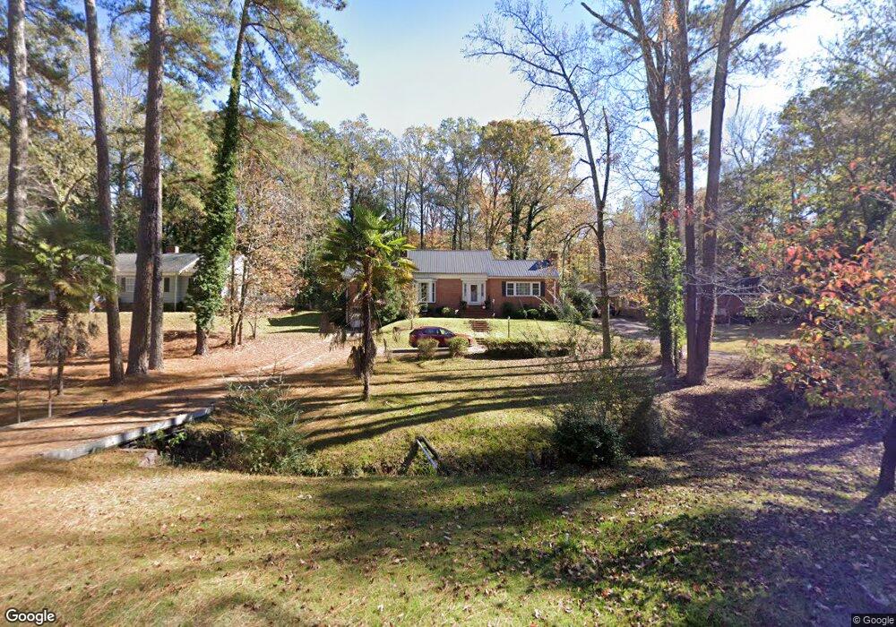
179 Brookside Dr Elberton, GA 30635
Estimated Value: $260,347 - $303,000
4
Beds
3
Baths
2,521
Sq Ft
$112/Sq Ft
Est. Value
About This Home
This home is located at 179 Brookside Dr, Elberton, GA 30635 and is currently estimated at $281,837, approximately $111 per square foot. 179 Brookside Dr is a home located in Elbert County with nearby schools including Elbert County Primary School, Elbert County Elementary School, and Elbert County Middle School.
Ownership History
Date
Name
Owned For
Owner Type
Purchase Details
Closed on
Oct 26, 2011
Sold by
Duke Charles E
Bought by
Sauls Janice J
Current Estimated Value
Home Financials for this Owner
Home Financials are based on the most recent Mortgage that was taken out on this home.
Original Mortgage
$134,501
Outstanding Balance
$92,729
Interest Rate
4.25%
Mortgage Type
FHA
Estimated Equity
$189,108
Purchase Details
Closed on
Mar 10, 2003
Sold by
Scoggins Margaret R
Bought by
Duke Charles E and Duke Jenifer N
Purchase Details
Closed on
Jul 1, 1984
Purchase Details
Closed on
Mar 1, 1981
Purchase Details
Closed on
Aug 1, 1962
Create a Home Valuation Report for This Property
The Home Valuation Report is an in-depth analysis detailing your home's value as well as a comparison with similar homes in the area
Home Values in the Area
Average Home Value in this Area
Purchase History
| Date | Buyer | Sale Price | Title Company |
|---|---|---|---|
| Sauls Janice J | $138,000 | -- | |
| Duke Charles E | $135,000 | -- | |
| -- | $72,000 | -- | |
| -- | $56,000 | -- | |
| -- | $20,900 | -- |
Source: Public Records
Mortgage History
| Date | Status | Borrower | Loan Amount |
|---|---|---|---|
| Open | Sauls Janice J | $134,501 |
Source: Public Records
Tax History Compared to Growth
Tax History
| Year | Tax Paid | Tax Assessment Tax Assessment Total Assessment is a certain percentage of the fair market value that is determined by local assessors to be the total taxable value of land and additions on the property. | Land | Improvement |
|---|---|---|---|---|
| 2024 | $2,638 | $107,216 | $8,000 | $99,216 |
| 2023 | $2,638 | $107,216 | $8,000 | $99,216 |
| 2022 | $1,771 | $71,990 | $8,000 | $63,990 |
| 2021 | $1,785 | $71,990 | $8,000 | $63,990 |
| 2020 | $1,712 | $62,064 | $8,000 | $54,064 |
| 2019 | $1,767 | $62,064 | $8,000 | $54,064 |
| 2018 | $1,806 | $62,064 | $8,000 | $54,064 |
| 2017 | $1,836 | $58,427 | $8,000 | $50,427 |
| 2016 | $1,715 | $58,427 | $8,000 | $50,427 |
| 2015 | -- | $58,427 | $8,000 | $50,427 |
| 2014 | -- | $58,427 | $8,000 | $50,427 |
| 2013 | -- | $57,435 | $8,000 | $49,435 |
Source: Public Records
Map
Nearby Homes
- 181 Brookside Dr
- 173 Brookside Dr
- 141 Wildwood Dr
- 135 Brookside Dr
- 844 Sherwood Dr
- 252 Edwards St
- 245 Edwards St
- 120 S Tusten St
- 105 S Thomas St
- 214 Campbell St
- 211 Snyder Ave
- 196 S Oliver St
- 2790 Cedar Creek Rd
- 0 Old Middleton Rd Unit 22775401
- 0 Old Middleton Rd Unit 10651016
- 415 Athenia St
- 968 Ext Elbert St
- 349 Cook St
- 0 Oak Dr Unit 7643600
- 0 Oak Dr Unit 10598083
- 177 Brookside Dr
- 183 Brookside Dr
- 540 Woodland Rd
- 178 Brookside Dr
- 131 Heard Dr
- 172 Brookside Dr
- 538 Woodland Rd
- 169 Heard Dr
- 130 Heard Dr
- 170 Brookside Dr
- 165 Brookside Dr
- 536 Woodland Rd
- 127 Heard Dr
- 541 Woodland Rd
- 159 Brookside Dr
- 166 Brookside Dr
- 185 Springdale Rd
- 171 Heard Dr
- 534 Woodland Rd
- 537 Woodland Rd