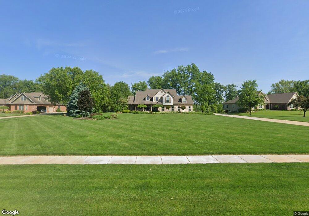
179 Buckskin Ln Valparaiso, IN 46383
Porter County NeighborhoodEstimated Value: $749,850 - $944,000
3
Beds
4
Baths
3,353
Sq Ft
$246/Sq Ft
Est. Value
About This Home
This home is located at 179 Buckskin Ln, Valparaiso, IN 46383 and is currently estimated at $826,463, approximately $246 per square foot. 179 Buckskin Ln is a home located in Porter County with nearby schools including Morgan Township Elementary School, Morgan Township Middle/High School, and Victory Christian Academy.
Ownership History
Date
Name
Owned For
Owner Type
Purchase Details
Closed on
Dec 30, 2015
Sold by
Bucher Development Llc
Bought by
Bucher Construction Ltd
Current Estimated Value
Purchase Details
Closed on
Aug 22, 2013
Sold by
Bucher Construction Ltd
Bought by
Bucher Property Holdings Llc
Purchase Details
Closed on
Jul 3, 2006
Sold by
Bucher Development Llc
Bought by
Bucher Dean A and Bucher Patricia S
Create a Home Valuation Report for This Property
The Home Valuation Report is an in-depth analysis detailing your home's value as well as a comparison with similar homes in the area
Home Values in the Area
Average Home Value in this Area
Purchase History
| Date | Buyer | Sale Price | Title Company |
|---|---|---|---|
| Bucher Construction Ltd | -- | None Available | |
| Bucher Property Holdings Llc | -- | None Available | |
| Bucher Dean A | -- | Chicago Title Insurance Co |
Source: Public Records
Tax History Compared to Growth
Tax History
| Year | Tax Paid | Tax Assessment Tax Assessment Total Assessment is a certain percentage of the fair market value that is determined by local assessors to be the total taxable value of land and additions on the property. | Land | Improvement |
|---|---|---|---|---|
| 2024 | $4,780 | $700,900 | $95,300 | $605,600 |
| 2023 | $4,640 | $645,900 | $86,600 | $559,300 |
| 2022 | $5,180 | $660,900 | $86,600 | $574,300 |
| 2021 | $4,668 | $562,300 | $86,600 | $475,700 |
| 2020 | $4,280 | $520,300 | $78,700 | $441,600 |
| 2019 | $4,270 | $500,900 | $78,700 | $422,200 |
| 2018 | $4,103 | $490,500 | $78,700 | $411,800 |
| 2017 | $4,112 | $498,500 | $78,700 | $419,800 |
| 2016 | $3,983 | $498,300 | $81,800 | $416,500 |
| 2014 | $4,007 | $461,900 | $79,100 | $382,800 |
| 2013 | -- | $440,300 | $80,000 | $360,300 |
Source: Public Records
Map
Nearby Homes
- 197 Appaloosa Ln
- 239 Bayberry Ct
- 323 E 124 S
- 3353 Field Hawk Dr
- 232 E 250 S
- 3251 Mockingbird Ln
- 279 S State Road 49
- 1206 Meadow Glen Dr
- 3359 Blue Jay Dr
- 48 E Division Rd
- 0 Smoke Rd
- 501 Eagle Ct
- 372 Radcliff Dr
- 421 Amy Rose Ln
- 355 E 300 S
- 0 Parcel A 325 E
- 0 Parcel B 325 E
- 2054 Lawndale Dr
- 1954 Lawndale Dr
- 168 Jamestown Ave
- 181 Buckskin Ln
- 177 Buckskin Ln
- 182 Buckskin Ln
- 184 Buckskin Ln
- 183 Buckskin Ln
- 186 Buckskin Ln
- 180 Buckskin Ln
- 188 Buckskin Ln
- 190 Buckskin Ln
- 178 Arthur Ln
- 185 E 112 S
- 125 S 150 E
- 180 Arthur Ln
- 187 Appaloosa Ln
- 185 Appaloosa Ln
- 182 Arthur Ln
- 192 Buckskin Ln
- 187 E 112 S
- 189 Appaloosa Ln
- 183 Appaloosa Ln