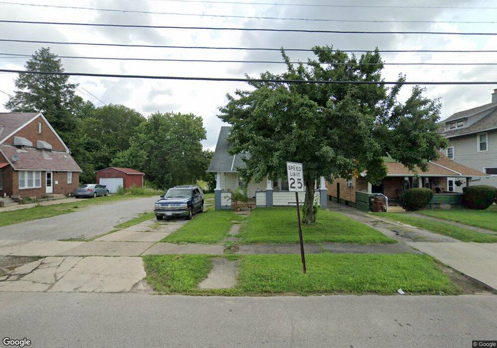
179 Carpenter Rd Mansfield, OH 44903
1
Bed
1
Bath
1,176
Sq Ft
6,534
Sq Ft Lot
About This Home
This home is located at 179 Carpenter Rd, Mansfield, OH 44903. 179 Carpenter Rd is a home located in Richland County with nearby schools including St. Peter's High School/Junior High, St. Peter's Elementary/Montessori School, and Discovery School.
Ownership History
Date
Name
Owned For
Owner Type
Purchase Details
Closed on
Sep 25, 2008
Sold by
Citifinancial Inc
Bought by
Med Central Health Systems and Medcentral Health System
Purchase Details
Closed on
Jun 2, 2008
Sold by
Powers David E
Bought by
Citifinancial Inc
Purchase Details
Closed on
Jan 24, 2001
Sold by
Sheldon J Steve
Bought by
Powers Jodi
Home Financials for this Owner
Home Financials are based on the most recent Mortgage that was taken out on this home.
Original Mortgage
$60,341
Interest Rate
7.43%
Mortgage Type
FHA
Purchase Details
Closed on
May 7, 1997
Sold by
Barber Karen M
Bought by
Sheldon Steve J and Sheldon Jennifer E
Create a Home Valuation Report for This Property
The Home Valuation Report is an in-depth analysis detailing your home's value as well as a comparison with similar homes in the area
Home Values in the Area
Average Home Value in this Area
Purchase History
| Date | Buyer | Sale Price | Title Company |
|---|---|---|---|
| Med Central Health Systems | $30,000 | Chicago Title | |
| Citifinancial Inc | $24,000 | Accommodation | |
| Powers Jodi | $61,000 | -- | |
| Sheldon Steve J | $45,000 | -- |
Source: Public Records
Mortgage History
| Date | Status | Borrower | Loan Amount |
|---|---|---|---|
| Previous Owner | Powers Jodi | $60,341 |
Source: Public Records
Tax History Compared to Growth
Tax History
| Year | Tax Paid | Tax Assessment Tax Assessment Total Assessment is a certain percentage of the fair market value that is determined by local assessors to be the total taxable value of land and additions on the property. | Land | Improvement |
|---|---|---|---|---|
| 2024 | -- | $2,650 | $2,650 | $0 |
| 2023 | $0 | $2,650 | $2,650 | $0 |
| 2022 | $0 | $2,410 | $2,410 | $0 |
| 2021 | $0 | $2,410 | $2,410 | $0 |
| 2020 | $0 | $2,410 | $2,410 | $0 |
| 2019 | $0 | $2,410 | $2,410 | $0 |
| 2018 | $0 | $2,410 | $2,410 | $0 |
| 2017 | $0 | $2,410 | $2,410 | $0 |
| 2016 | -- | $12,780 | $2,680 | $10,100 |
| 2015 | -- | $12,780 | $2,680 | $10,100 |
| 2014 | -- | $12,780 | $2,680 | $10,100 |
| 2012 | -- | $12,780 | $2,680 | $10,100 |
Source: Public Records
Map
Nearby Homes
- 118 Lind Ave
- 135 Wood St
- 114 Vennum Ave
- 257 Wood St
- 450 Glessner Ave
- 131 Sturges Ave
- 37 Baldwin Ave
- 76 Bartley Ave
- 38 Baldwin Ave
- 88 Sherman Ave
- 470 Woodward Ave
- 126 Dawson Ave
- 2 Bowman St
- 353 Sturges Ave
- 96 Glenwood Heights
- 116 W 2nd St
- 71 Glenwood Blvd
- 406 Sherman Place
- 24 Stewart Ave S
- 175 S Mulberry St
- 181 Carpenter Rd
- 167 Carpenter Rd
- 185 Carpenter Rd
- 163 Carpenter Rd
- 157 Carpenter Rd Unit 159
- 312 Glessner Ave
- 155 Carpenter Rd
- 304 Glessner Ave
- 160 Carpenter Rd
- 184 Wood St Unit 6
- 156 Carpenter Rd
- 147 Carpenter Rd
- 300 Glessner Ave
- 166 Wood St
- 143 Carpenter Rd
- 150 Carpenter Rd
- 176 Wood St
- 296 Glessner Ave
- 156 Wood St
- 144 Carpenter Rd