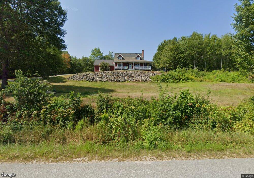
179 Devereux Rd Parsonsfield, ME 04047
Estimated Value: $382,000 - $475,429
3
Beds
2
Baths
1,530
Sq Ft
$276/Sq Ft
Est. Value
About This Home
This home is located at 179 Devereux Rd, Parsonsfield, ME 04047 and is currently estimated at $421,857, approximately $275 per square foot. 179 Devereux Rd is a home located in York County.
Ownership History
Date
Name
Owned For
Owner Type
Purchase Details
Closed on
Feb 17, 2017
Sold by
Gammon Kelly J
Bought by
Royal River Llc
Current Estimated Value
Purchase Details
Closed on
Apr 1, 2015
Sold by
Gammon Kelly J
Bought by
Sawyer Ashley J and Day Andrew J
Home Financials for this Owner
Home Financials are based on the most recent Mortgage that was taken out on this home.
Original Mortgage
$182,139
Outstanding Balance
$140,265
Interest Rate
3.75%
Mortgage Type
FHA
Estimated Equity
$281,592
Create a Home Valuation Report for This Property
The Home Valuation Report is an in-depth analysis detailing your home's value as well as a comparison with similar homes in the area
Home Values in the Area
Average Home Value in this Area
Purchase History
| Date | Buyer | Sale Price | Title Company |
|---|---|---|---|
| Royal River Llc | -- | -- | |
| Sawyer Ashley J | -- | -- |
Source: Public Records
Mortgage History
| Date | Status | Borrower | Loan Amount |
|---|---|---|---|
| Open | Sawyer Ashley J | $182,139 |
Source: Public Records
Tax History Compared to Growth
Tax History
| Year | Tax Paid | Tax Assessment Tax Assessment Total Assessment is a certain percentage of the fair market value that is determined by local assessors to be the total taxable value of land and additions on the property. | Land | Improvement |
|---|---|---|---|---|
| 2024 | $3,641 | $216,715 | $58,860 | $157,855 |
| 2023 | $3,511 | $216,715 | $58,860 | $157,855 |
| 2022 | $3,359 | $216,715 | $58,860 | $157,855 |
| 2021 | $3,348 | $216,715 | $58,860 | $157,855 |
| 2020 | $3,283 | $216,715 | $58,860 | $157,855 |
| 2019 | $3,229 | $216,715 | $58,860 | $157,855 |
| 2017 | $3,229 | $216,715 | $58,860 | $157,855 |
| 2016 | $3,229 | $216,715 | $58,860 | $157,855 |
| 2015 | $3,251 | $216,715 | $58,860 | $157,855 |
| 2013 | $3,164 | $216,715 | $58,860 | $157,855 |
Source: Public Records
Map
Nearby Homes
- 12 Main St
- 32 Summer St
- 122 Ossipee Trail
- 266 S Hiram Rd
- 35 Pine St
- 761 Pendexter Rd
- 248 Spec Pond Rd
- 206 Gilman Rd
- 696 S Hiram Rd
- 20 Hollyhock Farm Ln
- 96 Maple St
- R3-32 Ossipee Trail
- Lot #00 North Rd
- Lot# 01 North Rd
- Lot #02 North Rd
- Lot #8 Jordan Heights Rd
- Lot #2 Jordan Heights Rd
- Lot #3 Jordan Heights Rd
- Lot #4 Jordan Heights Rd
- Lot #11 Jordan Heights Rd