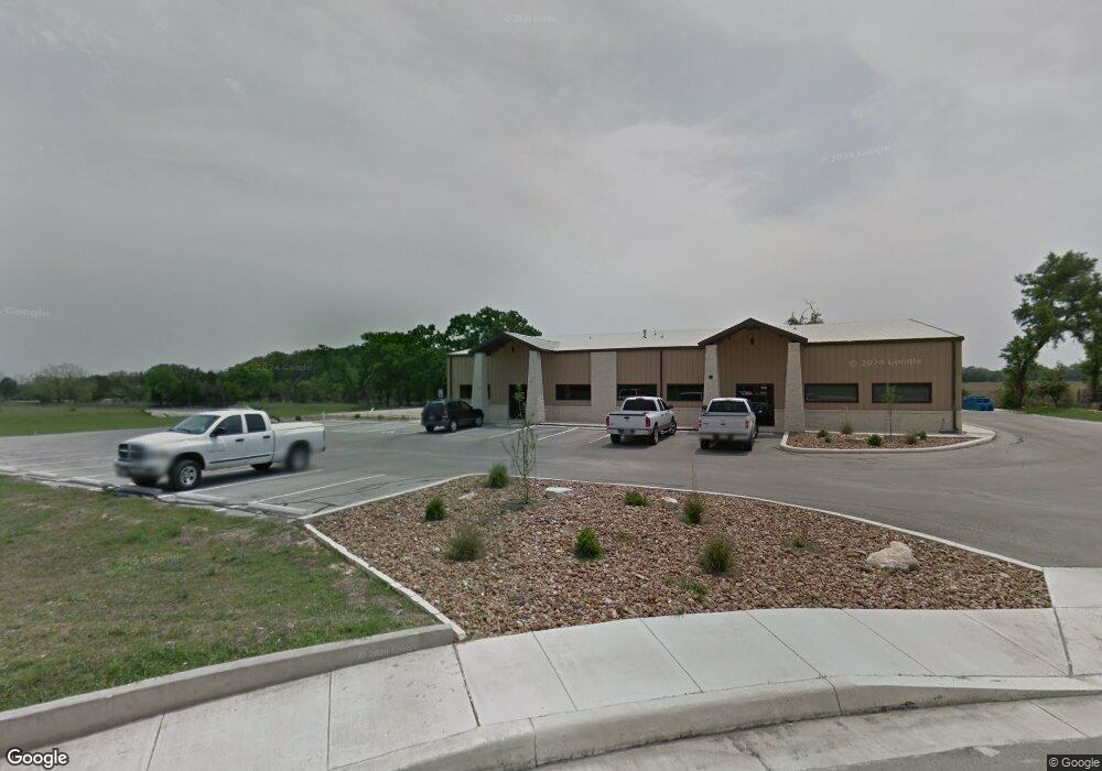
179 Enterprise Pkwy Boerne, TX 78006
--
Bed
--
Bath
3,960
Sq Ft
1.03
Acres
About This Home
This home is located at 179 Enterprise Pkwy, Boerne, TX 78006. 179 Enterprise Pkwy is a home located in Kendall County with nearby schools including Kendall Elementary School, Boerne Middle School South, and Samuel V. Champion High School.
Ownership History
Date
Name
Owned For
Owner Type
Purchase Details
Closed on
Feb 24, 2015
Sold by
Egigian Donald S
Bought by
Don Egigian Properties Llc
Home Financials for this Owner
Home Financials are based on the most recent Mortgage that was taken out on this home.
Original Mortgage
$615,000
Interest Rate
3.66%
Mortgage Type
Commercial
Purchase Details
Closed on
Feb 9, 2015
Sold by
Egigian Donald S
Bought by
Don Egigian Properties Llc
Home Financials for this Owner
Home Financials are based on the most recent Mortgage that was taken out on this home.
Original Mortgage
$615,000
Interest Rate
3.66%
Mortgage Type
Commercial
Purchase Details
Closed on
Jul 15, 2008
Sold by
Dumar Ltd
Bought by
Egigian Donald S and Donald S Egigian 2004 Trust
Create a Home Valuation Report for This Property
The Home Valuation Report is an in-depth analysis detailing your home's value as well as a comparison with similar homes in the area
Home Values in the Area
Average Home Value in this Area
Purchase History
| Date | Buyer | Sale Price | Title Company |
|---|---|---|---|
| Don Egigian Properties Llc | -- | Texas Investors Title | |
| Don Egigian Properties Llc | -- | None Available | |
| Egigian Donald S | -- | -- |
Source: Public Records
Mortgage History
| Date | Status | Borrower | Loan Amount |
|---|---|---|---|
| Closed | Don Egigian Properties Llc | $615,000 |
Source: Public Records
Tax History Compared to Growth
Tax History
| Year | Tax Paid | Tax Assessment Tax Assessment Total Assessment is a certain percentage of the fair market value that is determined by local assessors to be the total taxable value of land and additions on the property. | Land | Improvement |
|---|---|---|---|---|
| 2025 | $25,903 | $1,802,650 | $659,540 | $1,143,110 |
| 2024 | $25,903 | $1,400,000 | $512,222 | $887,778 |
| 2023 | $26,005 | $1,400,000 | $512,222 | $887,778 |
| 2022 | $29,401 | $1,453,840 | $494,660 | $959,180 |
| 2021 | $20,510 | $957,680 | $219,850 | $737,830 |
| 2020 | $20,817 | $957,680 | $219,850 | $737,830 |
| 2019 | $16,687 | $743,730 | $219,850 | $523,880 |
| 2018 | $16,687 | $743,730 | $219,850 | $523,880 |
| 2017 | $16,373 | $742,320 | $219,850 | $522,470 |
| 2016 | $16,373 | $742,320 | $219,850 | $522,470 |
| 2015 | $16,071 | $742,320 | $219,850 | $522,470 |
| 2014 | $16,071 | $742,320 | $219,850 | $522,470 |
| 2013 | -- | $746,800 | $224,330 | $522,470 |
Source: Public Records
Map
Nearby Homes
- 104 Katie Ct
- 241 Winding Path
- 141 Shadow Knolls
- 129 Windmill Breeze
- 229 Katie Ct
- 224 Jordan Place
- 161 Michelle Ln
- 240 Katie Ct
- 216 Jolie Cir
- 108 Old Ridge Ln
- 123 Lina Ln
- 2608V Plan at Corley Farms - 50'
- 2942H Plan at Corley Farms - 50'
- 2722H Plan at Corley Farms - 50'
- 2569V Plan at Corley Farms - 50'
- 2232V Plan at Corley Farms - 50'
- 2606V Plan at Corley Farms - 50'
- 2599W Plan at Corley Farms - 50'
- 2358V Plan at Corley Farms - 50'
- 2206H Plan at Corley Farms - 50'
- 179 Enterprise Pkwy Unit 101
- 179 Enterprise Pkwy Unit 103
- 175 Enterprise Pkwy
- 176 Enterprise Pkwy Unit D
- 176 Enterprise Pkwy Unit C&D
- 176 Enterprise Pkwy Unit C
- 176 Enterprise Pkwy
- 171 Enterprise Pkwy
- 172 Enterprise Pkwy
- 30875 Interstate 10 W Unit C
- 30875 Interstate 10 W Unit 104
- 30875 Interstate 10 W Unit D
- 30875 Interstate 10 W Unit G
- 30875 Interstate 10 W Unit 102
- 30875 Interstate 10 W Unit 3
- 30875 Interstate 10 W Unit 1
- 30875 Interstate 10 W Unit A
- 159 Enterprise Pkwy
- 31007 Interstate 10 W Unit SUITE 107
- 31007 Interstate 10 W Unit 116