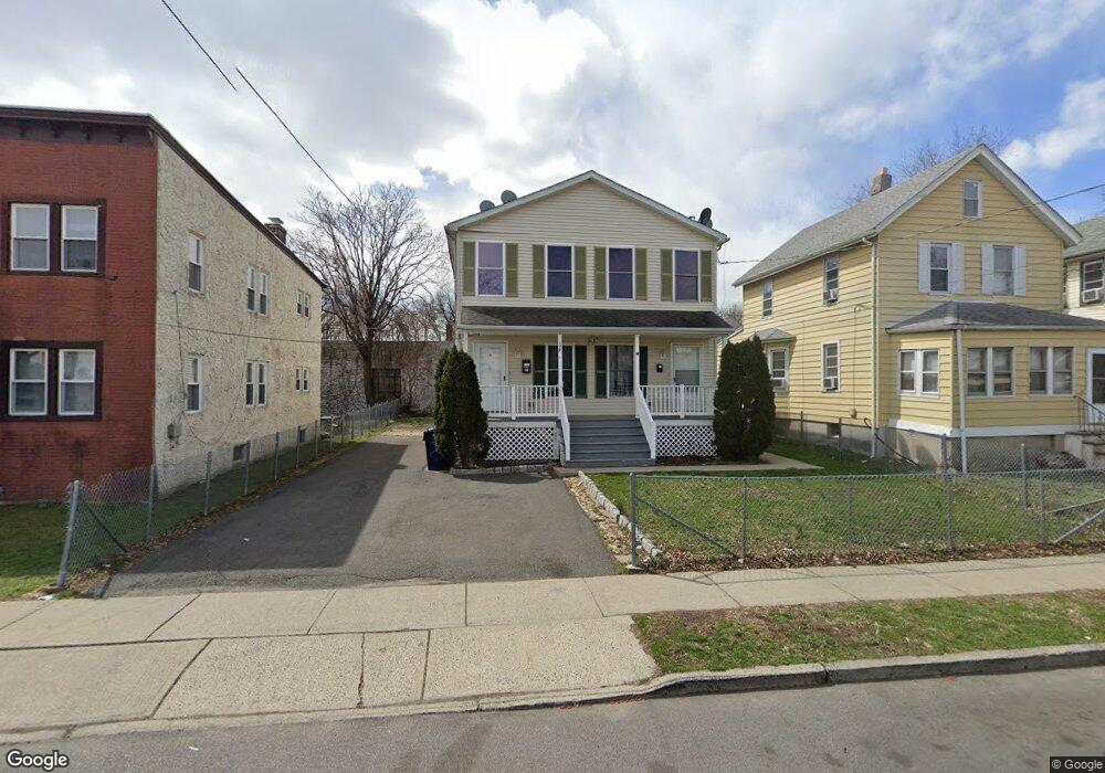
179 High St Hackensack, NJ 07601
Estimated Value: $792,564
--
Bed
--
Bath
2,700
Sq Ft
$294/Sq Ft
Est. Value
About This Home
This home is located at 179 High St, Hackensack, NJ 07601 and is currently estimated at $792,564, approximately $293 per square foot. 179 High St is a home located in Bergen County with nearby schools including Hackensack High School and Bergen County Christian Academy.
Ownership History
Date
Name
Owned For
Owner Type
Purchase Details
Closed on
Nov 17, 2008
Sold by
Gmac Rfc Master Servicing
Bought by
Wachovia Mortgage Corp
Current Estimated Value
Purchase Details
Closed on
Mar 17, 2008
Sold by
Mcguire Leo P
Bought by
Sheriff Of Bergen County and Ramache Mariana
Purchase Details
Closed on
Jun 26, 2003
Sold by
Ag Properties
Bought by
Santander Mike
Home Financials for this Owner
Home Financials are based on the most recent Mortgage that was taken out on this home.
Original Mortgage
$360,000
Interest Rate
5.45%
Purchase Details
Closed on
Jun 14, 2002
Sold by
Gigante Louis
Bought by
Ag Properties Llc
Purchase Details
Closed on
Dec 27, 2000
Sold by
Monaghan Michael J
Bought by
Gigante Louis and Gigante Barbara
Create a Home Valuation Report for This Property
The Home Valuation Report is an in-depth analysis detailing your home's value as well as a comparison with similar homes in the area
Home Values in the Area
Average Home Value in this Area
Purchase History
| Date | Buyer | Sale Price | Title Company |
|---|---|---|---|
| Wachovia Mortgage Corp | -- | -- | |
| Sheriff Of Bergen County | $550,645 | -- | |
| Santander Mike | $379,000 | -- | |
| Ag Properties Llc | $69,000 | -- | |
| Gigante Louis | $20,000 | -- | |
| Gigante Louis | $20,000 | -- |
Source: Public Records
Mortgage History
| Date | Status | Borrower | Loan Amount |
|---|---|---|---|
| Previous Owner | Santander Mike | $360,000 |
Source: Public Records
Tax History Compared to Growth
Tax History
| Year | Tax Paid | Tax Assessment Tax Assessment Total Assessment is a certain percentage of the fair market value that is determined by local assessors to be the total taxable value of land and additions on the property. | Land | Improvement |
|---|---|---|---|---|
| 2025 | -- | $492,800 | $134,800 | $358,000 |
| 2024 | -- | $492,800 | $134,800 | $358,000 |
| 2023 | -- | $492,800 | $134,800 | $358,000 |
| 2022 | $0 | $481,900 | $124,100 | $357,800 |
| 2021 | $0 | $387,800 | $100,700 | $287,100 |
| 2020 | $0 | $387,800 | $100,700 | $287,100 |
| 2019 | $6,418 | $383,500 | $99,300 | $284,200 |
| 2018 | $13,505 | $380,300 | $96,900 | $283,400 |
| 2017 | $12,269 | $375,900 | $95,500 | $280,400 |
| 2016 | $12,269 | $363,200 | $86,000 | $277,200 |
| 2015 | $14,371 | $410,600 | $114,600 | $296,000 |
| 2014 | $13,640 | $410,600 | $114,600 | $296,000 |
Source: Public Records
Map
Nearby Homes
- 190 Central Ave Unit 3
- 190 Central Ave
- 174 Clay St
- 181 Berdan Place
- 280 Central Ave
- 300 Park St Unit 4A
- 160 Overlook Ave Unit 4-B
- 160 Overlook Ave Unit 7A
- 160 Overlook Ave Unit 2C
- 160 Overlook Ave Unit 20D
- 160 Overlook Ave Unit 17 C
- 150 Overlook Ave Unit 6H
- 150 Overlook Ave Unit 12E
- 150 Overlook Ave Unit 6E
- 298 3rd St
- 275 State St Unit 5B
- 280 Prospect Ave Unit 11H
- 280 Prospect Ave Unit 5F
- 280 Prospect Ave Unit 1B
- 280 Prospect Ave Unit 9H
- 183 High St
- 177 High St
- 175 High St
- 185 High St Unit 87
- 173 High St
- 188 Central Ave
- 189 High St Unit 91
- 259 Railroad Place
- 259 Railroad Place Unit 2
- 180 High St
- 180 High St Unit 1
- 196 Central Ave
- 176 High St
- 174 High St
- 255 Railroad Place
- 198 Central Ave
- 198 Central Ave Unit 1
- 198 Central Ave Unit 2
- 198 Central Ave Unit 2nd Floor
- 193 High St Unit 95