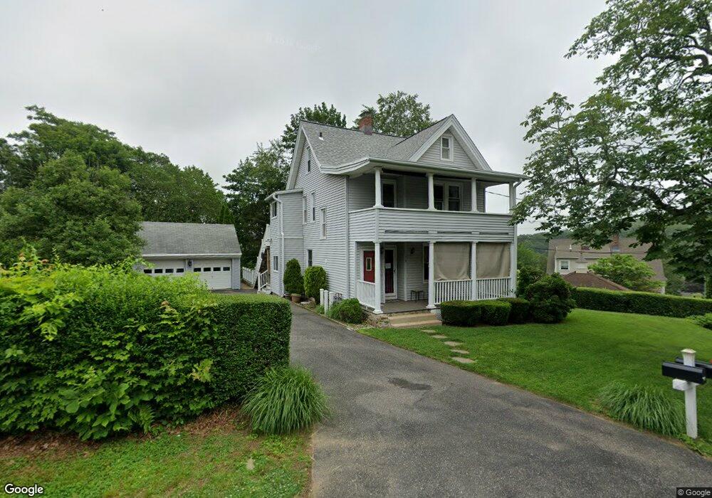
179 Hillside Ave Unit 181 Shelton, CT 06484
Estimated Value: $373,000 - $464,607
2
Beds
2
Baths
2,529
Sq Ft
$171/Sq Ft
Est. Value
About This Home
This home is located at 179 Hillside Ave Unit 181, Shelton, CT 06484 and is currently estimated at $433,152, approximately $171 per square foot. 179 Hillside Ave Unit 181 is a home located in Fairfield County with nearby schools including Perry Hill School, Sunnyside Elementary School, and Shelton Intermediate School.
Ownership History
Date
Name
Owned For
Owner Type
Purchase Details
Closed on
Feb 22, 1990
Sold by
Fiordelisi Rose
Bought by
Fiordelisi Salvatore V
Current Estimated Value
Home Financials for this Owner
Home Financials are based on the most recent Mortgage that was taken out on this home.
Original Mortgage
$128,000
Interest Rate
9.7%
Mortgage Type
Purchase Money Mortgage
Create a Home Valuation Report for This Property
The Home Valuation Report is an in-depth analysis detailing your home's value as well as a comparison with similar homes in the area
Home Values in the Area
Average Home Value in this Area
Purchase History
| Date | Buyer | Sale Price | Title Company |
|---|---|---|---|
| Fiordelisi Salvatore V | $85,000 | -- |
Source: Public Records
Mortgage History
| Date | Status | Borrower | Loan Amount |
|---|---|---|---|
| Closed | Fiordelisi Salvatore V | $68,500 | |
| Closed | Fiordelisi Salvatore V | $128,000 |
Source: Public Records
Tax History Compared to Growth
Tax History
| Year | Tax Paid | Tax Assessment Tax Assessment Total Assessment is a certain percentage of the fair market value that is determined by local assessors to be the total taxable value of land and additions on the property. | Land | Improvement |
|---|---|---|---|---|
| 2025 | $4,604 | $244,650 | $77,000 | $167,650 |
| 2024 | $4,692 | $244,650 | $77,000 | $167,650 |
| 2023 | $4,274 | $244,650 | $77,000 | $167,650 |
| 2022 | $4,274 | $244,650 | $77,000 | $167,650 |
| 2021 | $4,050 | $183,830 | $66,510 | $117,320 |
| 2020 | $4,121 | $183,820 | $66,500 | $117,320 |
| 2019 | $4,121 | $183,820 | $66,500 | $117,320 |
| 2017 | $4,083 | $183,830 | $66,500 | $117,330 |
| 2015 | $3,773 | $169,120 | $48,160 | $120,960 |
| 2014 | $3,773 | $169,120 | $48,160 | $120,960 |
Source: Public Records
Map
Nearby Homes
- 26 King St
- 163 Coram Ave
- 83 Myrtle St Unit BLDG 2, 5
- 50 Kneen St
- 0 Harvard Ave
- 75 Beecher Ave
- 25 Gilbert St
- 28 Edgewood Ave
- 72 Providence Ave
- 56 Wakelee Avenue Extension Unit 53
- 59 Cranston Ave
- 10 Colonial Village
- 2 Laurel Ln
- 45 1/2 Woonsocket Ave
- 85 River Rd Unit 7 Windward Way
- 85 River Rd Unit 3 Windward Way
- 85 River Rd Unit 4 Windward Way
- 85 River Rd Unit 1 Windward Way
- 85 River Rd Unit 5 Windward Way
- 222 Grove St
- 187 Hillside Ave
- 187 Hillside Ave Unit 2nd floor
- 188 Hillside Ave
- 65 Park St Unit 67
- 59 Park St
- 174 Hillside Ave
- 53 Park St
- 3 Coram Rd
- 189 Hillside Ave
- 5 Coram Rd
- 68 Park St
- 47 Park St Unit 49
- 158 Hillside Ave
- 11 Coram Rd
- 13 Huntington Ave
- 4 Huntington Ave
- 15 Huntington Ave
- 9 Coram Rd
- 17 Huntington Ave
- 43 Park St