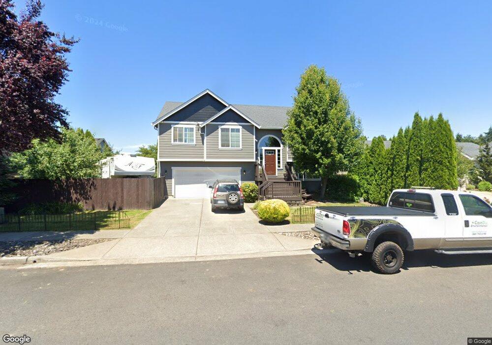
179 Leif Dr Kelso, WA 98626
Lexington NeighborhoodEstimated Value: $498,000 - $540,000
5
Beds
3
Baths
2,386
Sq Ft
$217/Sq Ft
Est. Value
About This Home
This home is located at 179 Leif Dr, Kelso, WA 98626 and is currently estimated at $517,524, approximately $216 per square foot. 179 Leif Dr is a home located in Cowlitz County with nearby schools including Beacon Hill Elementary School, Huntington Middle School, and Kelso High School.
Ownership History
Date
Name
Owned For
Owner Type
Purchase Details
Closed on
Mar 18, 2009
Sold by
Venture Bank
Bought by
Melin Ronald Walter and Melin Jennifer J
Current Estimated Value
Home Financials for this Owner
Home Financials are based on the most recent Mortgage that was taken out on this home.
Original Mortgage
$224,730
Outstanding Balance
$143,201
Interest Rate
5.17%
Mortgage Type
VA
Estimated Equity
$374,323
Purchase Details
Closed on
Dec 4, 2008
Sold by
Sound Built Homes Inc
Bought by
Venture Bank
Create a Home Valuation Report for This Property
The Home Valuation Report is an in-depth analysis detailing your home's value as well as a comparison with similar homes in the area
Home Values in the Area
Average Home Value in this Area
Purchase History
| Date | Buyer | Sale Price | Title Company |
|---|---|---|---|
| Melin Ronald Walter | $220,000 | Cascade Titl Co | |
| Venture Bank | -- | None Available |
Source: Public Records
Mortgage History
| Date | Status | Borrower | Loan Amount |
|---|---|---|---|
| Open | Melin Ronald Walter | $224,730 |
Source: Public Records
Tax History Compared to Growth
Tax History
| Year | Tax Paid | Tax Assessment Tax Assessment Total Assessment is a certain percentage of the fair market value that is determined by local assessors to be the total taxable value of land and additions on the property. | Land | Improvement |
|---|---|---|---|---|
| 2024 | $6,413 | $456,120 | $53,250 | $402,870 |
| 2023 | $6,086 | $456,300 | $53,250 | $403,050 |
| 2022 | $5,520 | $448,580 | $53,250 | $395,330 |
| 2021 | $5,045 | $380,600 | $53,250 | $327,350 |
| 2020 | $4,460 | $333,260 | $46,300 | $286,960 |
| 2019 | $4,598 | $293,403 | $46,288 | $247,115 |
| 2018 | $4,360 | $288,560 | $46,290 | $242,270 |
| 2017 | $3,924 | $254,230 | $44,080 | $210,150 |
| 2016 | $3,596 | $228,250 | $41,200 | $187,050 |
| 2015 | $3,623 | $212,090 | $41,200 | $170,890 |
| 2013 | -- | $173,090 | $40,000 | $133,090 |
Source: Public Records
Map
Nearby Homes
- 202 Wyatt Dr
- 109 Indigo Ct
- 99 Rainbow Way Unit 1
- 310 Lexington Ave
- 106 Villa Rd
- 304 Lexington Ave
- 215 Sparks Dr
- 1450 Westside Hwy Unit 36
- 123 Wilshire Way
- 650 Rainbow Way
- 118 Adams Dr
- 143 Balboa Loop
- 244 Sparks Dr
- 566 Rainbow Way
- 126 Westminster Dr
- 147 Alameda Dr
- 178 Decatur Dr
- 201 Ponderosa Dr
- 157 Chickadee Dr
- 175 Shoreview Dr