179 Loudon Rd Unit 8 Concord, NH 03301
Concord Heights NeighborhoodAbout This Home
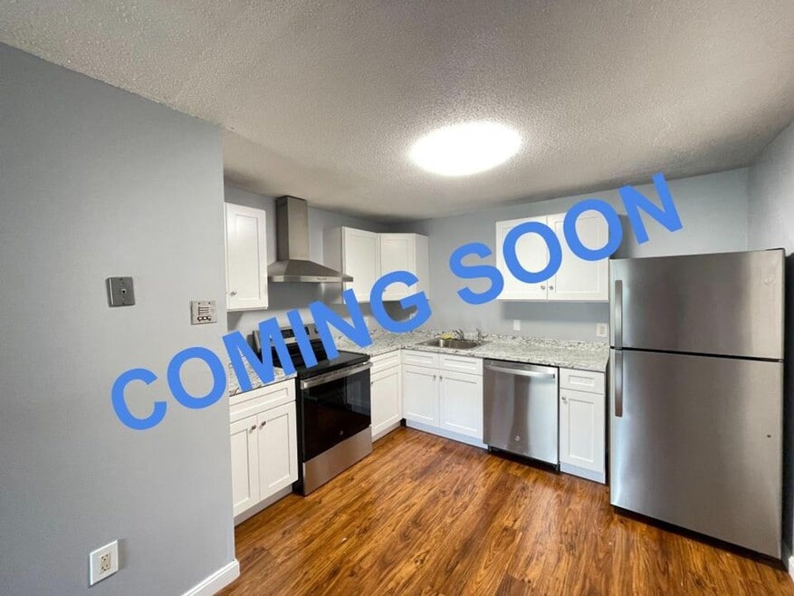
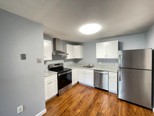
COMING SOON!
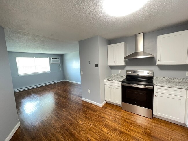
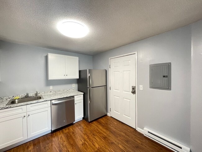
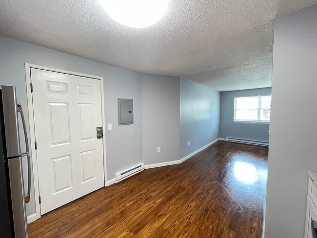
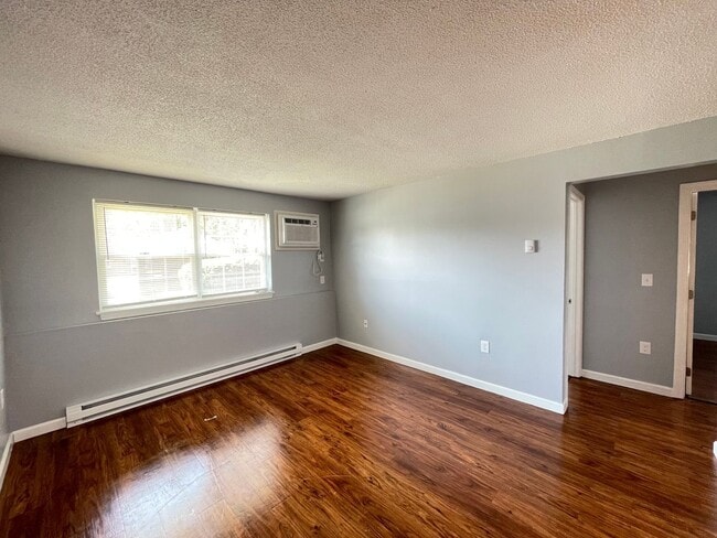
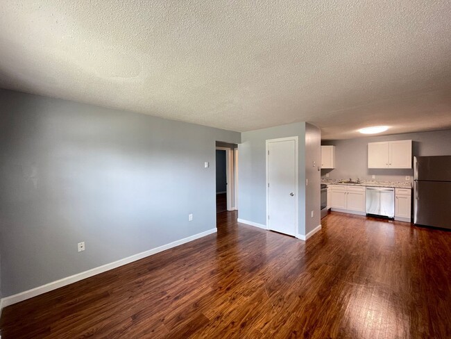
Introducing our newest addition to the vibrant city of Concord, NH - a modern 2 bedroom, 1 bathroom gem that is sure to impress! This chic urban living space boasts hot water included, off-street parking, and brand new flooring throughout. Located in a prime location, residents will have easy access to Loudon Road and all that Concord has to offer. Stay tuned for more details on this stylish apartment
Blue Door Living is one of the highest-rated property management companies in New Hampshire (4.5 stars with 300+ reviews), offering its residents many benefits:
- Online resident portal for convenience
- Many accepted payment methods
- Maintenance issues are resolved in 3.4 days on average
- 24/7 emergency maintenance phone line & personnel
- Option to enroll in the credit boosting service CredHub, which allows you to improve your credit score by up to 60 points through on-time rent payments.
The rent is $1,675/month. This owner is accepting Section 8 and VASH. The tenant is responsible for electricity. Additional pet rent is $50/month for each cat and $75/month for each dog. We have dog breed restrictions (listed on )—please make sure your dog is permitted before applying.
Blue Door Living has the following application requirements:
- Your net monthly household income must be at least 2.5 times the monthly rent.
- You must have had no evictions or foreclosures within the past 4 years.
- You must owe no money to a utility company or property manager/previous landlord.
- At least one applicant must have a credit score of 600 or higher.
Renting this apartment is as easy as 1, 2, 3!
1) Visit or call to self-schedule a showing.
2) Complete our online rental application at by clicking the Submit Application button for this apartment. Everyone 18 and over and any cosigners must complete an application. A $40 non-refundable fee per application allows Blue Door Living to do a credit and background check.
3) Your application will be screened in 1-4 business days. If you are approved, you must sign the lease, pay your security deposit, and schedule your move-in within 3 days of being approved.
Don't miss out on this opportunity to call this charming apartment your home. Schedule a showing today. We look forward to hearing from you soon.
AMENITIES:
* New Flooring
* Off-Street Parking
* Hot Water Included
By submitting your information on this page you consent to being contacted by the Property Manager and RentEngine via SMS, phone, or email.

Map
Property History
| Date | Event | Price | List to Sale | Price per Sq Ft |
|---|---|---|---|---|
| 12/16/2025 12/16/25 | For Rent | $1,675 | -- | -- |
- 12 E Side Dr Unit 106
- 12 E Side Dr Unit 4-13
- 12 E Side Dr Unit 12
- 43 Branch Turnpike
- 59 Branch Turnpike
- 58 Branch Turnpike Unit 73
- 58 Branch Turnpike Unit 26
- 8 NE Village Rd
- 17 Burns Ave Unit 2
- 24 Cricket Ln
- 6 Grover St
- 294 Portsmouth St
- 6 Heights Rd
- 19 Grappone Dr
- 33 Mulberry St Unit 2
- 15 Bridle Path Trail
- 9 Strawberry Ln
- 27 Pinewood Trail
- 7 Highridge Trail
- 11 Washington St
- 175 Loudon Rd Unit 12
- 181 Loudon Rd Unit 201
- 128 Loudon Rd Unit 11F
- 169 Portsmouth St
- 169 Portsmouth St Unit C-82
- 169 Portsmouth St Unit E-124
- 169 Portsmouth St Unit A-52
- 30 Cherry St
- 30 Cherry St Unit 30-210
- 11 Stickney Ave
- 39 S Main St Unit 2
- 50 N State St
- 32 S Main St
- 4 N State St Unit 203
- 5-7 S State St
- 62 Washington St
- 41 N Spring St Unit 39B
- 35-39 Thompson St
- 56 Rumford St Unit 3
- 76 Warren St Unit 2