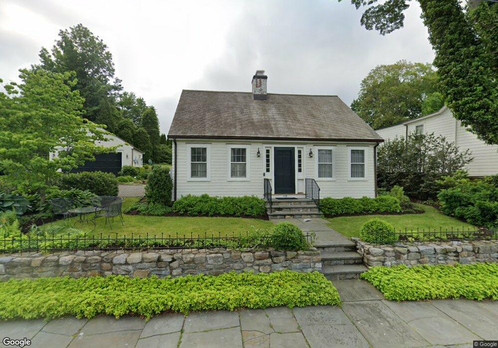
179 Main St Southport, CT 06890
Southport NeighborhoodEstimated Value: $1,624,000 - $2,373,000
3
Beds
3
Baths
1,770
Sq Ft
$1,065/Sq Ft
Est. Value
About This Home
This home is located at 179 Main St, Southport, CT 06890 and is currently estimated at $1,885,302, approximately $1,065 per square foot. 179 Main St is a home located in Fairfield County with nearby schools including Mill Hill School, Roger Ludlowe Middle School, and Fairfield Ludlowe High School.
Ownership History
Date
Name
Owned For
Owner Type
Purchase Details
Closed on
Jan 25, 2013
Sold by
Clark George
Bought by
Cargill Virginia
Current Estimated Value
Home Financials for this Owner
Home Financials are based on the most recent Mortgage that was taken out on this home.
Original Mortgage
$400,000
Outstanding Balance
$278,845
Interest Rate
3.35%
Estimated Equity
$1,606,457
Purchase Details
Closed on
Apr 29, 2009
Sold by
Est Estes Lynette C and Estes Howard C
Bought by
Clark Elisabeth R and Clark George E
Create a Home Valuation Report for This Property
The Home Valuation Report is an in-depth analysis detailing your home's value as well as a comparison with similar homes in the area
Home Values in the Area
Average Home Value in this Area
Purchase History
| Date | Buyer | Sale Price | Title Company |
|---|---|---|---|
| Cargill Virginia | $900,000 | -- | |
| Cargill Virginia | $900,000 | -- | |
| Clark Elisabeth R | $1,100,000 | -- | |
| Clark Elisabeth R | $1,100,000 | -- |
Source: Public Records
Mortgage History
| Date | Status | Borrower | Loan Amount |
|---|---|---|---|
| Open | Clark Elisabeth R | $400,000 | |
| Closed | Clark Elisabeth R | $400,000 |
Source: Public Records
Tax History Compared to Growth
Tax History
| Year | Tax Paid | Tax Assessment Tax Assessment Total Assessment is a certain percentage of the fair market value that is determined by local assessors to be the total taxable value of land and additions on the property. | Land | Improvement |
|---|---|---|---|---|
| 2025 | $22,331 | $786,590 | $587,230 | $199,360 |
| 2024 | $21,946 | $786,590 | $587,230 | $199,360 |
| 2023 | $21,639 | $786,590 | $587,230 | $199,360 |
| 2022 | $21,427 | $786,590 | $587,230 | $199,360 |
| 2021 | $21,222 | $786,590 | $587,230 | $199,360 |
| 2020 | $20,720 | $773,430 | $549,780 | $223,650 |
| 2019 | $20,720 | $773,430 | $549,780 | $223,650 |
| 2018 | $20,388 | $773,430 | $549,780 | $223,650 |
| 2017 | $19,970 | $773,430 | $549,780 | $223,650 |
| 2016 | $19,556 | $768,390 | $549,780 | $218,610 |
| 2015 | $20,964 | $845,670 | $644,280 | $201,390 |
| 2014 | $20,148 | $825,720 | $644,280 | $181,440 |
Source: Public Records
Map
Nearby Homes
- 2 Elmwood Dr Unit 2
- 260 Willow St
- 944 Pequot Ave
- 28 Mill Hill Rd Unit 28
- 305 S Gate Ln
- 153 Pease Ave
- 828 Sasco Hill Rd
- 775 Sasco Hill Rd
- 100 Overhill Rd
- 88 Overhill Rd
- 85 Patrick Dr
- 154 Gorham Rd
- 53 Hilltop Dr
- 1131 Sasco Hill Rd
- 844 Mill Hill Terrace
- 972 S Pine Creek Rd
- 209 S Pine Creek Rd
- 57 Beaumont Place
- 646 Mill Hill Terrace
- 97 Field Point Dr
- 249 Main St Unit 2
- 249 Main St Unit I
- 207 Main St
- 219 Main St
- 580 Harbor Rd
- 227 Main St
- 648 Harbor Rd
- 608 Harbor Rd
- 608 Harbor Rd Unit SMRNT
- 608 Harbor Rd Unit RNTL
- 608 Harbor Rd Unit Comp
- 139 Main St
- 226 Main St
- 142 Main St
- 238 Main St
- 238 Main St Unit 1R
- 238 Main St Unit 238
- 251 Main St Unit 2
- 251 Main St Unit 1
- 240 Main St