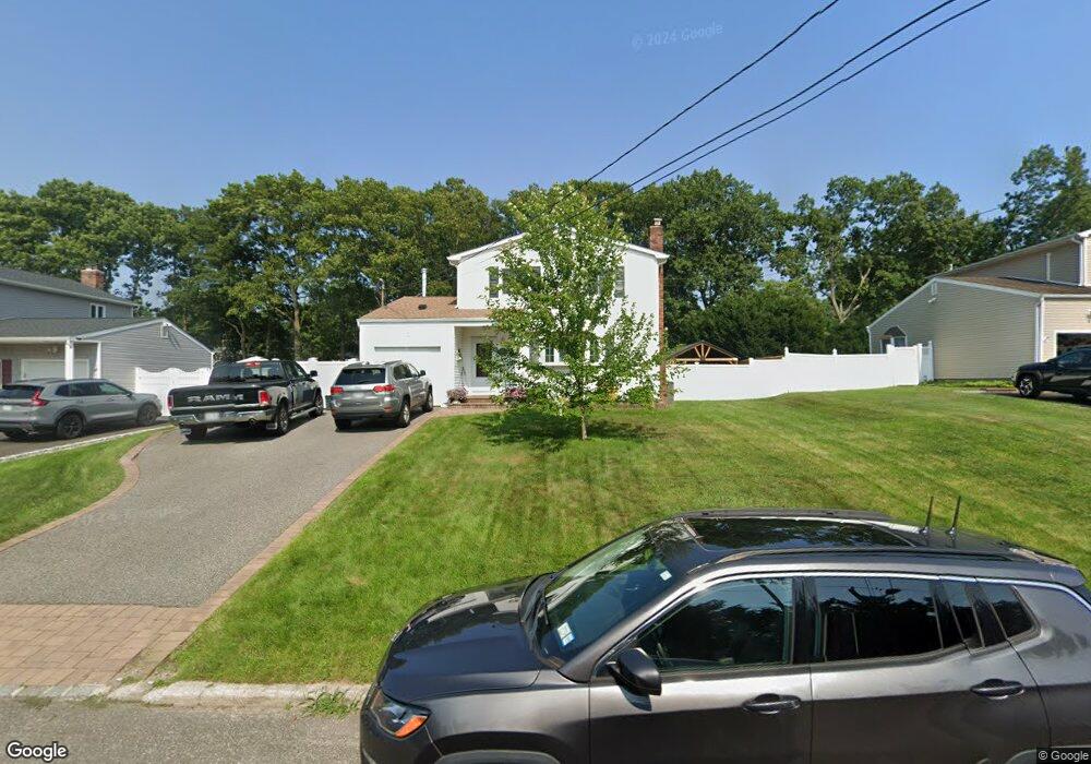
179 Maple St Medford, NY 11763
Estimated Value: $468,000 - $615,000
3
Beds
1
Bath
1,488
Sq Ft
$372/Sq Ft
Est. Value
About This Home
This home is located at 179 Maple St, Medford, NY 11763 and is currently estimated at $554,122, approximately $372 per square foot. 179 Maple St is a home located in Suffolk County with nearby schools including Patchogue-Medford High School, Victory Christian Academy, and Long Island Baptist Academy.
Ownership History
Date
Name
Owned For
Owner Type
Purchase Details
Closed on
Apr 14, 2004
Sold by
Mccaffrey Lorraine
Bought by
Mccaffrey Bernard and Mccaffrey Patricia
Current Estimated Value
Home Financials for this Owner
Home Financials are based on the most recent Mortgage that was taken out on this home.
Original Mortgage
$230,001
Outstanding Balance
$116,383
Interest Rate
6.75%
Mortgage Type
Purchase Money Mortgage
Estimated Equity
$437,739
Purchase Details
Closed on
Aug 19, 1997
Sold by
Mccaffrey Lorraine and Saitta Andrew J
Bought by
Mccaffrey Lorraine
Purchase Details
Closed on
Jun 22, 1994
Sold by
Mccaffrey Lorraine
Bought by
Mccaffrey Lorraine and Saitta Andrew J
Create a Home Valuation Report for This Property
The Home Valuation Report is an in-depth analysis detailing your home's value as well as a comparison with similar homes in the area
Home Values in the Area
Average Home Value in this Area
Purchase History
| Date | Buyer | Sale Price | Title Company |
|---|---|---|---|
| Mccaffrey Bernard | $160,000 | Titleserv | |
| Mccaffrey Lorraine | -- | First American Title Ins Co | |
| Mccaffrey Lorraine | -- | Commonwealth Land Title Ins |
Source: Public Records
Mortgage History
| Date | Status | Borrower | Loan Amount |
|---|---|---|---|
| Open | Mccaffrey Bernard | $230,001 |
Source: Public Records
Tax History Compared to Growth
Tax History
| Year | Tax Paid | Tax Assessment Tax Assessment Total Assessment is a certain percentage of the fair market value that is determined by local assessors to be the total taxable value of land and additions on the property. | Land | Improvement |
|---|---|---|---|---|
| 2024 | $10,607 | $2,675 | $300 | $2,375 |
| 2023 | $10,607 | $2,675 | $300 | $2,375 |
| 2022 | $9,258 | $2,675 | $300 | $2,375 |
| 2021 | $9,258 | $2,675 | $300 | $2,375 |
| 2020 | $9,578 | $2,675 | $300 | $2,375 |
| 2019 | $9,578 | $0 | $0 | $0 |
| 2018 | $8,949 | $2,675 | $300 | $2,375 |
| 2017 | $8,949 | $2,675 | $300 | $2,375 |
| 2016 | $8,771 | $2,675 | $300 | $2,375 |
| 2015 | -- | $2,675 | $300 | $2,375 |
| 2014 | -- | $2,675 | $300 | $2,375 |
Source: Public Records
Map
Nearby Homes
- 102 Pennsylvania Ave
- 302 Bridgeport Ave
- 359 Jamaica Ave
- 10 Matsunaye Dr
- 74 Oregon Ave
- 61 Pennsylvania Ave
- 3 Lacebark Ln
- 209 Jamaica Ave
- 187 Robinson Ave
- 9 Private Rd
- 5 Torrey Pine Ln
- 52 White Pine Way
- 36 Torrey Pine Ln
- 186 Jamaica Ave
- 75 White Pine Way
- V/L Elmhurst Ave
- 116 E Woodside Ave
- 2617 Kane Ave
- 34 Harlem Ave
- 8 Nantucket Dr