Estimated Value: $141,000 - $158,273
--
Bed
--
Bath
1,548
Sq Ft
$99/Sq Ft
Est. Value
About This Home
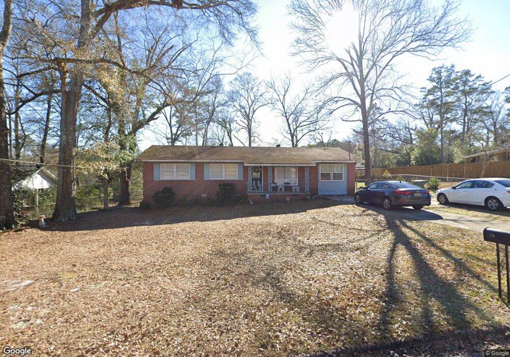
This home is located at 179 Myrtlewood Dr, Ozark, AL 36360 and is currently estimated at $153,068, approximately $98 per square foot. 179 Myrtlewood Dr is a home located in Dale County with nearby schools including Lisenby Primary School, Mixon Intermediate School, and D. A. Smith Middle School.
Ownership History
Date
Name
Owned For
Owner Type
Purchase Details
Closed on
Aug 27, 2015
Sold by
Mcmurtry Annette W
Bought by
Sanders Roger Ozene and Sanders Dana M
Current Estimated Value
Purchase Details
Closed on
Jul 31, 2015
Sold by
Clark Sean T and Clark Margaret G
Bought by
Mcmurtry Annette W
Purchase Details
Closed on
Jul 8, 2011
Sold by
Mcmurtry Annette W
Bought by
Clark Sean T and Clark Margaret G
Purchase Details
Closed on
May 9, 2011
Sold by
Jeffery Brent A and Jeffery Polly D
Bought by
Mcmurtry Annette W
Create a Home Valuation Report for This Property
The Home Valuation Report is an in-depth analysis detailing your home's value as well as a comparison with similar homes in the area
Home Values in the Area
Average Home Value in this Area
Purchase History
| Date | Buyer | Sale Price | Title Company |
|---|---|---|---|
| Sanders Roger Ozene | $96,210 | -- | |
| Mcmurtry Annette W | $96,210 | -- | |
| Clark Sean T | -- | -- | |
| Mcmurtry Annette W | -- | -- |
Source: Public Records
Tax History Compared to Growth
Tax History
| Year | Tax Paid | Tax Assessment Tax Assessment Total Assessment is a certain percentage of the fair market value that is determined by local assessors to be the total taxable value of land and additions on the property. | Land | Improvement |
|---|---|---|---|---|
| 2024 | $705 | $15,020 | $1,420 | $13,600 |
| 2023 | $705 | $13,140 | $1,420 | $11,720 |
| 2022 | $494 | $10,860 | $10,860 | $0 |
| 2021 | $459 | $10,160 | $1,420 | $8,740 |
| 2020 | $459 | $10,160 | $560 | $9,600 |
| 2019 | $459 | $10,160 | $560 | $9,600 |
| 2018 | $433 | $9,640 | $560 | $9,080 |
| 2017 | $433 | $9,640 | $560 | $9,080 |
| 2016 | $433 | $9,640 | $560 | $9,080 |
| 2015 | $433 | $9,640 | $560 | $9,080 |
| 2014 | $426 | $9,500 | $560 | $8,940 |
| 2013 | $422 | $9,500 | $560 | $8,940 |
Source: Public Records
Map
Nearby Homes
- Lot 6 & 7 Brookwood Brookwood Cir
- 424 Merrydell Dr
- 8602 U S 231
- N/A U S 231
- 0 U S 231
- Lot 4 U S 231
- Lot 5 U S 231
- 127 Peters Cir
- 178 Jasmine Dr
- 1401 Deese Rd
- 0 Deese Rd
- 00 Harris Rd
- 262 Rosemary Ln
- 179 Dixie Dr
- 240 Bradford Dr
- 124 Sandy Hills Ct
- 130 Stephanie Dr
- 876 Camilla Ave
- 1.144 Acres S Highway 231
- 471 Magnolia St
- 165 Myrtlewood Dr
- 261 Fairwood Cir
- 160 Myrtlewood Dr
- 178 Merrydell Dr
- 229 Fairwood Cir
- 196 Merrydell Dr
- 162 Merrydell Dr
- 281 Fairwood Cir
- 138 Merrydell Dr
- 144 Myrtlewood Dr
- 248 Fairwood Cir
- 268 Fairwood Cir
- 205 Fairwood Cir
- 216 Merrydell Dr
- 222 Fairwood Cir
- 291 Fairwood Cir
- 291 Fairwood Cir
- 171 Merry Dell Dr
- 1843 Andrews Ave
- 374 Meadowlake Dr