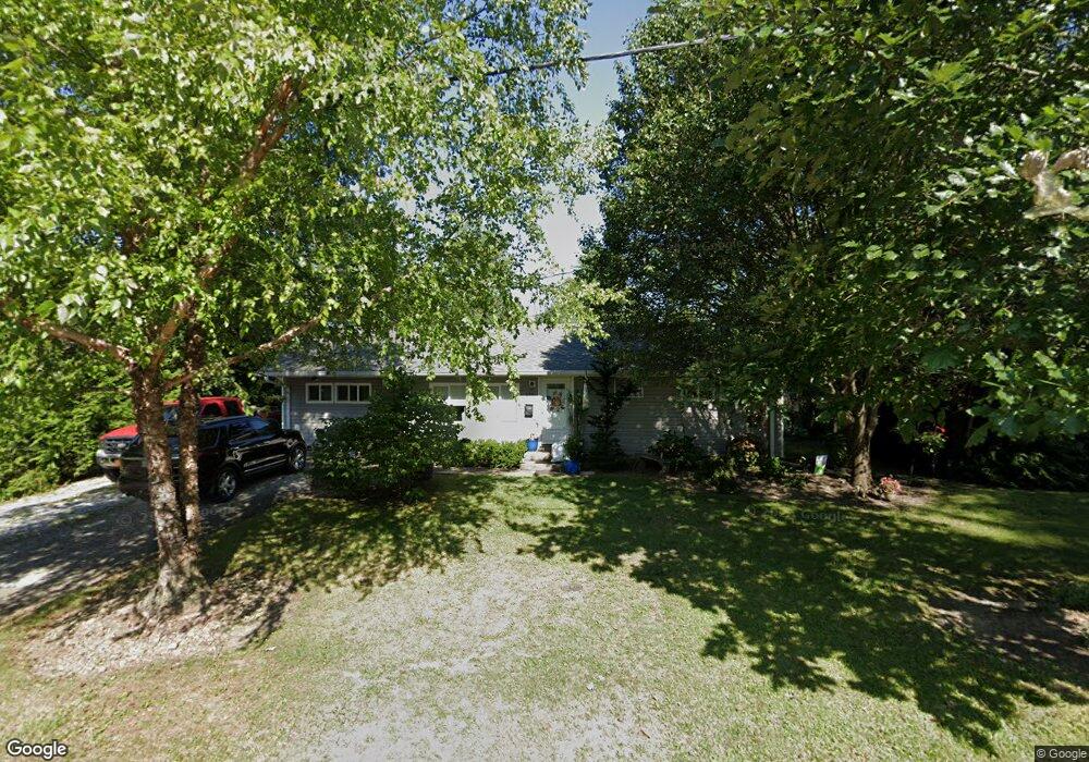
179 N High St Williamsburg, OH 45176
Estimated Value: $157,509 - $214,000
3
Beds
1
Bath
956
Sq Ft
$196/Sq Ft
Est. Value
About This Home
This home is located at 179 N High St, Williamsburg, OH 45176 and is currently estimated at $187,127, approximately $195 per square foot. 179 N High St is a home located in Clermont County with nearby schools including Williamsburg Elementary School and Williamsburg High School.
Ownership History
Date
Name
Owned For
Owner Type
Purchase Details
Closed on
Feb 9, 2006
Sold by
Baldwin Joseph W and Baldwin Judy
Bought by
Caudill Gregory and Caudill Kimberly A
Current Estimated Value
Home Financials for this Owner
Home Financials are based on the most recent Mortgage that was taken out on this home.
Original Mortgage
$103,500
Outstanding Balance
$69,261
Interest Rate
9.62%
Mortgage Type
Stand Alone First
Estimated Equity
$117,866
Purchase Details
Closed on
Apr 14, 2004
Sold by
Caudill Kimberly A and Baldwin Joseph W
Bought by
Baldwin Joseph W and Baldwin Judy
Purchase Details
Closed on
Nov 7, 2003
Sold by
Hud
Bought by
Baldwin Joseph W and Caudill Kimberly A
Purchase Details
Closed on
Apr 5, 2000
Sold by
Robbins Charlotte
Bought by
Holtkamp Michael D
Home Financials for this Owner
Home Financials are based on the most recent Mortgage that was taken out on this home.
Original Mortgage
$69,325
Interest Rate
8.31%
Mortgage Type
FHA
Create a Home Valuation Report for This Property
The Home Valuation Report is an in-depth analysis detailing your home's value as well as a comparison with similar homes in the area
Home Values in the Area
Average Home Value in this Area
Purchase History
| Date | Buyer | Sale Price | Title Company |
|---|---|---|---|
| Caudill Gregory | $104,000 | Royal Land Title Agency Ltd | |
| Baldwin Joseph W | -- | -- | |
| Baldwin Joseph W | -- | -- | |
| Holtkamp Michael D | $69,900 | -- |
Source: Public Records
Mortgage History
| Date | Status | Borrower | Loan Amount |
|---|---|---|---|
| Open | Caudill Gregory | $103,500 | |
| Previous Owner | Holtkamp Michael D | $69,325 |
Source: Public Records
Tax History Compared to Growth
Tax History
| Year | Tax Paid | Tax Assessment Tax Assessment Total Assessment is a certain percentage of the fair market value that is determined by local assessors to be the total taxable value of land and additions on the property. | Land | Improvement |
|---|---|---|---|---|
| 2024 | $1,239 | $28,810 | $2,980 | $25,830 |
| 2023 | $1,241 | $28,810 | $2,980 | $25,830 |
| 2022 | $1,131 | $23,490 | $2,420 | $21,070 |
| 2021 | $1,016 | $23,490 | $2,420 | $21,070 |
| 2020 | $1,018 | $23,490 | $2,420 | $21,070 |
| 2019 | $1,164 | $26,120 | $2,280 | $23,840 |
| 2018 | $1,167 | $26,120 | $2,280 | $23,840 |
| 2017 | $998 | $26,120 | $2,280 | $23,840 |
| 2016 | $998 | $20,900 | $1,820 | $19,080 |
| 2015 | $961 | $20,900 | $1,820 | $19,080 |
| 2014 | $961 | $20,900 | $1,820 | $19,080 |
| 2013 | $834 | $17,820 | $2,560 | $15,260 |
Source: Public Records
Map
Nearby Homes
- 877 Gay St
- 230 Gay St
- 144 N Front St
- 120 Walnut St
- 649 Hoffman Ave
- Acres Dela Palma Rd
- 115 Cornerstone Dr
- 119 Cornerstone Dr
- 126 Cornerstone Dr
- 130 Cornerstone Dr
- Bellamy Plan at Cornerstone Crossing
- Fairton Plan at Cornerstone Crossing
- Harmony Plan at Cornerstone Crossing
- Aldridge Plan at Cornerstone Crossing
- 4488 Ohio 133
- 111 Copper Sun Ct
- 110 Copper Sun Ct
- 3717 Cobb Rd
- 18 Lynn Ct
- 3690 Todds Run Foster Rd