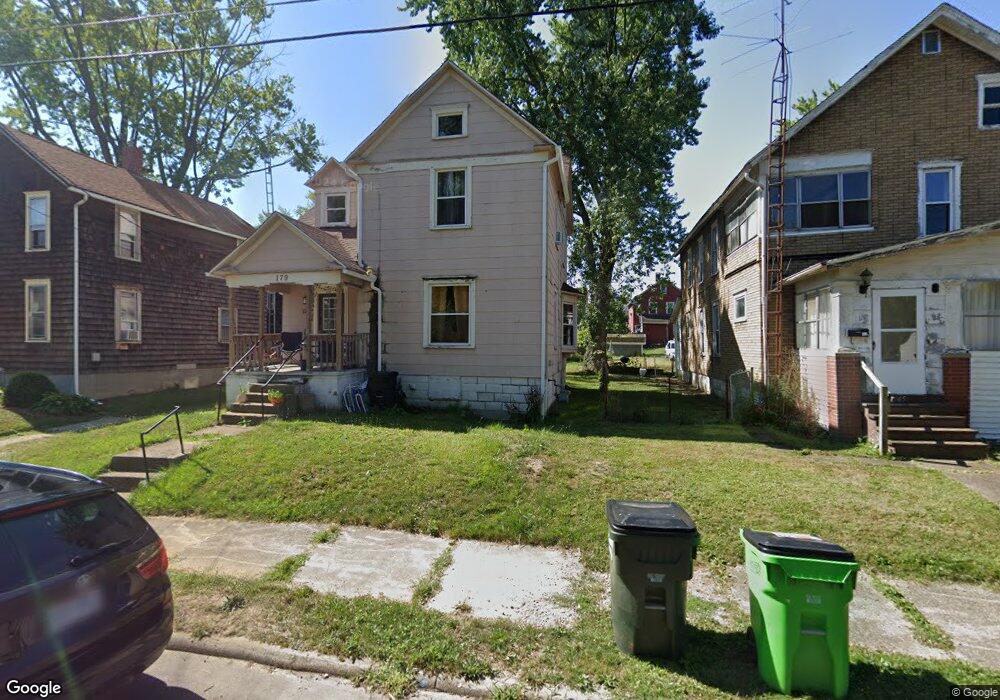
179 Rosenberry St Alliance, OH 44601
Estimated Value: $82,000 - $92,000
3
Beds
1
Bath
1,376
Sq Ft
$64/Sq Ft
Est. Value
About This Home
This home is located at 179 Rosenberry St, Alliance, OH 44601 and is currently estimated at $88,333, approximately $64 per square foot. 179 Rosenberry St is a home located in Stark County with nearby schools including Alliance Elementary School at Rockhill, Alliance Intermediate School at Northside, and Alliance Middle School.
Ownership History
Date
Name
Owned For
Owner Type
Purchase Details
Closed on
Jul 13, 2021
Sold by
Mulholland Holdings Llc
Bought by
Sapphire Properties Of Ohio Llc
Current Estimated Value
Home Financials for this Owner
Home Financials are based on the most recent Mortgage that was taken out on this home.
Original Mortgage
$953,520
Outstanding Balance
$798,081
Interest Rate
2.93%
Mortgage Type
Future Advance Clause Open End Mortgage
Estimated Equity
-$709,748
Purchase Details
Closed on
Mar 9, 2018
Sold by
Rg Properties Of Ohio Llc
Bought by
Mulholland Holding Llc
Home Financials for this Owner
Home Financials are based on the most recent Mortgage that was taken out on this home.
Original Mortgage
$55,920
Interest Rate
4.22%
Mortgage Type
New Conventional
Purchase Details
Closed on
Dec 26, 2012
Sold by
Schlabach Johannes
Bought by
Rg Properties Llc
Home Financials for this Owner
Home Financials are based on the most recent Mortgage that was taken out on this home.
Original Mortgage
$26,175
Interest Rate
3.3%
Mortgage Type
Future Advance Clause Open End Mortgage
Purchase Details
Closed on
Jan 21, 2006
Sold by
Yoders Land & Timber Consultant Ltd
Bought by
Schlabach Johannes
Purchase Details
Closed on
Jan 19, 2005
Sold by
Mcafee James and Mcafee Craig
Bought by
Yoders Land & Timber Consultant Ltd
Purchase Details
Closed on
Sep 29, 1997
Sold by
Rent To Own Leasing Co
Bought by
Mcafee James H and Mcafee James
Home Financials for this Owner
Home Financials are based on the most recent Mortgage that was taken out on this home.
Original Mortgage
$32,000
Interest Rate
7.63%
Mortgage Type
New Conventional
Purchase Details
Closed on
Jul 31, 1997
Sold by
Steves Lester S
Bought by
Rent To Own Leasing Co
Home Financials for this Owner
Home Financials are based on the most recent Mortgage that was taken out on this home.
Original Mortgage
$32,000
Interest Rate
7.63%
Mortgage Type
New Conventional
Create a Home Valuation Report for This Property
The Home Valuation Report is an in-depth analysis detailing your home's value as well as a comparison with similar homes in the area
Home Values in the Area
Average Home Value in this Area
Purchase History
| Date | Buyer | Sale Price | Title Company |
|---|---|---|---|
| Sapphire Properties Of Ohio Llc | $549,400 | None Available | |
| Mulholland Holding Llc | $69,900 | None Available | |
| Rg Properties Llc | $34,900 | None Available | |
| Schlabach Johannes | $7,000 | None Available | |
| Yoders Land & Timber Consultant Ltd | $5,000 | -- | |
| Mcafee James H | $28,000 | -- | |
| Rent To Own Leasing Co | $16,500 | -- |
Source: Public Records
Mortgage History
| Date | Status | Borrower | Loan Amount |
|---|---|---|---|
| Open | Sapphire Properties Of Ohio Llc | $953,520 | |
| Previous Owner | Mulholland Holding Llc | $55,920 | |
| Previous Owner | Rg Properties Llc | $26,175 | |
| Previous Owner | Mcafee James H | $32,000 |
Source: Public Records
Tax History Compared to Growth
Tax History
| Year | Tax Paid | Tax Assessment Tax Assessment Total Assessment is a certain percentage of the fair market value that is determined by local assessors to be the total taxable value of land and additions on the property. | Land | Improvement |
|---|---|---|---|---|
| 2025 | -- | $7,530 | $3,640 | $3,890 |
| 2024 | $0 | $7,530 | $3,640 | $3,890 |
| 2023 | $270 | $6,550 | $3,570 | $2,980 |
| 2022 | $271 | $6,550 | $3,570 | $2,980 |
| 2021 | $472 | $6,550 | $3,570 | $2,980 |
| 2020 | $324 | $7,290 | $3,120 | $4,170 |
| 2019 | $320 | $7,290 | $3,120 | $4,170 |
| 2018 | $321 | $7,290 | $3,120 | $4,170 |
| 2017 | $278 | $6,200 | $2,590 | $3,610 |
| 2016 | $281 | $6,200 | $2,590 | $3,610 |
| 2015 | $401 | $8,790 | $2,590 | $6,200 |
| 2014 | $435 | $9,070 | $2,660 | $6,410 |
| 2013 | $217 | $9,070 | $2,660 | $6,410 |
Source: Public Records
Map
Nearby Homes
- 807 S Union Ave
- 1005 S Freedom Ave
- 452 E Summit St
- 203 Glamorgan St
- 140 W Summit St
- 551 South St
- 1437 S Linden Ave
- 1044 S Liberty Ave
- 1475 Chatauqua Ct
- 432 S Linden Ave
- 427 S Union Ave
- 404 S Linden Ave
- 814 Milner St
- V/L S Fredeom Ave
- 548 E High St
- 729 Waugh St
- 442 S Liberty Ave
- 1395 S Webb Ave
- 831 Wade Ave
- 112 E College St
- 165 Rosenberry St
- 187 Rosenberry St
- 161 Rosenberry St
- 205 Rosenberry St
- 205 Rosenberry St
- 172 Rosenberry St
- 186 Rosenberry St
- 204 Rosenberry St
- 180 Milner St
- 155 Rosenberry St
- 215 Rosenberry St
- 170 Milner St
- 188 Milner St
- 206 Milner St
- 160 Milner St
- 143 Rosenberry St
- 221 Rosenberry St
- 152 Rosenberry St
- 152 Rosenberry St
- 152 Rosenberry St