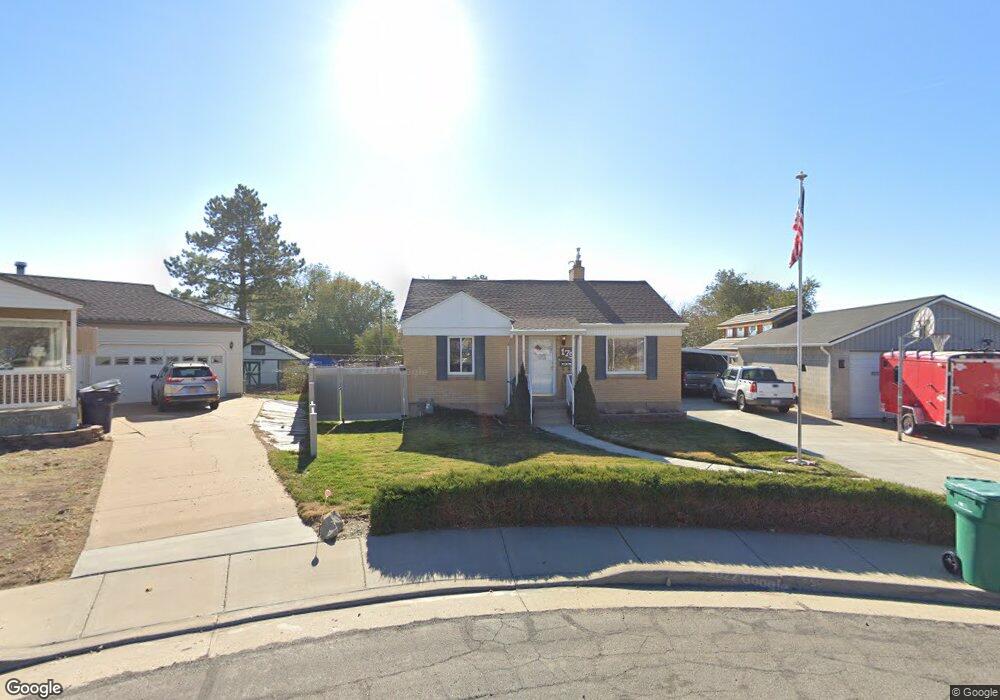
179 Ross Dr Clearfield, UT 84015
Estimated Value: $361,000 - $412,000
3
Beds
1
Bath
1,376
Sq Ft
$278/Sq Ft
Est. Value
About This Home
This home is located at 179 Ross Dr, Clearfield, UT 84015 and is currently estimated at $382,492, approximately $277 per square foot. 179 Ross Dr is a home located in Davis County with nearby schools including South Clearfield Elementary School, North Davis Junior High School, and Clearfield High School.
Ownership History
Date
Name
Owned For
Owner Type
Purchase Details
Closed on
Jun 9, 2020
Sold by
Cannon Clifford M and Cannon Cynthia B
Bought by
Cannon Cynthia B and Cannon Clifford M
Current Estimated Value
Home Financials for this Owner
Home Financials are based on the most recent Mortgage that was taken out on this home.
Original Mortgage
$94,500
Interest Rate
3.2%
Mortgage Type
New Conventional
Purchase Details
Closed on
May 21, 2020
Sold by
Cannon Clifford M and Cannon Cynthia B
Bought by
Cannon Clifford Murray and Cannon Cynthia B
Home Financials for this Owner
Home Financials are based on the most recent Mortgage that was taken out on this home.
Original Mortgage
$94,500
Interest Rate
3.2%
Mortgage Type
New Conventional
Purchase Details
Closed on
Jul 15, 2014
Sold by
Cannon Christian Eugene and Cannon John Ravsten
Bought by
Cannon Clifford M and Cannon Cynthia B
Create a Home Valuation Report for This Property
The Home Valuation Report is an in-depth analysis detailing your home's value as well as a comparison with similar homes in the area
Home Values in the Area
Average Home Value in this Area
Purchase History
| Date | Buyer | Sale Price | Title Company |
|---|---|---|---|
| Cannon Cynthia B | -- | Stewart Title Ins Age | |
| Cannon Clifford Murray | -- | None Available | |
| Cannon Clifford M | -- | None Available |
Source: Public Records
Mortgage History
| Date | Status | Borrower | Loan Amount |
|---|---|---|---|
| Closed | Cannon Cynthia B | $94,500 |
Source: Public Records
Tax History Compared to Growth
Tax History
| Year | Tax Paid | Tax Assessment Tax Assessment Total Assessment is a certain percentage of the fair market value that is determined by local assessors to be the total taxable value of land and additions on the property. | Land | Improvement |
|---|---|---|---|---|
| 2025 | $2,273 | $209,550 | $81,710 | $127,840 |
| 2024 | $2,273 | $205,150 | $78,357 | $126,793 |
| 2023 | $2,040 | $338,000 | $124,767 | $213,233 |
| 2022 | $2,252 | $201,850 | $70,966 | $130,884 |
| 2021 | $1,891 | $256,000 | $78,531 | $177,469 |
| 2020 | $1,688 | $227,000 | $66,651 | $160,349 |
| 2019 | $1,582 | $210,000 | $67,635 | $142,365 |
| 2018 | $1,431 | $185,000 | $57,031 | $127,969 |
| 2016 | $1,176 | $79,475 | $24,193 | $55,282 |
| 2015 | $1,084 | $69,905 | $24,193 | $45,712 |
| 2014 | $1,053 | $68,784 | $24,193 | $44,591 |
| 2013 | -- | $68,858 | $26,467 | $42,391 |
Source: Public Records
Map
Nearby Homes
- 175 Ross Dr
- 153 Ross Dr
- 126 Ross Dr
- 189 E Ross Dr S
- 747 E 450 S
- 490 E 700 S Unit C35
- 490 E 700 S Unit 524
- 357 S 600 E
- 875 S Depot St Unit C306
- 875 S Depot St Unit A335
- 875 S Depot St Unit C-312
- 875 S Depot St Unit A336
- 875 S Depot St Unit B355
- 875 S Depot St Unit C316
- 875 S Depot St Unit C212
- 472 E Depot St Unit 116
- 464 E Depot St Unit 114
- 273 S 750 E
- 275 S 600 E
- 4 Bedroom Plan at Union Townhomes