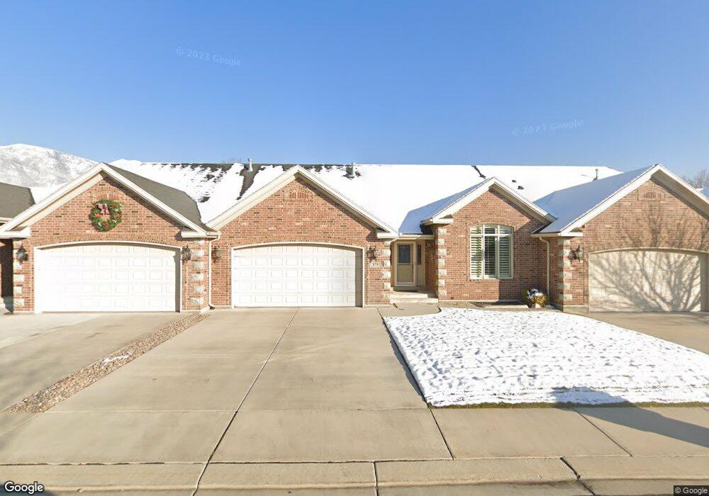
179 S 1060 E American Fork, UT 84003
Estimated Value: $513,000 - $557,000
1
Bed
3
Baths
1,498
Sq Ft
$362/Sq Ft
Est. Value
About This Home
This home is located at 179 S 1060 E, American Fork, UT 84003 and is currently estimated at $541,963, approximately $361 per square foot. 179 S 1060 E is a home located in Utah County with nearby schools including Barratt Elementary School, American Fork Junior High School, and American Fork High School.
Ownership History
Date
Name
Owned For
Owner Type
Purchase Details
Closed on
Oct 28, 2025
Sold by
Harvey Dan Pace and Kay Marie
Bought by
Brown Lane Paul and Brown Stacy Lee
Current Estimated Value
Home Financials for this Owner
Home Financials are based on the most recent Mortgage that was taken out on this home.
Original Mortgage
$545,000
Outstanding Balance
$545,000
Interest Rate
6.35%
Mortgage Type
VA
Estimated Equity
-$3,037
Purchase Details
Closed on
Aug 18, 2022
Sold by
Pace Dan and Pace Kay
Bought by
Harvey Dan Pace And Kay Marie Pace Family Liv and Pace
Purchase Details
Closed on
Mar 6, 2006
Sold by
Pristine Developers Inc
Bought by
Pace Dan and Pace Kay
Create a Home Valuation Report for This Property
The Home Valuation Report is an in-depth analysis detailing your home's value as well as a comparison with similar homes in the area
Home Values in the Area
Average Home Value in this Area
Purchase History
| Date | Buyer | Sale Price | Title Company |
|---|---|---|---|
| Brown Lane Paul | -- | Old Republic Title | |
| Harvey Dan Pace And Kay Marie Pace Family Liv | -- | None Listed On Document | |
| Harvey Dan Pace And Kay Marie Pace Family Liv | -- | None Listed On Document | |
| Pace Dan | -- | Mountain West Title Company |
Source: Public Records
Mortgage History
| Date | Status | Borrower | Loan Amount |
|---|---|---|---|
| Open | Brown Lane Paul | $545,000 |
Source: Public Records
Tax History
| Year | Tax Paid | Tax Assessment Tax Assessment Total Assessment is a certain percentage of the fair market value that is determined by local assessors to be the total taxable value of land and additions on the property. | Land | Improvement |
|---|---|---|---|---|
| 2025 | $2,548 | $283,250 | -- | -- |
| 2024 | $2,548 | $283,085 | $0 | $0 |
| 2023 | $2,266 | $266,970 | $0 | $0 |
| 2022 | $2,414 | $280,610 | $0 | $0 |
| 2021 | $1,978 | $359,200 | $53,900 | $305,300 |
| 2020 | $1,925 | $339,100 | $50,900 | $288,200 |
| 2019 | $1,862 | $339,100 | $50,900 | $288,200 |
| 2018 | $1,682 | $293,000 | $51,000 | $242,000 |
| 2017 | $1,714 | $161,150 | $0 | $0 |
| 2016 | $1,845 | $161,150 | $0 | $0 |
| 2015 | $1,944 | $161,150 | $0 | $0 |
| 2014 | $1,716 | $140,250 | $0 | $0 |
Source: Public Records
Map
Nearby Homes
Your Personal Tour Guide
Ask me questions while you tour the home.