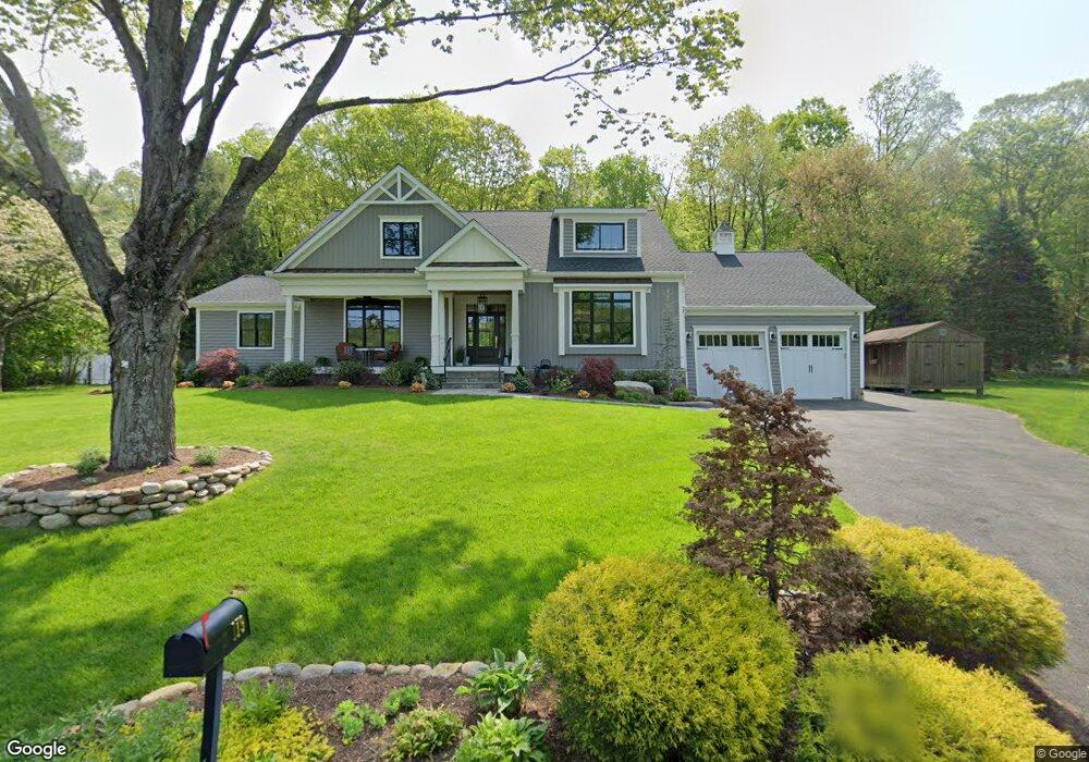
179 Stevenson Rd Fairfield, CT 06825
Estimated Value: $704,000 - $1,108,000
3
Beds
3
Baths
2,815
Sq Ft
$336/Sq Ft
Est. Value
About This Home
This home is located at 179 Stevenson Rd, Fairfield, CT 06825 and is currently estimated at $946,744, approximately $336 per square foot. 179 Stevenson Rd is a home located in Fairfield County with nearby schools including North Stratfield Elementary School, Fairfield Woods Middle School, and Fairfield Warde High School.
Ownership History
Date
Name
Owned For
Owner Type
Purchase Details
Closed on
Apr 1, 2008
Sold by
Proskinitopoulos Kosta
Bought by
Cuccaro Kevin M and Cuccaro Alison
Current Estimated Value
Purchase Details
Closed on
Aug 30, 2001
Sold by
Murphy S Mckinley and Murphy Mary F
Bought by
Proskinitpoulos Kosta
Create a Home Valuation Report for This Property
The Home Valuation Report is an in-depth analysis detailing your home's value as well as a comparison with similar homes in the area
Purchase History
| Date | Buyer | Sale Price | Title Company |
|---|---|---|---|
| Cuccaro Kevin M | $443,000 | -- | |
| Cuccaro Kevin M | $443,000 | -- | |
| Proskinitpoulos Kosta | $275,000 | -- | |
| Proskinitpoulos Kosta | $275,000 | -- |
Source: Public Records
Mortgage History
| Date | Status | Borrower | Loan Amount |
|---|---|---|---|
| Open | Proskinitpoulos Kosta | $320,000 | |
| Closed | Proskinitpoulos Kosta | $385,000 |
Source: Public Records
Tax History
| Year | Tax Paid | Tax Assessment Tax Assessment Total Assessment is a certain percentage of the fair market value that is determined by local assessors to be the total taxable value of land and additions on the property. | Land | Improvement |
|---|---|---|---|---|
| 2025 | $13,965 | $491,890 | $137,760 | $354,130 |
| 2024 | $13,724 | $491,890 | $137,760 | $354,130 |
| 2023 | $13,532 | $491,890 | $137,760 | $354,130 |
| 2022 | $13,399 | $491,890 | $137,760 | $354,130 |
| 2021 | $10,418 | $386,120 | $137,760 | $248,360 |
| 2020 | $6,841 | $255,360 | $183,680 | $71,680 |
| 2019 | $6,841 | $255,360 | $183,680 | $71,680 |
| 2018 | $13,281 | $255,360 | $183,680 | $71,680 |
| 2017 | $13,231 | $255,360 | $183,680 | $71,680 |
| 2016 | $6,499 | $255,360 | $183,680 | $71,680 |
| 2015 | $6,148 | $248,010 | $184,870 | $63,140 |
| 2014 | $6,051 | $248,010 | $184,870 | $63,140 |
Source: Public Records
Map
Nearby Homes
- 5763 Park Ave
- 132 Toll House Ln
- 40 Toll House Ln
- 18 Ridgebury Dr
- 93 Tersana Dr
- 121 Campbell Rd
- 8 Raleigh Rd
- 22 Newman Dr
- 3460 Old Town Rd
- 3432 Old Town Rd
- lot 194 Prospect Ave
- 170 Marilyn Dr
- 35 Sturbridge Rd
- 84 Delaware Rd
- 36 Rosewood Dr
- 66 Loftus Cir
- 134 Delaware Rd
- 3125 Old Town Rd
- 71 Schiller Rd
- 12 Ridgeway Rd
- 207 Stevenson Rd
- 145 Stevenson Rd
- 196 Stevenson Rd
- 218 Stevenson Rd
- 123 Stevenson Rd
- 235 Stevenson Rd
- 236 Stevenson Rd
- 101 Stevenson Rd
- 273 Toll House Ln
- 231 Toll House Ln
- 249 Toll House Ln
- 257 Stevenson Rd
- 258 Stevenson Rd
- 309 Toll House Ln
- 211 Toll House Ln
- 193 Toll House Ln
- 291 Toll House Ln
- 79 Stevenson Rd
- 279 Stevenson Rd
- 331 Toll House Ln
Your Personal Tour Guide
Ask me questions while you tour the home.