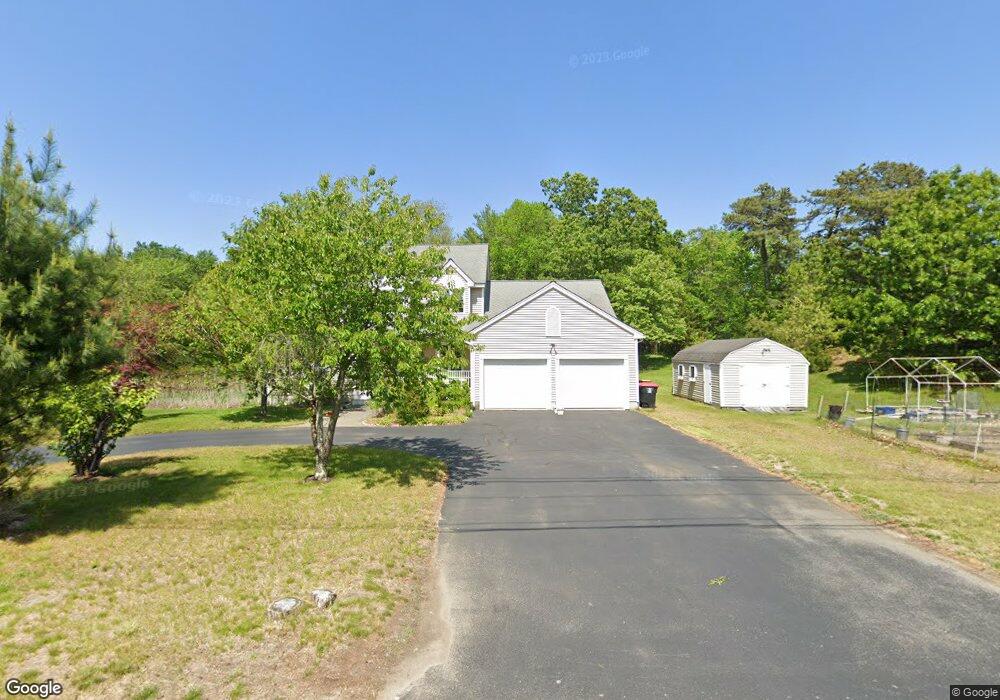
179 W River Rd Uxbridge, MA 01569
Estimated Value: $735,824 - $778,000
5
Beds
3
Baths
2,540
Sq Ft
$298/Sq Ft
Est. Value
About This Home
This home is located at 179 W River Rd, Uxbridge, MA 01569 and is currently estimated at $755,956, approximately $297 per square foot. 179 W River Rd is a home located in Worcester County with nearby schools including Uxbridge High School, Our Lady of the Valley Regional School, and Whitinsville Christian School.
Ownership History
Date
Name
Owned For
Owner Type
Purchase Details
Closed on
Sep 28, 2007
Sold by
Barton 4Th John D and Barton Tammy
Bought by
Macdonald Ian M and Macdonald Sandra J
Current Estimated Value
Home Financials for this Owner
Home Financials are based on the most recent Mortgage that was taken out on this home.
Original Mortgage
$323,000
Interest Rate
6.65%
Mortgage Type
Purchase Money Mortgage
Purchase Details
Closed on
Sep 14, 2004
Sold by
Trantham Allen L and Trantham Deborah T
Bought by
Barton 4Th John D and Barton Tammy
Home Financials for this Owner
Home Financials are based on the most recent Mortgage that was taken out on this home.
Original Mortgage
$378,250
Interest Rate
6.08%
Mortgage Type
Purchase Money Mortgage
Purchase Details
Closed on
May 11, 2000
Sold by
Fred Hutnak Dev Corp
Bought by
Trantham Allen L and Trantham Deborah T
Home Financials for this Owner
Home Financials are based on the most recent Mortgage that was taken out on this home.
Original Mortgage
$200,000
Interest Rate
8.21%
Mortgage Type
Purchase Money Mortgage
Create a Home Valuation Report for This Property
The Home Valuation Report is an in-depth analysis detailing your home's value as well as a comparison with similar homes in the area
Home Values in the Area
Average Home Value in this Area
Purchase History
| Date | Buyer | Sale Price | Title Company |
|---|---|---|---|
| Macdonald Ian M | $404,000 | -- | |
| Barton 4Th John D | $445,000 | -- | |
| Trantham Allen L | $268,000 | -- |
Source: Public Records
Mortgage History
| Date | Status | Borrower | Loan Amount |
|---|---|---|---|
| Open | Trantham Allen L | $300,000 | |
| Closed | Trantham Allen L | $328,000 | |
| Closed | Macdonald Ian M | $323,000 | |
| Previous Owner | Barton 4Th John D | $378,250 | |
| Previous Owner | Trantham Allen L | $50,000 | |
| Previous Owner | Trantham Allen L | $200,000 |
Source: Public Records
Tax History
| Year | Tax Paid | Tax Assessment Tax Assessment Total Assessment is a certain percentage of the fair market value that is determined by local assessors to be the total taxable value of land and additions on the property. | Land | Improvement |
|---|---|---|---|---|
| 2025 | $85 | $646,300 | $153,000 | $493,300 |
| 2024 | $8,038 | $622,100 | $145,200 | $476,900 |
| 2023 | $7,699 | $551,900 | $125,600 | $426,300 |
| 2022 | $6,968 | $459,600 | $109,900 | $349,700 |
| 2021 | $7,271 | $459,600 | $109,900 | $349,700 |
| 2020 | $7,168 | $428,200 | $117,700 | $310,500 |
| 2019 | $7,290 | $420,200 | $129,500 | $290,700 |
| 2018 | $7,069 | $411,700 | $129,500 | $282,200 |
| 2017 | $6,706 | $395,400 | $124,200 | $271,200 |
| 2016 | $6,541 | $372,300 | $95,000 | $277,300 |
| 2015 | $6,388 | $367,100 | $95,000 | $272,100 |
Source: Public Records
Map
Nearby Homes
- 35 Pouts Ln
- 25 Dunny Cove Ln
- 76 Pouts Ln
- 20 Nature View Dr Unit 20
- 24 Olde Canal Way Unit 24
- 223 Mendon St
- 37 Elizabeth St
- 3 Strathmore Shire Unit A
- 13A Asylum St
- 0 Louis St
- 288-290 Providence Rd
- 307 N Main St
- 36 Elm St
- 251 Union St
- 79 High St
- 71 Rivulet St Unit B
- 53 Asylum St
- 138 Elm St
- 125 Heritage Dr
- 237 Heritage Dr Unit 237
Your Personal Tour Guide
Ask me questions while you tour the home.