
Seller's Agent in 2025
Lisa Paulette
Coldwell Banker Realty - Framingham
(617) 967-5890
1 in this area
129 Total Sales
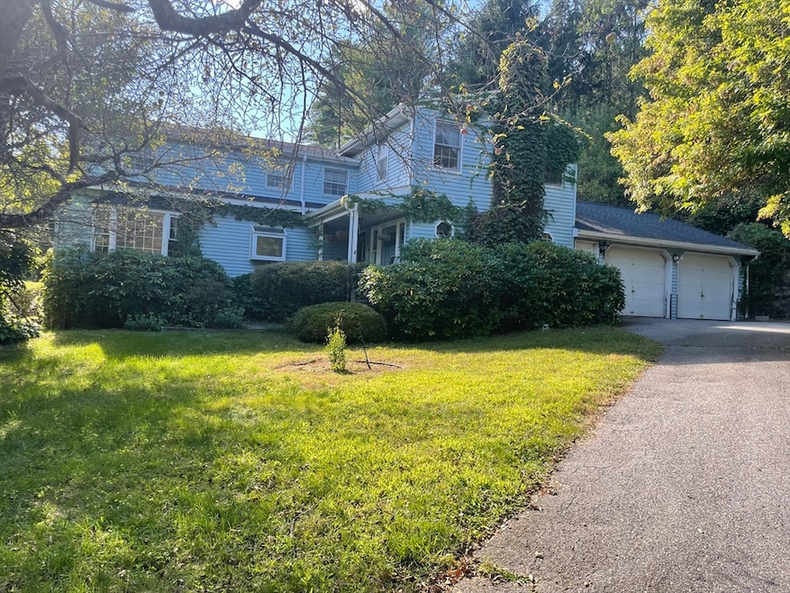
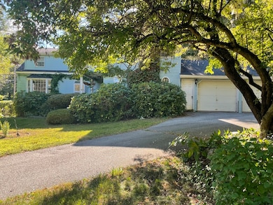
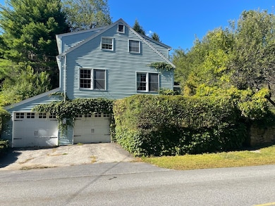
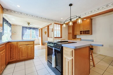
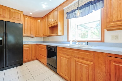
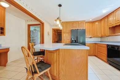
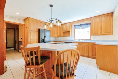
Spacious Colonial situated on 1.67 acres with access to riding trails, Purgatory State Park & highway. The The first floor a large kitchen with center island open to the dining area & living room with hardwood flooring & ample sunlight. There is a room off the kitchen for multi-purposes uses or 1st floor bedroom with a full bathroom attached & a cozy family room in front of house with wood stove. The second floor boasts a large main bedroom and 3 other good-sized bedrooms, plus a bonus room for additional space & full bathroom. Updates include a 200-amp electrical, a well water system with a 5-year-old tank and pump, and a roof and heating system both approximately 5 years old. The property also includes a two-car garage and a full basement with one car garage. The property features a barn with electricity and water access, along with a convenient garden shed for all your outdoor tools. The land is adorned with mature fruit trees including apple and pear, as well as blueberry bushes.
Last Agent to Sell the Property
Coldwell Banker Realty - Framingham Listed on: 08/09/2025
Last Buyer's Agent
Jakeline Silveira
eXp Realty
| Date | Type | Sale Price | Title Company |
|---|---|---|---|
| Quit Claim Deed | $530,000 | -- | |
| Deed | -- | -- | |
| Deed | -- | -- | |
| Quit Claim Deed | -- | -- | |
| Deed | -- | -- | |
| Deed | -- | -- |
| Date | Status | Loan Amount | Loan Type |
|---|---|---|---|
| Open | $503,000 | Purchase Money Mortgage | |
| Previous Owner | $35,000 | No Value Available | |
| Previous Owner | $52,000 | No Value Available |
| Date | Event | Price | List to Sale | Price per Sq Ft |
|---|---|---|---|---|
| 10/30/2025 10/30/25 | Sold | $530,000 | -3.5% | $179 / Sq Ft |
| 09/08/2025 09/08/25 | Pending | -- | -- | -- |
| 08/31/2025 08/31/25 | Price Changed | $549,000 | -8.5% | $185 / Sq Ft |
| 08/09/2025 08/09/25 | For Sale | $599,900 | -- | $202 / Sq Ft |
| Year | Tax Paid | Tax Assessment Tax Assessment Total Assessment is a certain percentage of the fair market value that is determined by local assessors to be the total taxable value of land and additions on the property. | Land | Improvement |
|---|---|---|---|---|
| 2025 | $5,809 | $483,300 | $175,600 | $307,700 |
| 2024 | $6,027 | $475,300 | $168,300 | $307,000 |
| 2023 | $6,656 | $480,600 | $152,500 | $328,100 |
| 2022 | $5,661 | $396,900 | $121,900 | $275,000 |
| 2021 | $5,661 | $353,800 | $121,900 | $231,900 |
| 2020 | $5,384 | $339,500 | $121,900 | $217,600 |
| 2019 | $5,262 | $318,500 | $121,900 | $196,600 |
| 2018 | $5,346 | $288,100 | $103,600 | $184,500 |
| 2017 | $5,342 | $280,500 | $91,100 | $189,400 |
| 2016 | $7,600 | $280,500 | $91,100 | $189,400 |
| 2015 | $4,535 | $271,900 | $91,100 | $180,800 |
| 2014 | $4,600 | $272,500 | $90,300 | $182,200 |
Seller's Agent in 2025
Lisa Paulette
Coldwell Banker Realty - Framingham
(617) 967-5890
1 in this area
129 Total Sales
J
Buyer's Agent in 2025
Jakeline Silveira
eXp Realty
Source: MLS Property Information Network (MLS PIN)
MLS Number: 73415810
APN: SUTT-000050-000000-000028
Disclaimer: Certain information contained herein is derived from information provided by parties other than Homes.com. All information provided is deemed reliable, but is not guaranteed to be accurate and should be independently verified.
![]() The property listing data and information, or the Images, set forth herein were provided to MLS Property Information Network, Inc. from third party sources, including sellers, lessors and public records, and were compiled by MLS Property Information Network, Inc. The property listing data and information, and the Images, are for the personal, non-commercial use of consumers having a good faith interest in purchasing or leasing listed properties of the type displayed to them and may not be used for any purpose other than to identify prospective properties which such consumers may have a good faith interest in purchasing or leasing. MLS Property Information Network, Inc. and its subscribers disclaim any and all representations and warranties as to the accuracy of the property listing data and information, or as to the accuracy of any of the Images, set forth herein.
The property listing data and information, or the Images, set forth herein were provided to MLS Property Information Network, Inc. from third party sources, including sellers, lessors and public records, and were compiled by MLS Property Information Network, Inc. The property listing data and information, and the Images, are for the personal, non-commercial use of consumers having a good faith interest in purchasing or leasing listed properties of the type displayed to them and may not be used for any purpose other than to identify prospective properties which such consumers may have a good faith interest in purchasing or leasing. MLS Property Information Network, Inc. and its subscribers disclaim any and all representations and warranties as to the accuracy of the property listing data and information, or as to the accuracy of any of the Images, set forth herein.
Ask me questions while you tour the home.