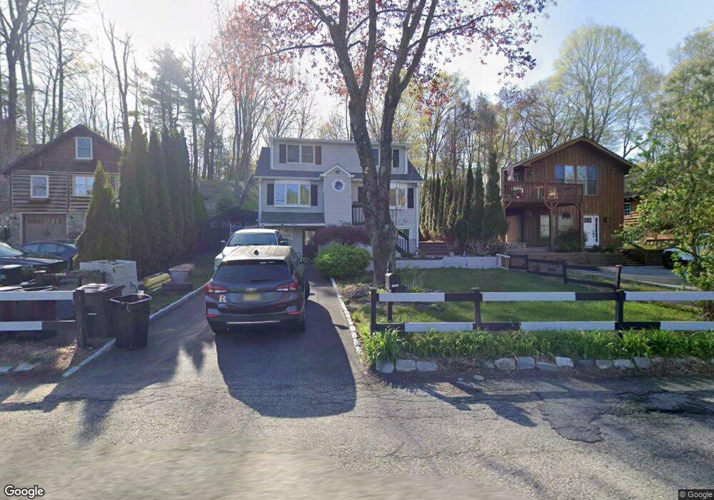
1790 Clinton Rd Hewitt, NJ 07421
Estimated Value: $387,000 - $597,000
--
Bed
--
Bath
1,248
Sq Ft
$380/Sq Ft
Est. Value
About This Home
This home is located at 1790 Clinton Rd, Hewitt, NJ 07421 and is currently estimated at $473,806, approximately $379 per square foot. 1790 Clinton Rd is a home located in Passaic County with nearby schools including Macopin Middle School and West Milford High School.
Ownership History
Date
Name
Owned For
Owner Type
Purchase Details
Closed on
Jan 4, 2008
Sold by
Kane Stephen
Bought by
Turre Ralph N
Current Estimated Value
Home Financials for this Owner
Home Financials are based on the most recent Mortgage that was taken out on this home.
Original Mortgage
$303,850
Outstanding Balance
$192,295
Interest Rate
6.21%
Mortgage Type
New Conventional
Estimated Equity
$281,511
Purchase Details
Closed on
Jul 29, 2004
Sold by
Peraza Katty
Bought by
Kane Stephen and Kane Dara
Home Financials for this Owner
Home Financials are based on the most recent Mortgage that was taken out on this home.
Original Mortgage
$280,000
Interest Rate
6.2%
Purchase Details
Closed on
Aug 24, 2002
Sold by
Peraza Katty
Bought by
Peraza Katty and Peraza Roberta
Purchase Details
Closed on
Mar 15, 2002
Sold by
Lainmo Joe
Bought by
Peraza Katty
Home Financials for this Owner
Home Financials are based on the most recent Mortgage that was taken out on this home.
Original Mortgage
$198,000
Interest Rate
6.85%
Create a Home Valuation Report for This Property
The Home Valuation Report is an in-depth analysis detailing your home's value as well as a comparison with similar homes in the area
Home Values in the Area
Average Home Value in this Area
Purchase History
| Date | Buyer | Sale Price | Title Company |
|---|---|---|---|
| Turre Ralph N | $303,850 | -- | |
| Kane Stephen | $381,000 | -- | |
| Peraza Katty | -- | -- | |
| Peraza Katty | $230,000 | -- |
Source: Public Records
Mortgage History
| Date | Status | Borrower | Loan Amount |
|---|---|---|---|
| Open | Turre Ralph N | $303,850 | |
| Previous Owner | Kane Stephen | $280,000 | |
| Previous Owner | Peraza Katty | $198,000 |
Source: Public Records
Tax History Compared to Growth
Tax History
| Year | Tax Paid | Tax Assessment Tax Assessment Total Assessment is a certain percentage of the fair market value that is determined by local assessors to be the total taxable value of land and additions on the property. | Land | Improvement |
|---|---|---|---|---|
| 2025 | $8,136 | $200,700 | $83,900 | $116,800 |
| 2024 | $8,179 | $200,700 | $83,900 | $116,800 |
| 2022 | $7,763 | $200,700 | $83,900 | $116,800 |
| 2021 | $7,597 | $200,700 | $83,900 | $116,800 |
| 2020 | $7,516 | $200,700 | $83,900 | $116,800 |
| 2019 | $7,416 | $200,700 | $83,900 | $116,800 |
| 2018 | $7,398 | $200,700 | $83,900 | $116,800 |
| 2017 | $7,432 | $200,700 | $83,900 | $116,800 |
| 2016 | $7,444 | $200,700 | $83,900 | $116,800 |
| 2015 | $7,358 | $200,700 | $83,900 | $116,800 |
| 2014 | $7,179 | $200,700 | $83,900 | $116,800 |
Source: Public Records
Map
Nearby Homes
- 1761 Clinton Rd
- 00-1 Clinton Rd
- 0 Brook Rd Unit 3989068
- 25 Charissaa Ct
- 7 Wayside Rd
- 9 Caldwell Rd
- 42 Witte Rd
- 546 Warwick Turnpike
- 574 Warwick Turnpike
- 00 Clinton Rd
- 15 Cliff Rd
- 30 Hemlock Ln
- 138 County Rd
- 0 Bearfort Rd
- 00 Bearfort Rd
- 4 Wyckoff Ct
- 195 Bearfort Rd
- 36 Belmont Dr
- 17 Belmont Dr
- 217 Bearfort Rd
- 1792 Clinton Rd
- 1788 Clinton Rd
- 1786 Clinton Rd
- 1796 Clinton Rd
- 1778 Clinton Rd
- 29 Goldfinch Ln
- 1802 Clinton Rd
- 4 Lookover Dr
- 1776 Clinton Rd
- 22 Brookfield Rd
- 48 Brookfield Rd
- 1770 Clinton Rd
- 59 Goldfinch Ln
- 1768 Clinton Rd
- 14 Brookfield Rd
- 63 Goldfinch Ln
- 1812 Clinton Rd
- 55 Goldfinch Ln
- 1765 Clinton Rd
- 69 Goldfinch Ln