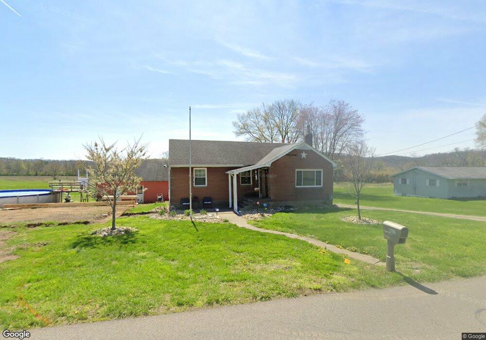
1790 Lawhead Ln Zanesville, OH 43701
Estimated Value: $216,000 - $244,000
3
Beds
1
Bath
1,031
Sq Ft
$224/Sq Ft
Est. Value
About This Home
This home is located at 1790 Lawhead Ln, Zanesville, OH 43701 and is currently estimated at $230,951, approximately $224 per square foot. 1790 Lawhead Ln is a home located in Muskingum County with nearby schools including Philo High School, Zanesville Community School, and Bishop Fenwick School.
Ownership History
Date
Name
Owned For
Owner Type
Purchase Details
Closed on
Aug 26, 2011
Sold by
Secretary Of Hud
Bought by
Hale Sabrina
Current Estimated Value
Home Financials for this Owner
Home Financials are based on the most recent Mortgage that was taken out on this home.
Original Mortgage
$74,611
Outstanding Balance
$51,434
Interest Rate
4.4%
Mortgage Type
New Conventional
Estimated Equity
$179,517
Purchase Details
Closed on
Mar 17, 2011
Sold by
Wells Fargo Bank Na
Bought by
Secretary Of Housing & Urban Development
Purchase Details
Closed on
Sep 28, 2010
Sold by
Brock William A and Brock William
Bought by
Wells Fargo Bank Na
Purchase Details
Closed on
Jun 30, 1993
Bought by
Brock Eleanor F Tod James
Create a Home Valuation Report for This Property
The Home Valuation Report is an in-depth analysis detailing your home's value as well as a comparison with similar homes in the area
Home Values in the Area
Average Home Value in this Area
Purchase History
| Date | Buyer | Sale Price | Title Company |
|---|---|---|---|
| Hale Sabrina | $67,100 | None Available | |
| Secretary Of Housing & Urban Development | -- | None Available | |
| Secretary Of Hud | -- | None Available | |
| Wells Fargo Bank Na | $26,000 | None Available | |
| Brock Eleanor F Tod James | -- | -- |
Source: Public Records
Mortgage History
| Date | Status | Borrower | Loan Amount |
|---|---|---|---|
| Open | Hale Sabrina | $74,611 |
Source: Public Records
Tax History Compared to Growth
Tax History
| Year | Tax Paid | Tax Assessment Tax Assessment Total Assessment is a certain percentage of the fair market value that is determined by local assessors to be the total taxable value of land and additions on the property. | Land | Improvement |
|---|---|---|---|---|
| 2024 | $1,490 | $46,270 | $7,630 | $38,640 |
| 2023 | $1,174 | $34,580 | $6,195 | $28,385 |
| 2022 | $1,127 | $34,580 | $6,195 | $28,385 |
| 2021 | $1,109 | $34,580 | $6,195 | $28,385 |
| 2020 | $1,031 | $31,465 | $5,635 | $25,830 |
| 2019 | $1,028 | $31,465 | $5,635 | $25,830 |
| 2018 | $1,051 | $31,465 | $5,635 | $25,830 |
| 2017 | $872 | $24,395 | $5,635 | $18,760 |
| 2016 | $838 | $24,400 | $5,640 | $18,760 |
| 2015 | $861 | $24,400 | $5,640 | $18,760 |
| 2013 | $928 | $24,400 | $5,640 | $18,760 |
Source: Public Records
Map
Nearby Homes
- 3000 S River Rd
- 3010 S River Rd
- 2630 Glenn Cir
- 3130 S River Rd
- 2519 Frick Dr
- 2435 Odessa Dr
- 0 Granger Hill Rd
- 5100 Ellerman Rd
- 92 Beechrock Dr
- 2188 S River Rd
- 2065 Russell Dr
- 0 Sealover Hollow Rd
- 211A E Main St
- 4145 Old River Rd
- 77 Grandview Ave
- 0 Stockdale Ln
- 137 E King St
- 16 Beech Rock Dr
- 97 E Main St
- 105 Rains Cir
- 1760 Lawhead Ln
- 1795 Lawhead Ln
- 2890 Frick Dr
- 1730 Lawhead Ln
- 2880 Frick Dr
- 2880 Carroll Dr
- 2870 Frick Dr
- 1835 Lawhead Ln
- 1725 Lawhead Ln
- 1700 Lawhead Ln
- 2860 Frick Dr
- 2885 Marlo Dr
- 1715 Lawhead Ln
- 2875 Marlo Dr
- 1810 Lawhead Ln
- 1810 Lawhead Ln
- 2875 Carroll Dr
- 2850 Frick Dr
- 2855 Marlo Dr
- 1865 Lawhead Ln