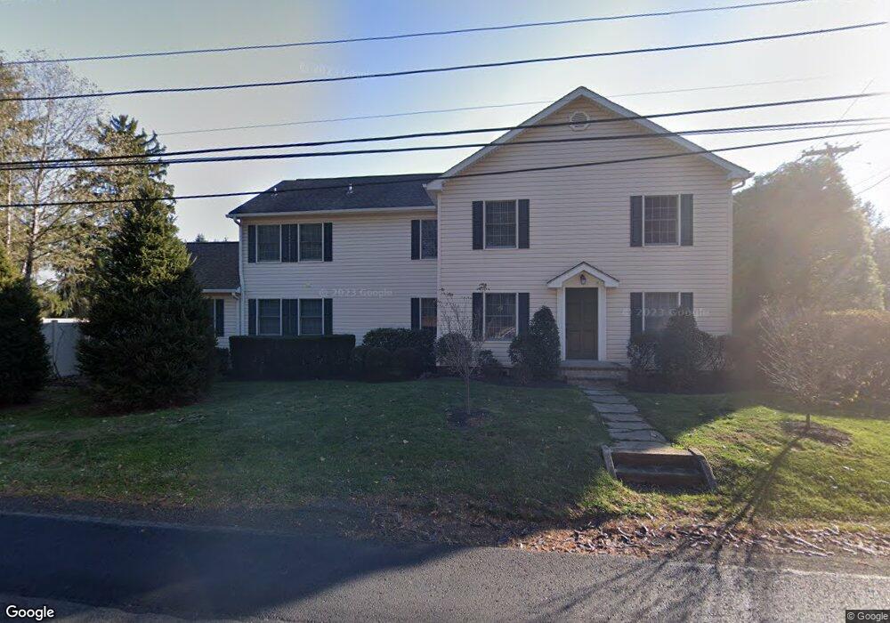
1790 Lindenhurst Rd Newtown, PA 18940
Estimated Value: $901,000 - $1,104,000
4
Beds
3
Baths
3,303
Sq Ft
$296/Sq Ft
Est. Value
About This Home
This home is located at 1790 Lindenhurst Rd, Newtown, PA 18940 and is currently estimated at $978,768, approximately $296 per square foot. 1790 Lindenhurst Rd is a home located in Bucks County with nearby schools including Sol Feinstone Elementary School, Newtown Middle School, and Council Rock High School North.
Ownership History
Date
Name
Owned For
Owner Type
Purchase Details
Closed on
Aug 29, 2007
Sold by
Sartori M Barbara
Bought by
Stewart Anthony M and Stewart Michelle
Current Estimated Value
Home Financials for this Owner
Home Financials are based on the most recent Mortgage that was taken out on this home.
Original Mortgage
$347,500
Outstanding Balance
$220,914
Interest Rate
6.65%
Mortgage Type
Purchase Money Mortgage
Estimated Equity
$757,854
Purchase Details
Closed on
Dec 19, 1996
Sold by
Balderston Jeannette U and Balderston Howard G
Bought by
Casale Samuel J and Casale Jane
Home Financials for this Owner
Home Financials are based on the most recent Mortgage that was taken out on this home.
Original Mortgage
$114,000
Interest Rate
7.46%
Create a Home Valuation Report for This Property
The Home Valuation Report is an in-depth analysis detailing your home's value as well as a comparison with similar homes in the area
Home Values in the Area
Average Home Value in this Area
Purchase History
| Date | Buyer | Sale Price | Title Company |
|---|---|---|---|
| Stewart Anthony M | $497,500 | None Available | |
| Casale Samuel J | $120,000 | Lawyers Title Insurance Corp |
Source: Public Records
Mortgage History
| Date | Status | Borrower | Loan Amount |
|---|---|---|---|
| Open | Stewart Anthony M | $347,500 | |
| Previous Owner | Casale Samuel J | $114,000 |
Source: Public Records
Tax History Compared to Growth
Tax History
| Year | Tax Paid | Tax Assessment Tax Assessment Total Assessment is a certain percentage of the fair market value that is determined by local assessors to be the total taxable value of land and additions on the property. | Land | Improvement |
|---|---|---|---|---|
| 2025 | $7,562 | $44,210 | $8,680 | $35,530 |
| 2024 | $7,562 | $44,210 | $8,680 | $35,530 |
| 2023 | $7,355 | $44,210 | $8,680 | $35,530 |
| 2022 | $7,317 | $44,210 | $8,680 | $35,530 |
| 2021 | $6,923 | $42,400 | $8,680 | $33,720 |
| 2020 | $6,757 | $42,400 | $8,680 | $33,720 |
| 2019 | $6,600 | $42,400 | $8,680 | $33,720 |
| 2018 | $6,477 | $42,400 | $8,680 | $33,720 |
| 2017 | $6,299 | $42,400 | $8,680 | $33,720 |
| 2016 | -- | $42,400 | $8,680 | $33,720 |
| 2015 | -- | $42,400 | $8,680 | $33,720 |
| 2014 | -- | $42,400 | $8,680 | $33,720 |
Source: Public Records
Map
Nearby Homes
- 2036 Silverwood Dr
- 910 Old Dolington Rd
- 2 Old Barn Ct
- 21 Belamour Dr
- 1092 S Kimbles Rd
- 29 Sunnyside Ln
- 3 Stonebridge Crossing Rd
- 1768 Ashbourne Dr
- 1789 Wrightstown Rd
- 1566 Woodside Rd
- 140 Glenwood Dr
- 25 Hillyer Ln
- 1045 Washington Crossing Rd
- 22 Delaney Dr
- 1720 Jockeys Way
- 1659 Wrightstown Rd
- 69 Hillyer Ln
- 52 Yorkshire Dr
- 38 Mcconkey Dr
- 44 Aster Way
- 760 Washington Crossing Rd
- 747 Washington Crossing Rd
- 756 Washington Crossing Rd
- 739 Washington Crossing Rd
- 735 Washington Crossing Rd
- 757 Washington Crossing Rd
- 731 Washington Crossing Rd
- 1996 Amber Dr
- 2002 Silverwood Dr
- 2000 Silverwood Dr
- 1992 Amber Dr
- 740 Towerview Dr
- 725 Washington Crossing Rd
- 736 Towerview Dr
- 732 Towerview Dr
- 728 Towerview Dr
- 2004 Silverwood Dr
- 721 Washington Crossing Rd
- 1988 Amber Dr
- 779 Washington Crossing Rd