Estimated Value: $435,474 - $453,000
3
Beds
3
Baths
2,293
Sq Ft
$194/Sq Ft
Est. Value
About This Home
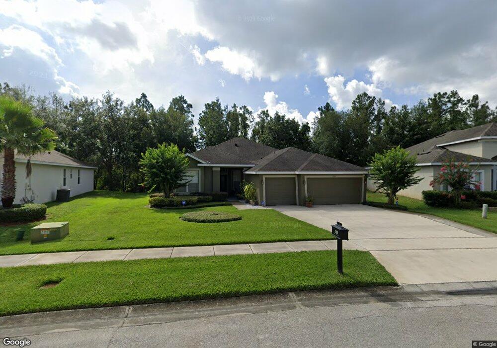
This home is located at 1790 Palmerston Cir, Ocoee, FL 34761 and is currently estimated at $445,619, approximately $194 per square foot. 1790 Palmerston Cir is a home located in Orange County with nearby schools including Prairie Lake Elementary School, Ocoee Middle School, and Wekiva High School.
Ownership History
Date
Name
Owned For
Owner Type
Purchase Details
Closed on
Aug 17, 2005
Sold by
Morrison Homes Inc
Bought by
Baker William T and Baker Ann M
Current Estimated Value
Home Financials for this Owner
Home Financials are based on the most recent Mortgage that was taken out on this home.
Original Mortgage
$252,550
Outstanding Balance
$131,900
Interest Rate
5.57%
Mortgage Type
Fannie Mae Freddie Mac
Estimated Equity
$313,719
Create a Home Valuation Report for This Property
The Home Valuation Report is an in-depth analysis detailing your home's value as well as a comparison with similar homes in the area
Home Values in the Area
Average Home Value in this Area
Purchase History
| Date | Buyer | Sale Price | Title Company |
|---|---|---|---|
| Baker William T | $280,700 | Universal Land Title Inc |
Source: Public Records
Mortgage History
| Date | Status | Borrower | Loan Amount |
|---|---|---|---|
| Open | Baker William T | $252,550 |
Source: Public Records
Tax History Compared to Growth
Tax History
| Year | Tax Paid | Tax Assessment Tax Assessment Total Assessment is a certain percentage of the fair market value that is determined by local assessors to be the total taxable value of land and additions on the property. | Land | Improvement |
|---|---|---|---|---|
| 2025 | $2,783 | $179,990 | -- | -- |
| 2024 | $2,689 | $179,990 | -- | -- |
| 2023 | $2,689 | $169,822 | $0 | $0 |
| 2022 | $2,597 | $164,876 | $0 | $0 |
| 2021 | $2,565 | $160,074 | $0 | $0 |
| 2020 | $2,450 | $157,864 | $0 | $0 |
| 2019 | $2,532 | $154,315 | $0 | $0 |
| 2018 | $2,521 | $151,438 | $0 | $0 |
| 2017 | $2,503 | $203,515 | $22,000 | $181,515 |
| 2016 | $2,506 | $197,993 | $22,000 | $175,993 |
| 2015 | $2,545 | $177,870 | $15,000 | $162,870 |
| 2014 | $2,529 | $173,241 | $20,000 | $153,241 |
Source: Public Records
Map
Nearby Homes
- 2123 Greenwood Oak Dr
- 3409 Briarwood Grove Dr
- 3417 Briarwood Grove Dr
- HARPER Plan at Wynwood
- CAMDEN Plan at Wynwood
- ROBINSON - FOLK VICTORIAN Plan at Wynwood
- ARIA Plan at Wynwood
- ROBIE Plan at Wynwood
- CALI Plan at Wynwood
- HAYDEN Plan at Wynwood
- ALLEX Plan at Wynwood
- DESTIN Plan at Wynwood
- 2123 Greenwood Oak Dr
- 2117 Greenwood Oak Dr
- 2043 Ashwood Bluff Dr
- 2074 Ashwood Bluff Dr
- 2049 Ashwood Bluff Dr
- 2050 Ashwood Bluff Dr
- 3350 Wynwood Forest Dr
- 3331 Wynwood Forest Dr
- 1786 Palmerston Cir
- 1794 Palmerston Cir
- 1798 Palmerston Cir
- 1782 Palmerston Cir
- 1785 Palmerston Cir
- 1795 Palmerston Cir
- 1781 Palmerston Cir
- 1802 Palmerston Cir
- 1778 Palmerston Cir
- 1801 Palmerston Cir
- 1773 Palmerston Cir
- 1806 Palmerston Cir
- 1809 Palmerston Cir
- 1737 Palmerston Cir
- 1774 Palmerston Cir
- 1751 Palmerston Cir
- 1733 Palmerston Cir
- 1818 Palmerston Cir
- 1821 Palmerston Cir
- 1766 Palmerston Cir