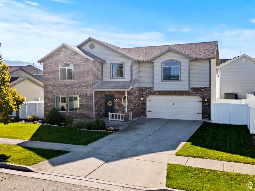
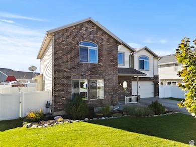
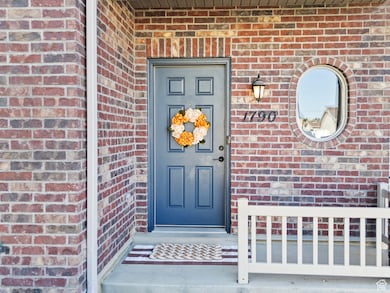
1790 W 620 S Logan, UT 84321
Woodruff NeighborhoodEstimated payment $2,543/month
Highlights
- Mountain View
- Gazebo
- 2 Car Attached Garage
- Vaulted Ceiling
- Cul-De-Sac
- Double Pane Windows
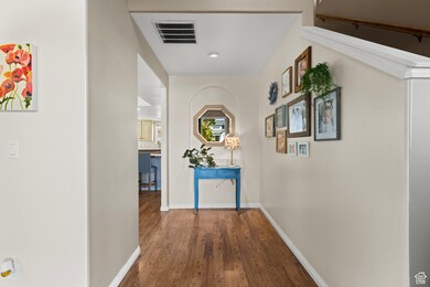
About This Home
Home is on a cul-de-sac located in a beautiful, quiet neighborhood and close to the conveniences that Cache Valley has to offer. The neighbors here are a wonderful group of people who truly embody what community is about - friendly, caring, and always looking out for one another. This home has been well maintained and is ready for its next owner to become part of this welcoming Logan neighborhood!
Listing Agent
Robert Jess
Shadow Mountain Realty LLC License #11545490 Listed on: 10/21/2025
Home Details
Home Type
- Single Family
Est. Annual Taxes
- $1,873
Year Built
- Built in 2007
Lot Details
- 5,663 Sq Ft Lot
- Cul-De-Sac
- Property is Fully Fenced
- Landscaped
- Sprinkler System
- Property is zoned Single-Family
HOA Fees
- $12 Monthly HOA Fees
Parking
- 2 Car Attached Garage
- 4 Open Parking Spaces
Home Design
- Brick Exterior Construction
Interior Spaces
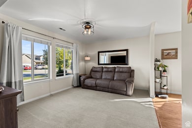
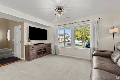
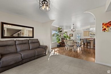
- 2,170 Sq Ft Home
- 2-Story Property
- Vaulted Ceiling
- Ceiling Fan
- Double Pane Windows
- Entrance Foyer
- Mountain Views
- Electric Dryer Hookup
Kitchen
- Free-Standing Range
- Microwave
- Disposal
Flooring
- Linoleum
- Tile
Bedrooms and Bathrooms
- 4 Bedrooms
- Walk-In Closet
- Bathtub With Separate Shower Stall
Outdoor Features
- Gazebo
Schools
- Mountainside Elementary School
- Spring Creek Middle School
- Ridgeline High School
Utilities
- Forced Air Heating and Cooling System
- Natural Gas Connected
- Satellite Dish
Community Details
- Reed Palmer Association, Phone Number (503) 939-8778
- Logan River Trails Subdivision
Listing and Financial Details
- Exclusions: TV Antenna
- Assessor Parcel Number 02-199-0036
Map
Home Values in the Area
Average Home Value in this Area
Tax History
| Year | Tax Paid | Tax Assessment Tax Assessment Total Assessment is a certain percentage of the fair market value that is determined by local assessors to be the total taxable value of land and additions on the property. | Land | Improvement |
|---|---|---|---|---|
| 2025 | $1,742 | $249,125 | $0 | $0 |
| 2024 | $1,883 | $249,915 | $0 | $0 |
| 2023 | $2,069 | $249,150 | $0 | $0 |
| 2022 | $1,892 | $224,840 | $0 | $0 |
| 2021 | $1,533 | $279,767 | $38,500 | $241,267 |
| 2020 | $1,455 | $248,298 | $38,500 | $209,798 |
| 2019 | $1,565 | $248,298 | $38,500 | $209,798 |
| 2018 | $1,482 | $225,820 | $38,500 | $187,320 |
| 2017 | $1,465 | $116,820 | $0 | $0 |
| 2016 | $1,494 | $97,285 | $0 | $0 |
| 2015 | $1,237 | $97,285 | $0 | $0 |
| 2014 | $1,203 | $97,285 | $0 | $0 |
| 2013 | -- | $97,285 | $0 | $0 |
Property History
| Date | Event | Price | List to Sale | Price per Sq Ft |
|---|---|---|---|---|
| 11/16/2025 11/16/25 | Pending | -- | -- | -- |
| 10/21/2025 10/21/25 | For Sale | $449,900 | -- | $207 / Sq Ft |
Purchase History
| Date | Type | Sale Price | Title Company |
|---|---|---|---|
| Warranty Deed | -- | American Secure Title Logan | |
| Interfamily Deed Transfer | -- | Northern Title Company | |
| Warranty Deed | -- | Northern Title Company |
Mortgage History
| Date | Status | Loan Amount | Loan Type |
|---|---|---|---|
| Open | $183,121 | FHA | |
| Previous Owner | $194,355 | FHA |
Source: UtahRealEstate.com
MLS Number: 2118645
APN: 02-199-0036
Disclaimer: Certain information contained herein is derived from information provided by parties other than Homes.com. All information provided is deemed reliable, but is not guaranteed to be accurate and should be independently verified.
![]() IDX information is provided exclusively for consumers’ personal, non-commercial use, that it may not be used for any purpose other than to identify prospective properties consumers may be interested in purchasing, and that the data is deemed reliable but is not guaranteed accurate by the MLS. Licensor is only providing the MLS Content and not other sources of data provided in the Product.
IDX information is provided exclusively for consumers’ personal, non-commercial use, that it may not be used for any purpose other than to identify prospective properties consumers may be interested in purchasing, and that the data is deemed reliable but is not guaranteed accurate by the MLS. Licensor is only providing the MLS Content and not other sources of data provided in the Product.
Based on information from the Wasatch Front Regional Multiple Listing Service, Inc.. All data, including all measurements and calculations of area, is obtained from various sources and has not been, and will not be, verified by broker or the MLS. All information should be independently reviewed and verified for accuracy. Properties may or may not be listed by the office/agent presenting the information.
- Redwood Plan at Rivergate - Logan
- Madison Plan at Rivergate - Logan
- Sitka Plan at Sugar Creek - Logan (Townhomes)
- Hawthorne Plan at Rivergate - Logan
- Springhill Plan at Rivergate - Logan
- Auburn Plan at Rivergate - Logan
- Hilldale Plan at Rivergate - Logan
- 2157 S 1580 W
- 539 S 1580 W Unit 121
- 534 S 1580 W
- 1615 W Silver Canoe Way Unit 215
- 763 S 1500 W
- 552 Rivergate Dr
- 524 Rivergate Dr
- 1603 Silver Canoe Way
- 1506 Silver Canoe Loop
- 1506 Silver Canoe Loop Unit 102
- 1585 W Silver Canoe Way
- 1615 Silver Canoe Way
- 542 1225 W