Estimated Value: $840,000 - $935,000
5
Beds
2
Baths
2,087
Sq Ft
$417/Sq Ft
Est. Value
About This Home
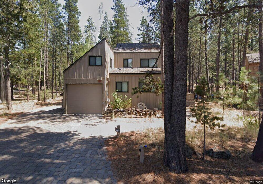
This home is located at 17903 Muskrat Ln, Bend, OR 97707 and is currently estimated at $870,517, approximately $417 per square foot. 17903 Muskrat Ln is a home with nearby schools including Elk Meadow Elementary School, Cascade Middle School, and Summit High School.
Ownership History
Date
Name
Owned For
Owner Type
Purchase Details
Closed on
Jun 22, 2009
Sold by
Kiriazis Michael and Kiriazis Anne Marie E
Bought by
Rubin David Charles and Labray Ann
Current Estimated Value
Purchase Details
Closed on
Sep 7, 2006
Sold by
Vranizan Ralph A
Bought by
Kiriazis Michael and Kiriazis Anne Marie E
Home Financials for this Owner
Home Financials are based on the most recent Mortgage that was taken out on this home.
Original Mortgage
$25,500
Interest Rate
6.61%
Mortgage Type
Seller Take Back
Purchase Details
Closed on
Nov 1, 2004
Sold by
Kiriazis Michael and Kiriazis Anne Marie
Bought by
Vranizan Ralph A
Purchase Details
Closed on
Aug 9, 2004
Sold by
Neale Robert P and Neale Renee L
Bought by
Kiriazis Michael and Kiriazis Anne Marie
Home Financials for this Owner
Home Financials are based on the most recent Mortgage that was taken out on this home.
Original Mortgage
$220,000
Interest Rate
6.17%
Mortgage Type
Unknown
Create a Home Valuation Report for This Property
The Home Valuation Report is an in-depth analysis detailing your home's value as well as a comparison with similar homes in the area
Home Values in the Area
Average Home Value in this Area
Purchase History
| Date | Buyer | Sale Price | Title Company |
|---|---|---|---|
| Rubin David Charles | $290,000 | First American Title | |
| Kiriazis Michael | $104,875 | None Available | |
| Vranizan Ralph A | $91,666 | -- | |
| Kiriazis Michael | $275,000 | First Amer Title Ins Co Or |
Source: Public Records
Mortgage History
| Date | Status | Borrower | Loan Amount |
|---|---|---|---|
| Previous Owner | Kiriazis Michael | $25,500 | |
| Previous Owner | Kiriazis Michael | $220,000 |
Source: Public Records
Tax History Compared to Growth
Tax History
| Year | Tax Paid | Tax Assessment Tax Assessment Total Assessment is a certain percentage of the fair market value that is determined by local assessors to be the total taxable value of land and additions on the property. | Land | Improvement |
|---|---|---|---|---|
| 2025 | $5,864 | $382,610 | -- | -- |
| 2024 | $5,614 | $371,470 | -- | -- |
| 2023 | $5,440 | $360,660 | $0 | $0 |
| 2022 | $5,065 | $339,970 | $0 | $0 |
| 2021 | $4,967 | $330,070 | $0 | $0 |
| 2020 | $4,696 | $330,070 | $0 | $0 |
| 2019 | $4,566 | $320,460 | $0 | $0 |
| 2018 | $4,434 | $311,130 | $0 | $0 |
| 2017 | $4,301 | $302,070 | $0 | $0 |
| 2016 | $4,091 | $293,280 | $0 | $0 |
| 2015 | $3,990 | $284,740 | $0 | $0 |
Source: Public Records
Map
Nearby Homes
- 57124 Evergreen Loop Unit 33
- 57190 Evergreen Loop Unit 22
- 57111 Fremont Dr Unit 2
- 57085 Fox Ln
- 57307 Beaver Ridge Loop Unit 7D
- 57301 Beaver Ridge Loop Unit 10A2
- 57113 Brassie Ln Unit 22
- 57326 Beaver Ridge Loop Unit 12
- 57327 Beaver Ridge Loop Unit 6C2
- 57338 Beaver Ridge Loop Unit 16B2
- 17905 Rhododendron Ln
- 57089 Wild Lily Ln Unit 16
- 57357 Beaver Ridge Loop Unit 22
- 57357 Beaver Ridge Loop Unit 22B1
- 57211 Island Rd Unit 11
- 57075 Wild Lily Unit 11
- 57008 Antelope Ln Unit 4
- 56995 Coyote Ln Unit 16
- 57057 Abbot House Ln Unit 9
- 57377 Beaver Ridge Loop Unit 29C