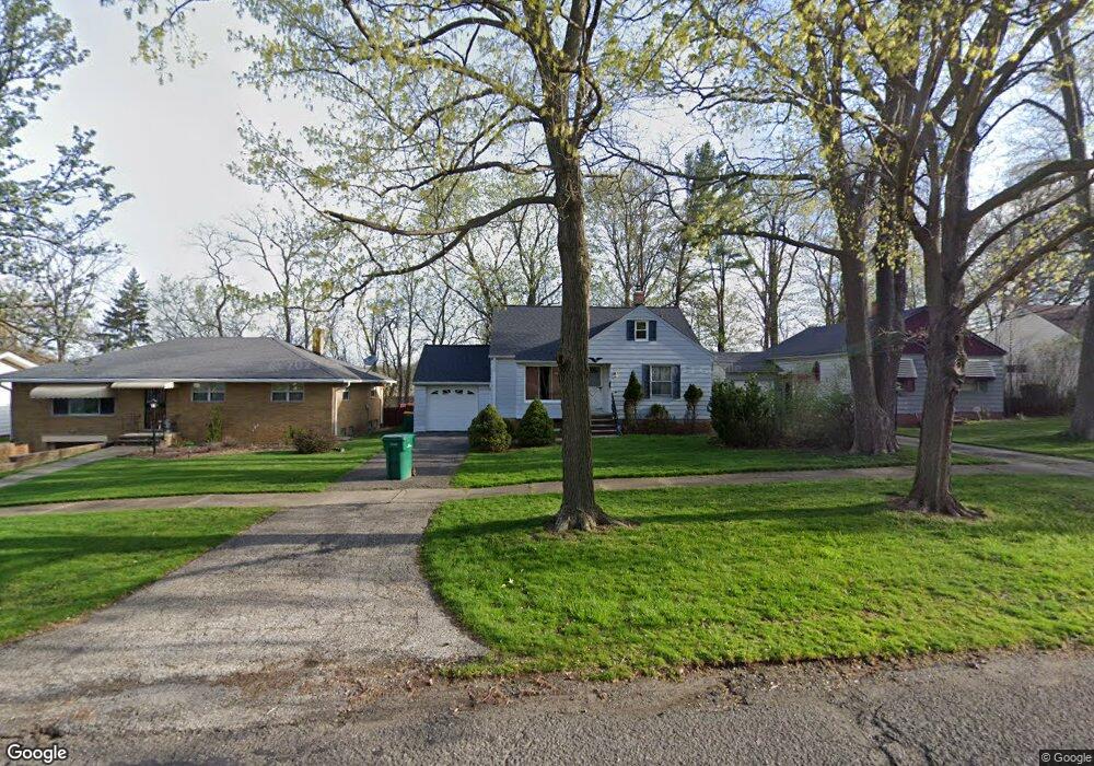
17905 Mccracken Rd Maple Heights, OH 44137
Estimated Value: $121,035 - $155,000
3
Beds
1
Bath
1,384
Sq Ft
$99/Sq Ft
Est. Value
About This Home
This home is located at 17905 Mccracken Rd, Maple Heights, OH 44137 and is currently estimated at $137,009, approximately $98 per square foot. 17905 Mccracken Rd is a home located in Cuyahoga County with nearby schools including Abraham Lincoln Elementary School, Rockside/ J.F. Kennedy School, and Barack Obama School.
Ownership History
Date
Name
Owned For
Owner Type
Purchase Details
Closed on
Oct 29, 1997
Sold by
Humphries Charles L
Bought by
Groves Mary A
Current Estimated Value
Home Financials for this Owner
Home Financials are based on the most recent Mortgage that was taken out on this home.
Original Mortgage
$62,500
Outstanding Balance
$10,466
Interest Rate
7.51%
Mortgage Type
New Conventional
Estimated Equity
$126,543
Purchase Details
Closed on
Jun 24, 1985
Sold by
Bair David C
Bought by
Humphries Charles L
Purchase Details
Closed on
Dec 23, 1977
Sold by
Wojtowicz John A and Wojtowicz Virginia
Bought by
Bair David C
Purchase Details
Closed on
Jan 1, 1975
Bought by
Wojtowicz John A and Wojtowicz Virginia
Create a Home Valuation Report for This Property
The Home Valuation Report is an in-depth analysis detailing your home's value as well as a comparison with similar homes in the area
Home Values in the Area
Average Home Value in this Area
Purchase History
| Date | Buyer | Sale Price | Title Company |
|---|---|---|---|
| Groves Mary A | $73,600 | -- | |
| Humphries Charles L | $52,900 | -- | |
| Bair David C | $37,500 | -- | |
| Wojtowicz John A | -- | -- |
Source: Public Records
Mortgage History
| Date | Status | Borrower | Loan Amount |
|---|---|---|---|
| Open | Groves Mary A | $62,500 |
Source: Public Records
Tax History Compared to Growth
Tax History
| Year | Tax Paid | Tax Assessment Tax Assessment Total Assessment is a certain percentage of the fair market value that is determined by local assessors to be the total taxable value of land and additions on the property. | Land | Improvement |
|---|---|---|---|---|
| 2024 | $3,480 | $38,290 | $9,135 | $29,155 |
| 2023 | $2,335 | $21,250 | $5,250 | $16,000 |
| 2022 | $2,327 | $21,250 | $5,250 | $16,000 |
| 2021 | $2,476 | $21,250 | $5,250 | $16,000 |
| 2020 | $2,169 | $16,100 | $3,990 | $12,110 |
| 2019 | $2,155 | $46,000 | $11,400 | $34,600 |
| 2018 | $1,993 | $16,100 | $3,990 | $12,110 |
| 2017 | $1,993 | $14,390 | $3,710 | $10,680 |
| 2016 | $1,926 | $14,390 | $3,710 | $10,680 |
| 2015 | $1,920 | $14,390 | $3,710 | $10,680 |
| 2014 | $1,920 | $15,820 | $4,060 | $11,760 |
Source: Public Records
Map
Nearby Homes
- 5031 Cato St
- 5061 Philip Ave
- 5082 Philip Ave
- 5110 Philip Ave
- 5199 Arch St
- 5185 Clement Ave
- 5231 Philip Ave
- 16712 Kollin Ave
- 5239 Arch St
- 5234 Erwin St
- 5208 Clement Ave
- 5257 Philip Ave
- 4737 E 174th St
- 5212 Catherine St
- 17806 Tarkington Ave
- 5210 Theodore St
- 5320 Clement Ave
- 19309 Nitra Ave
- 5165 Camden Rd
- 5265 Bellview St
- 17909 Mccracken Rd
- 17901 Mccracken Rd
- 17913 Mccracken Rd
- 17781 Mccracken Rd
- 17741 Mccracken Rd
- 17917 Mccracken Rd
- 17991 Mccracken Rd
- 17904 Mccracken Rd
- 17900 Mccracken Rd
- 17908 Mccracken Rd
- 17914 Mccracken Rd
- 17766 Mccracken Rd
- 17916 Mccracken Rd
- 17721 Mccracken Rd
- 18105 Mccracken Rd
- 17762 Mccracken Rd
- 5030 Arch St
- 5030 Arch St Unit 2/UP
- 5030 Arch St Unit 1/DN
- 17750 Mccracken Rd