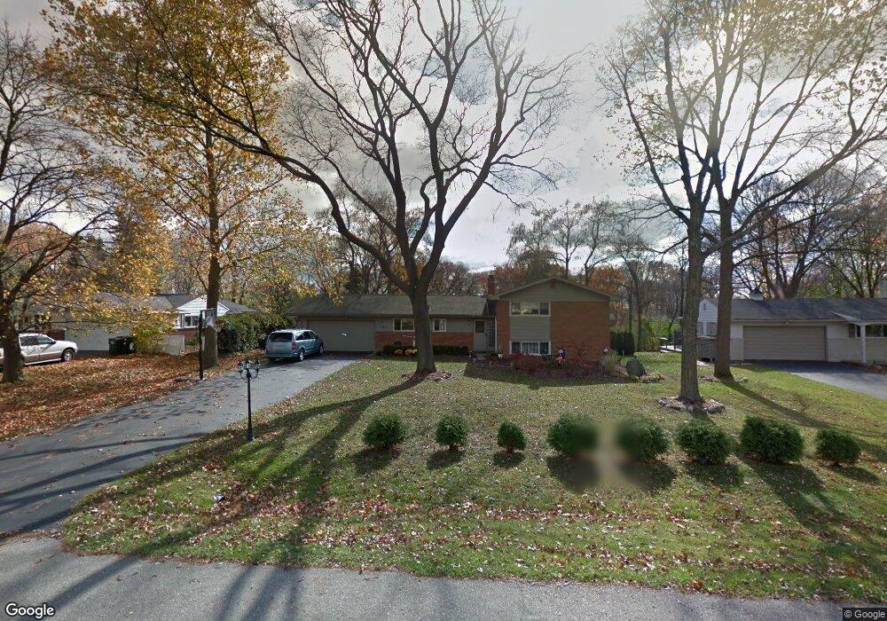
1791 Ansal Dr Rochester Hills, MI 48309
Estimated Value: $423,000 - $464,000
4
Beds
3
Baths
2,118
Sq Ft
$211/Sq Ft
Est. Value
About This Home
This home is located at 1791 Ansal Dr, Rochester Hills, MI 48309 and is currently estimated at $447,823, approximately $211 per square foot. 1791 Ansal Dr is a home located in Oakland County with nearby schools including University Hills Elementary School, West Middle School, and Rochester High School.
Ownership History
Date
Name
Owned For
Owner Type
Purchase Details
Closed on
May 15, 2006
Sold by
Loock Timothy C and Nowinski Loock Christine M
Bought by
Loock Timothy C and Nowinski Loock Christine M
Current Estimated Value
Purchase Details
Closed on
Aug 18, 1995
Sold by
Barrett Susan M
Bought by
Loock Timothy C and Loock Christine
Home Financials for this Owner
Home Financials are based on the most recent Mortgage that was taken out on this home.
Original Mortgage
$127,500
Interest Rate
7.43%
Mortgage Type
New Conventional
Purchase Details
Closed on
Aug 11, 1994
Sold by
Barthel John W
Bought by
Barrett Susan M and Barrett William A
Home Financials for this Owner
Home Financials are based on the most recent Mortgage that was taken out on this home.
Original Mortgage
$119,200
Interest Rate
5%
Mortgage Type
New Conventional
Create a Home Valuation Report for This Property
The Home Valuation Report is an in-depth analysis detailing your home's value as well as a comparison with similar homes in the area
Home Values in the Area
Average Home Value in this Area
Purchase History
| Date | Buyer | Sale Price | Title Company |
|---|---|---|---|
| Loock Timothy C | -- | None Available | |
| Loock Timothy C | $170,000 | -- | |
| Barrett Susan M | $149,000 | -- |
Source: Public Records
Mortgage History
| Date | Status | Borrower | Loan Amount |
|---|---|---|---|
| Closed | Loock Timothy C | $127,500 | |
| Previous Owner | Barrett Susan M | $119,200 |
Source: Public Records
Tax History Compared to Growth
Tax History
| Year | Tax Paid | Tax Assessment Tax Assessment Total Assessment is a certain percentage of the fair market value that is determined by local assessors to be the total taxable value of land and additions on the property. | Land | Improvement |
|---|---|---|---|---|
| 2022 | $1,822 | $154,020 | $0 | $0 |
| 2018 | $3,017 | $133,520 | $0 | $0 |
| 2017 | $2,958 | $130,960 | $0 | $0 |
| 2015 | -- | $116,830 | $0 | $0 |
| 2014 | -- | $100,830 | $0 | $0 |
| 2011 | -- | $88,810 | $0 | $0 |
Source: Public Records
Map
Nearby Homes
- 2072 Belle Vernon Dr
- 2152 Avoncrest Dr
- 1665 Huntington Park Unit E
- 126 Orchardale Dr
- 626 Wilwood Rd
- 123 Longford Dr
- 100 Longford Dr
- 650 Longford Dr
- 184 Shagbark Dr
- 147 Stratford Ln Unit 129
- 2247 Walton Blvd Unit 46
- 51 Manor Way Unit 30
- 2245 Walton Blvd Unit 58
- 2222 Walton Blvd
- 73 Nevada Ave
- 2377 Walton Blvd Unit 15
- 110 Stratford Ln
- 65 Stratford Ln
- 1008 Hidden Ln
- 941 Viewland Dr
- 1771 Ansal Dr
- 1811 Ansal Dr
- 1857 Ansal Dr
- 1816 Ansal Dr
- 475 Nesbit Ln
- 482 Lake Forest Rd
- 470 Lake Forest Rd
- 1840 Ansal Dr
- 488 Lake Forest Rd
- 475 Wimpole Dr
- 455 Wimpole Dr
- 457 Nesbit Ln
- 452 Lake Forest Rd
- 456 Nesbit Ln
- 495 Wimpole Dr
- 498 Lake Forest Rd
- 1862 Ansal Dr
- 440 Lake Forest Rd
- 1887 Ansal Dr
- 1814 Campus Ct