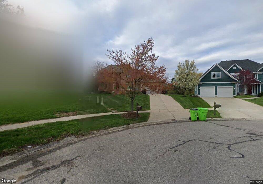
1791 Cranberry Ct Unit 119 Ann Arbor, MI 48103
Estimated Value: $740,048 - $766,000
4
Beds
3
Baths
2,871
Sq Ft
$262/Sq Ft
Est. Value
About This Home
This home is located at 1791 Cranberry Ct Unit 119, Ann Arbor, MI 48103 and is currently estimated at $753,512, approximately $262 per square foot. 1791 Cranberry Ct Unit 119 is a home located in Washtenaw County with nearby schools including Dicken Elementary School, Slauson Middle School, and Pioneer High School.
Ownership History
Date
Name
Owned For
Owner Type
Purchase Details
Closed on
Aug 28, 2003
Sold by
Perlstein Shari and Prince Elizabeth C
Bought by
Pui John and Ng Vivian
Current Estimated Value
Home Financials for this Owner
Home Financials are based on the most recent Mortgage that was taken out on this home.
Original Mortgage
$322,700
Interest Rate
6.04%
Mortgage Type
Purchase Money Mortgage
Create a Home Valuation Report for This Property
The Home Valuation Report is an in-depth analysis detailing your home's value as well as a comparison with similar homes in the area
Home Values in the Area
Average Home Value in this Area
Purchase History
| Date | Buyer | Sale Price | Title Company |
|---|---|---|---|
| Pui John | $425,000 | -- |
Source: Public Records
Mortgage History
| Date | Status | Borrower | Loan Amount |
|---|---|---|---|
| Previous Owner | Pui John | $322,700 | |
| Closed | Pui John | $102,300 |
Source: Public Records
Tax History Compared to Growth
Tax History
| Year | Tax Paid | Tax Assessment Tax Assessment Total Assessment is a certain percentage of the fair market value that is determined by local assessors to be the total taxable value of land and additions on the property. | Land | Improvement |
|---|---|---|---|---|
| 2025 | -- | $365,000 | $0 | $0 |
| 2024 | $6,449 | $362,200 | $0 | $0 |
| 2023 | $6,197 | $344,000 | $0 | $0 |
| 2022 | $8,648 | $305,500 | $0 | $0 |
| 2021 | $8,222 | $299,200 | $0 | $0 |
| 2020 | $8,783 | $293,800 | $0 | $0 |
| 2019 | $8,152 | $279,900 | $279,900 | $0 |
| 2018 | $7,958 | $260,700 | $0 | $0 |
| 2017 | $7,696 | $264,500 | $0 | $0 |
| 2016 | $5,151 | $202,528 | $0 | $0 |
| 2015 | -- | $201,923 | $0 | $0 |
| 2014 | -- | $195,615 | $0 | $0 |
| 2013 | -- | $195,615 | $0 | $0 |
Source: Public Records
Map
Nearby Homes
- 1860 Chicory Ridge
- 1929 Harley Dr
- 1770 Harley Dr
- 1419 N Bay Dr Unit 73
- 1366 N Bay Dr Unit 144
- 1599 Scio Ridge Rd
- 1740 S Maple Rd Unit 2
- 2512 Jade Ct Unit 18
- 2126 Pauline Blvd Unit 104
- 1225 S Maple Rd Unit 307
- 1235 S Maple Rd Unit 202
- 2120 Pauline Blvd Unit 305
- 2165 Pauline Ct Unit 14
- 1265 S Maple Rd Unit 207
- 813 E Summerfield Glen Cir
- 2147 Pauline Ct Unit 17
- 1053 Bluestem Ln
- 2104 Pauline Blvd Unit 305
- 2033 Pauline Ct
- 1439 Glastonbury Rd
- 1799 Cranberry Ct
- 1747 Chicory Ridge
- 1769 Cranberry Ct
- 1733 Chicory Ridge
- 1807 Cranberry Ct
- 0 Chicory Ridge
- 1748 Chicory Ridge
- 1760 Chicory Ridge
- 1732 Chicory Ridge
- 1815 Cranberry Ct Unit 116
- 1719 Chicory Ridge
- 1839 Cranberry Ct Unit 114
- 1772 Chicory Ridge
- 1660 Chapleau Dr Unit 45
- 1652 Chapleau Dr Unit 44
- 1676 Chapleau Dr Unit 47
- 1644 Chapleau Dr
- 1714 Chicory Ridge
- 1853 Cranberry Ct
- 1636 Chapleau Dr Unit 42