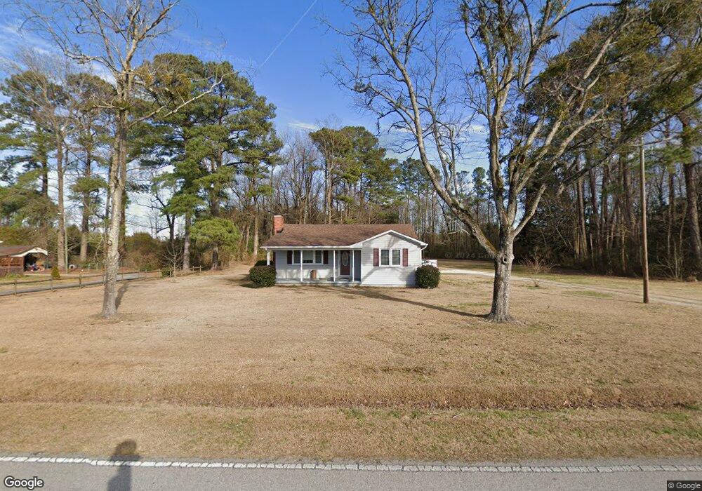
1791 Haw Branch Rd Beulaville, NC 28518
Estimated Value: $132,000 - $227,000
3
Beds
1
Bath
1,152
Sq Ft
$154/Sq Ft
Est. Value
About This Home
This home is located at 1791 Haw Branch Rd, Beulaville, NC 28518 and is currently estimated at $177,317, approximately $153 per square foot. 1791 Haw Branch Rd is a home located in Onslow County with nearby schools including Richlands Elementary School, Trexler Middle School, and Richlands High School.
Ownership History
Date
Name
Owned For
Owner Type
Purchase Details
Closed on
Oct 23, 2008
Sold by
Horne Robert G and Horne Pansy T
Bought by
Jenkins Richard Mcneil and Jenkins Anna Burridge
Current Estimated Value
Home Financials for this Owner
Home Financials are based on the most recent Mortgage that was taken out on this home.
Original Mortgage
$80,000
Outstanding Balance
$19,266
Interest Rate
5.96%
Mortgage Type
Seller Take Back
Estimated Equity
$158,051
Create a Home Valuation Report for This Property
The Home Valuation Report is an in-depth analysis detailing your home's value as well as a comparison with similar homes in the area
Home Values in the Area
Average Home Value in this Area
Purchase History
| Date | Buyer | Sale Price | Title Company |
|---|---|---|---|
| Jenkins Richard Mcneil | $80,000 | None Available |
Source: Public Records
Mortgage History
| Date | Status | Borrower | Loan Amount |
|---|---|---|---|
| Open | Jenkins Richard Mcneil | $80,000 |
Source: Public Records
Tax History Compared to Growth
Tax History
| Year | Tax Paid | Tax Assessment Tax Assessment Total Assessment is a certain percentage of the fair market value that is determined by local assessors to be the total taxable value of land and additions on the property. | Land | Improvement |
|---|---|---|---|---|
| 2025 | $471 | $71,885 | $28,190 | $43,695 |
| 2024 | $471 | $71,885 | $28,190 | $43,695 |
| 2023 | $471 | $71,885 | $28,190 | $43,695 |
| 2022 | $471 | $71,885 | $28,190 | $43,695 |
| 2021 | $395 | $56,050 | $20,670 | $35,380 |
| 2020 | $381 | $54,100 | $20,670 | $33,430 |
| 2019 | $381 | $54,100 | $20,670 | $33,430 |
| 2018 | $381 | $54,100 | $20,670 | $33,430 |
| 2017 | $378 | $55,940 | $20,670 | $35,270 |
| 2016 | $378 | $55,940 | $0 | $0 |
| 2015 | $378 | $55,940 | $0 | $0 |
| 2014 | $378 | $55,940 | $0 | $0 |
Source: Public Records
Map
Nearby Homes
- 1872 Haw Branch Rd
- 112 Christy Dr
- 313 Caleb Ct
- 198 Christy Dr
- 1651 Haw Branch Rd
- 158 Christy Dr
- 263 Sweet Gum Ln
- 2932 Catherine Lake Rd
- 521 Cherry Blossom Ln
- 160 Ashbury Park Ln
- 588 Luther Banks Rd
- 308 Snow Bell Ct
- 441 Cedar Fork Rd
- 1441 Haw Branch Rd
- 503 Orchard Creek Dr
- 3244 Catherine Lake Rd
- 3245 Catherine Lake Rd
- 3287 Catherine Lake Rd
- 308 Big Tree Ln
- 0 Remington Way
- 1785 Haw Branch Rd
- 1792 Haw Branch Rd
- 1800 Haw Branch Rd
- 1781 Haw Branch Rd
- 1809 Haw Branch Rd
- 1810 Haw Branch Rd
- 1835 Haw Branch Rd
- 1832 Haw Branch Rd
- 1839 Haw Branch Rd
- 1840 Haw Branch Rd
- 1843 Haw Branch Rd
- 1846 Haw Branch Rd
- 1740 Haw Branch Rd
- 1847 Haw Branch Rd
- 1853 Haw Branch Rd
- 1852 Haw Branch Rd
- 209 Chandler Simpson Ct
- 1688 Haw Branch Rd
- 207 Chandler Simpson Ct
- 1859 Haw Branch Rd